Download
1 / 1
10 likes | 68 Views
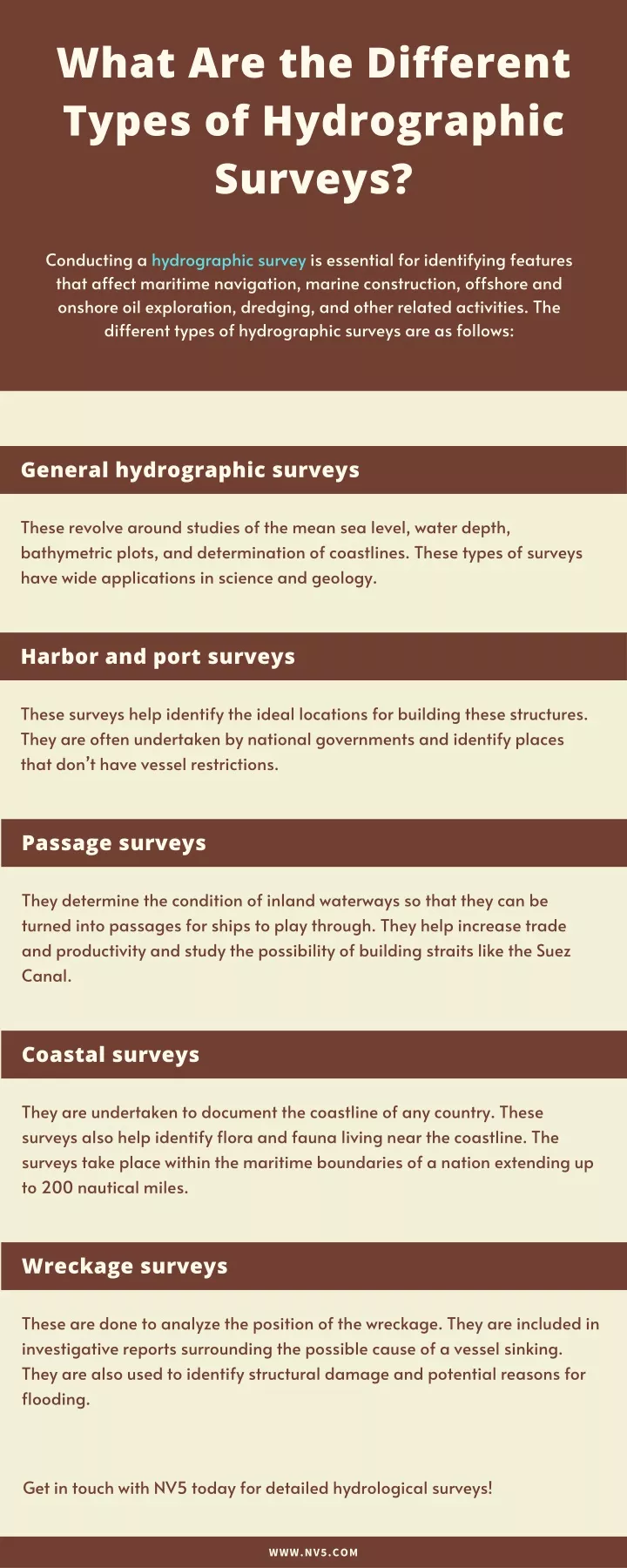
Conducting a hydrographic survey is essential for identifying features that affect maritime navigation, marine construction, offshore and onshore oil exploration, dredging, and other related activities. The different types of hydrographic surveys are as follows:<br>

E N D
What Are the Different Types of Hydrographic Surveys? Conducting a hydrographic survey is essential for identifying features that affect maritime navigation, marine construction, offshore and onshore oil exploration, dredging, and other related activities. The different types of hydrographic surveys are as follows: General hydrographic surveys These revolve around studies of the mean sea level, water depth, bathymetric plots, and determination of coastlines. These types of surveys have wide applications in science and geology. Harbor and port surveys These surveys help identify the ideal locations for building these structures. They are often undertaken by national governments and identify places that don’t have vessel restrictions. Passage surveys They determine the condition of inland waterways so that they can be turned into passages for ships to play through. They help increase trade and productivity and study the possibility of building straits like the Suez Canal. Coastal surveys They are undertaken to document the coastline of any country. These surveys also help identify flora and fauna living near the coastline. The surveys take place within the maritime boundaries of a nation extending up to 200 nautical miles. Wreckage surveys These are done to analyze the position of the wreckage. They are included in investigative reports surrounding the possible cause of a vessel sinking. They are also used to identify structural damage and potential reasons for flooding. Get in touch with NV5 today for detailed hydrological surveys! WWW.NV5.COM