Download
1 / 14
140 likes | 265 Views
Extending GIS into EMR. Final Presentation. Project Team. Rahkiya Hawkins (Team Leader) Cristian Andrade Perry E s tes Steve Friedlander Kevin Gravesande (Customer). Customer & Communication Methods .

E N D
Extending GIS into EMR Final Presentation
Project Team • Rahkiya Hawkins (Team Leader) • Cristian Andrade • Perry Estes • Steve Friedlander • Kevin Gravesande (Customer)
Customer & Communication Methods • Kevin Gravesande (DPS 2009), IS Director, STAR ProgramSUNY Downstate Medical Center450 Clarkson Avenue, Box 1240, Brooklyn, New York 11203, kgravesande@verizon.net • Meetings are conducted with our customer at least once a week depending on his availability either through conference calls or web conferencing. • Also our project website has a progress update link which provides all the customer meeting dates and project progress.
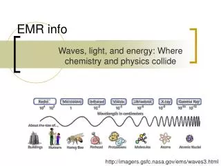
What is a Geographic Information System? • A GIS is a digital database that employs a spatial coordinate system as the primary reference. • Spatial data is stored in map form corresponding to a defined location on the Earth’s surface. • Spatial data contains three components: Points, Lines, and Polygons. • GIS must also handle attribute data such as elevation numbers, land use designations, and boundary information.
Project Background • This project concerns the extension of an existing Geographic Information Systems (GIS) and Electronic Medical Record (EMR) to improve health services. • Extending GIS into EMR will provide real-time healthcare service to clients and allow health care professionals to explore, identify, and implement preventive measures to inhibit the spread of diseases, thus producing a powerful tool.
What Information Can an GIS/EMR Application Provide? • GIS can provide information that a medical facility may not be readily privy to such as: • Environmental risk factors • Socioeconomic status • Access to local amenities and community services/facilities
Project Description • This semester, Team 5 continued to develop an application that captures residence location data from an end-user and geocodes the location of the individual based on his/her residence address using Google Maps.
Project Description (Continued) • This application will permit end-users to visualize their location and view information from various data sources as it relates to: • Air quality data • Metropolitan Transportation Authority data • Selected Facilities and Program Sites data • Property Address Directory (PAD) Sites for New York City
Project Specifications • A summary of our project specifications is located on our project website located at: http://utopia.csis.pace.edu/cs691/2008-2009/team5/
Analyses • Data source information is loaded into existing SQL 2008 repository on the Team 5 database. • SQL based queries and stored procedures are called in C# to extract data based on customer requirements.
Components Built • Team members Cris and Perry have built development and testing environments at their locations. They have also loaded the EMR application and built a SQL 2008 relational repository. • What was created: • Implemented New York City MTA data as a data source in the application project. • Implemented New York City Selected Facilities and Program Sites data as a data source in the application project. • Developed and implemented SQL Server stored procedures and C# code for geocoding patient addresses.
Conclusion of Part I This concludes the first part of the presentation. Now we will move to the second part of the presentation which includes more detail concerning the design components of the EMR/GIS application.