Download
1 / 14
140 likes | 273 Views
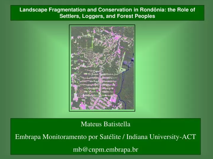
Landscape Fragmentation and Conservation in Rondônia: the Role of Settlers, Loggers, and Forest Peoples. Mateus Batistella Embrapa Monitoramento por Satélite / Indiana University-ACT mb@cnpm.embrapa.br. WATER. AIR. PEOPLE. FIRE. LAND. PA ÍS. PA ISAGEM. TERRA. TERRIT ÓRIO. LAND.

E N D
Landscape Fragmentation and Conservation in Rondônia: the Role of Settlers, Loggers, and Forest Peoples Mateus Batistella Embrapa Monitoramento por Satélite / Indiana University-ACT mb@cnpm.embrapa.br
WATER AIR PEOPLE FIRE LAND
PAÍS PAISAGEM TERRA TERRITÓRIO LAND LANDSCAPE An understanding of changes in Amazonian landscapes depends on documentation about alterations in land cover.
Time Regional context Machadinho (local context) Anari (local context) Layers of information Layers of information Multiple dates Multiple areas Space Conceptual approach for analyses of the human dimensions of landscape change
Machadinho Anari • Similar biophysical features • Similar age: early 80’s • Similar colonists assets • Different architectures • Different institutions Machadinho d’Oeste and Vale do Anari in the State of Rondônia • Total area: 3,383 Km2
Fieldwork: training samples • Vegetation structure analysis: SS1, SS2, SS3, forest • Multitemporal LULC classification • GIS integration • Landscape metrics calculation • Institutional analysis
1988 1994 1998 Land-use/Land-Cover Dynamics: Settlements • Less forest cover in Anari (fishbone) after 15 years of colonization • Similar forest cover in both settlements when considering just private properties (51%) • Pasture conversion increased threefold in fishbone and less than twofold in Machadinho
Landscape Structure and Change • In 1998, the largest patch index for forest is higher in Machadinho, but lower when excluding reserves Machadinho • Mean patch size of forest decreases at a higher rate in fishbone. In 1994, MPS is similar in both settlements • Mean patch size of agricultural lands is greater in fishbone Anari
International, National, and Regional incentives, rules, and policies Biophysical attributes of landscapes Attributes of the community Decisions of the community Household characteristics Landscape change Individual decisions Hierarchical approach defining landscape change Adapted from Ostrom (1997)
Settlers Rubber tappers Communal reserves Private properties Loggers Settlers Private properties Loggers Machadinho d’Oeste Vale do Anari
Beyond the metrics: Institutions Making a Difference • Rural settlements in the Amazon: demand to settle landless migrants • Different arrangements: rapid projects vs. well planned initiatives • Accountability to distinct actors: settlers, loggers, rubber tappers • The diversity of situations involving multiple actors, biophysical features, and rules leads to a mosaic of land-use trajectories and landscape patterns
Beyond the metrics: Institutions Making a Difference • Machadinho illustrates how settlement implementation can incorporate ecological (topography-based), economic (infrastructure), and social (accountability to local populations) attributes that are usually overlooked in other development projects • Higher pasture conversion in Anari is related to poor access to resources and infrastructure. Better efficiency of agricultural systems in Machadinho is related to the access to water, better roads, and agricultural extension • The communal reserves in Machadinho corroborate the importance of governance over resources by local people. Not the reserves per se, but rubber tappers organized in associations and with clear strategies regarding their rights over these lands are the key factor in maintaining large patches of forest preserved