Download
1 / 23
240 likes | 584 Views
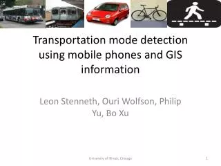
Using Mobile Phones to Determine Transportation Modes. Sasank Reddy et al., ACM Transactions on Sensor Networks, Vol. 6, No. 2, Article 13, Feb 2010. 2011.04.11 Hyeong-il Ko. Contents. Introduction Related Work Approach Experimental Setup Results Conclusion. Introduction.

E N D
Using Mobile Phones to Determine Transportation Modes Sasank Reddy et al., ACM Transactions on Sensor Networks, Vol. 6, No. 2, Article 13, Feb 2010 2011.04.11 Hyeong-ilKo
Contents • Introduction • Related Work • Approach • Experimental Setup • Results • Conclusion
Introduction • Mobile phones • Computation, sensing, and communication capabilities • Carried by people throughout the day • Target applications for transportation mode inference and location information • Physical Activity Monitoring • Personal Impact and/or Exposure Monitoring • Transportation and Mobility-Based Recruitment
Approach • Design Goal • User convenience • 4 properties of suggested system to be convenient • Contained in one sensing unit • Flexible in terms of the position and orientation • Able to work for a variety of users without additional training • Not reliant on external spatial or user history based indexes • Contribution • Suggested classifier that uses information from an accelerometer and a GPS • Able to run on a commodity mobile device
Approach • Sensor Selection • Bluetooth • Not ubiquitous in outdoor settings • Static Bluetooth beacons mainly exists indoor settings • Difficult to distinguish if an individual is moving • Difficult to distinguish if an environment is changing • Other people carrying devices are moving
Sensor Selection • WiFi and GSM • Not discriminative when speed profiles are similar • Slow moving traffic, biking, and walking • Depends on the density network and end points
Sensor Selection • Accelerometer and GPS • 10~20% accuracy dropped if only 1 sensor of them is used • Negligible 0.6% improved when 4 sensing modalities are used
Feature Selection • Feature Selection • Window Size • A window of 1 sec • Type of Features • Accelerometer • Magnitude of the force vector from 3 axises • Mean, variance, energy, and DFT energy coefficient between 1-10Hz • Speed • Value directly used from GPS receiver • Noise filtering step • Discarding GPS points deemed invalid • Excluding accelerometer data if too few samples are received for classification
Feature Selection • Selection Method • CFS(Correlation based Feature Selection) • Feature subset selector that eliminates irrelevant and redundant attributes • Feature subset • Variance along with DFT energy coefficients between 1-3Hz • Speed from the GPS receiver
Classifier Selection • Classifiers • Instance Classifiers • E.g. C4.5 DT, KMC, NB, NN, and SVM • CHMM(Continuous HMM) • Output symbols : independent multi-variate Gaussian distributions • Hidden states : classification classes • Transition probability • Instance based classifier + DHMM(Discrete Hidden Markov Model) • DHMM output symbols : instance-based classifications • Hidden states : classification classes • State transition probabilities
Experimental Setup • Hardware Platform • Nokia n95 • CPU : 332 MHz ARM processor • RAM : 128MB • 3 axis accelerometer that can sample at 32 Hz • Built-in GPS receiver that can sample at 1 Hz • WiFi radio that can scan at 0.33 Hz • GSM cell radio that can sample at 1 Hz • Bluetooth radio that can scan at 0.08 Hz • Battery : 950 mAh • OS : Symbian S60 3rd Edition • Software Setup • Weka Machine Learning Toolkit • Generalized Hidden Markov Model library • Python
Experimental Setup • Data Collection • Volunteers to obtain data set • 16 individuals • 8 male + 8 female • The ages of 20-45 • Accelerometer, GPS, WiFi, and GSM information obtained • How to collect data • 1.25 hrs of data per position per individual • Positions : Still, Walk, Run, Bike, Motor, All • Total 120 hrs
Results • Classification Accuracy
Results • Structure of Overall Classifier
Results • Device Placement Variation • Mobile phones are often carried at different positions • Classifier is trained on data from all 6 positions • Arm, bag, chest, hand, pocket, and waist
Results • Extended Transportation Mode Traces • Would the DT+DHMM classifier perform in “everyday” use? • 1 of the volunteers • carried the mobile phone over 4 weeks • documented instances of each of the transportation modes
Results • Extended Transportation Mode Traces(Cont’d) • Would the DT+DHMM classifier perform in challenging urban environment? • The volunteer • Carried the mobile phone 3.5 hrs in urban canyons • At least 30 mins for each transportation mode • Result • Average accuracy : 92.6% • Still, walking, and motorized transport : 95% • Biking and running state : around 88%
Results • Memory and CPU Benchmarks • Using Nokia Energy Profiler • 20 mins trials were performed
Results • Energy Consumption
Results • Energy-Aware Detection • Authors’ objective • To create a transportation classifier that captures the behavior of individuals when they are outside • The classifier should be energy efficient • The most effective method to determine when the user is outdoors again • GPS • Sampling GPS for the purpose is power hungry • Trigger approach proposed • Attempting to sample the GPS when only changes occur to the primary GSM cell tower would be more efficient in terms of energy usage • GSM cell towers are used to determine the start of outdoor trips • Filter to eliminate the “ping pong” effect
Results • Trigger approach proposed(Cont’d) • To test the performance of the GSM triggered approach, • 16 individuals labeled indoor/outdoor status and collected GSM cell tower every 1 sec for a day • Total time of the day trace data collection • Average : 23.2 hrs • Mininum time : 20.7 hrs • Maximum time : 26.8 hrs • Corresponding outdoor time • Average : 3.09 hrs • Maximum : 12.0 hrs • Minimum : 0.93 hrs • The average percentage of outdoor time identified • 91.5% • 12.4% energy save compared to GPS
Conclusion • Transportation mode classification system • Distinguishing between being stationary, walking, running, biking and in motorized travel • Employing a DT followed by a DHMM • Using a mobile phone equipped with a GPS receiver and an accelerometer • Convenient for a user • By not having strict position and orientation requirements • Achieving a high accuracy level(93.6%) • Based on a dataset of 120 hrs of data from 16 users • Not relying on external spatial indexes • Working well without user-specific training information