Download
1 / 44
440 likes | 457 Views
This course explores the history and archaeology of the ancient Near East through the lens of landscapes. Topics include early archaeological work, large-scale excavations, cultural landscapes, remote sensing techniques, and the socialization of the world through urbanization. Emphasis is placed on interdisciplinary research methods such as surveying, paleoenvironmental studies, and ethnography.

E N D
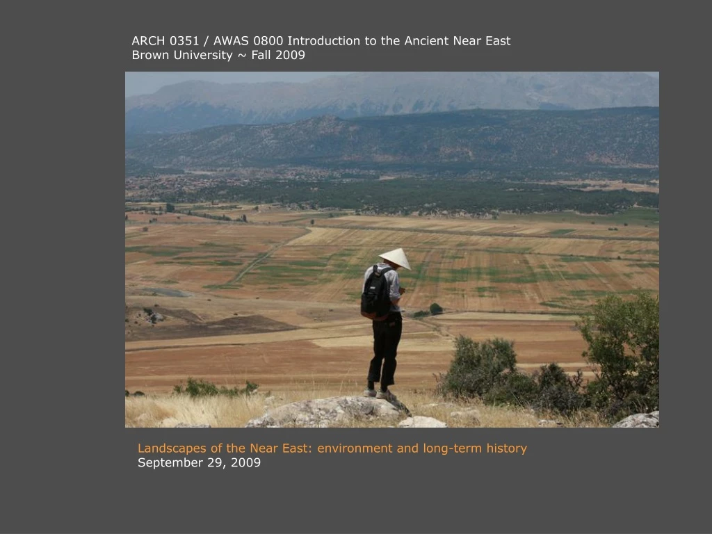
ARCH 0351 / AWAS 0800 Introduction to the Ancient Near East Brown University ~ Fall 2009 Landscapes of the Near East: environment and long-term history September 29, 2009
Birth of Near Eastern archaeology • Rediscovery (early travellers, antiquarians) • Early archaeological work (mid 19th c. excavations), • mainly Layard’s Nimrud and Botta’s Khorsabad • International phase (1860-1880) • decipherment of cuneiform script, Hormuzd Rassam’s work • Large scale excavations (1880s to First World War) • University of Pennsylvania at Nippur, Germans in Babylon • Scientific archaeology. • which took off especially after WWII, with Processual/New Archaeology
German excavations at Babylon (new archaeological field techniques) Director architect/archaeologist Robert Koldewey feeds cats 1899-1917.
Tell Tayinat 1935-38 Mesopotamia in the late 19th and early 20th c. The land of large scale excavations at massive mounds, producing pretty artifacts and tablets.
What is landscape? “Landscape is the world as it is known to those who dwell therein, who inhabit its places, and journey along the paths connecting them...” Tim Ingold 1993: 156
"The lived body allows us to know what space, place and landscape are, because it is the author of them all." Christopher Tilley, The materiality of stone 2004: 3.
Pieter Bruegel the Elder (1525?-1569) The Harvesters (1565), Oil on wood 118.1 x 160.7 cm, Metropolitan Museum of Art
Weltlandschaft landscape as a meaningful whole- a continuous world that we inhabit Joachim Patinir, also called de Patinier and de Patiner (c. 1480 – October 5, 1524) Landscape with St. Gerome, c. 1515-24. Oil on wood. Museo del Prado, Madrid, Spain.
Changing landscape around a dam construction on the Euphrates- South East Turkey, 1976-1999.
Sedimented landscapes and landscapes with memory: ancient and modern settlements at the site of Tall-e Malyan, Iran (ancient Anshan).
Cultural landscapes, planned cities:Bishapur, Iran. Founded by Sasanian king Shapur I in 3rd c. AD
Archaeology of landscapes (an interdisciplinary world) • Archaeological survey • Extensive- traditional “landrover” surveys, more successful in identifying large sites • Intensive field-walking, that identifies “off-site” features, “specialty sites”, villages, • hamlets, extra-urban cult sites, “artifact scatters”, “linear hollows”, mining sites • Architectural, topographic surveying, GPS • Excavation sampling, surface scraping, • Paleoenvironmental studies, Palynology: Holocene vegetation change, climatology, also dendrochronology • Geomorphology: alluviation, soil erosion that buries archaeological sites, changing course of rivers, • coastlines, environmental degradation etc. “Boring” and “Coring”, soil sampling • Ethnography of landscapes: what do contemporary societies make of their environment? Ethnobotany. • Remote sensing (subsurface remains-electric resistivity, magnetometry, Ground Penetrating Radar), • non-invasive techniques, use of satellite imagery (declassified military surveillance images, • imaging spectrometers recording electromagnetic signals of the earth’s surface), • aerial (baloon, blimp, kite) photography • GIS: Geographical Information Systems- spatial integration of landscape data.
Uruk and Nippur, urbanization in Southern Alluvium (4000-2900 BC) villages, hamlets, towns and cities: socialization of the world
Palynology, paleobotany and paleoenvironmental research pollen diagrams from lake bottom sediments
Tell Brak, North Syria, immediate environs Lienar hollows: CORONA Image Nineveh-Mosul, North Iraq CORONA Image
Noah’s Flood at the Black Sea? Ryan and Pitman hypothesis
Transcaucasus Anatolia Syria Levant Iran Mesopotamia Egypt
ARCH 0351 / AWAS 0800 Introduction to the Ancient Near East Brown University ~ Fall 2009 Landscapes of the Near East: environment and long-term history September 29, 2009
What is then landscape? “Landscape is the world as it is known to those who dwell therein, who inhabit its places, and journey along the paths connecting them...” Tim Ingold 1993: 156
Archaeology of landscapes (an interdisciplinary world) • Archaeological survey • Extensive- traditional “landrover” surveys, more successful in identifying large sites • Intensive field-walking, that identifies “off-site” features, “specialty sites”, villages, • hamlets, extra-urban cult sites, “artifact scatters”, “linear hollows”, mining sites • Architectural, topographic surveying, GPS • Excavation sampling, surface scraping, • Paleoenvironmental studies, Palynology: Holocene vegetation change, climatology, also dendrochronology • Geomorphology: alluviation, soil erosion that buries archaeological sites, changing course of rivers, • coastlines, environmental degradation etc. “Boring” and “Coring”, soil sampling • Ethnography of landscapes: what do contemporary societies make of their environment? Ethnobotany. • Remote sensing (subsurface remains-electric resistivity, magnetometry, Ground Penetrating Radar), • non-invasive techniques, use of satellite imagery (declassified military surveillance images, • imaging spectrometers recording electromagnetic signals of the earth’s surface), • aerial (baloon, blimp, kite) photography • GIS: Geographical Information Systems- spatial integration of landscape data.
Near Eastern Landscapes • Lower Mesopotamia, a.k.a Southern Alluvium in Southern Iraq (landscapes of irrigated agriculture on the Tigris-Euphrates basin) • So-called “Fertile Crescent”: in more scholarly terms Northern Syro-Mesopotamia, i.e. Rolling hills landscapes of dry-farming in North Syria, Northern Iraq, Southeast Turkey (oak-pistacio forests) • High Plateau landscapes of Anatolia (Turkey), Iran, and Transcaucuses • The Black Sea Basin • The Levant and the Eastern Mediterranean Coastline, Cyprus (olive orchards, wineyards and cedar forests) • Syro-Arab Desert Landscapes, spotted with oases (compare to Central Asia).
200 mm annual rainfall line and the distribution of barley and wheat in the Near East, with some Epipalaeolithic and Proto-Neolithic settlements.
Southern alluvium : the marshes (lately drained by Saddam Hussein’s engineers).
Mudhif Traditional reed structures of Southern Iraq
Section Map Southern alluvium. Irrigation system and settlement network in Southern Mesopotamia (Postgate)
Hattusha Karkamish Nineveh Kalhu Babylon Nippur Jerusalem Uruk Persepolis Ur
Middle Euphrates and its tributaries: River-side settlement in Syria