Download
1 / 76
760 likes | 773 Views
Learn about RESULTS Business Views, CRS Reports, spatial coverage, data access, and more. Understand the scope and layers of spatial coverage. Gain insights into business guidance and efficiencies gained through new business views.

E N D
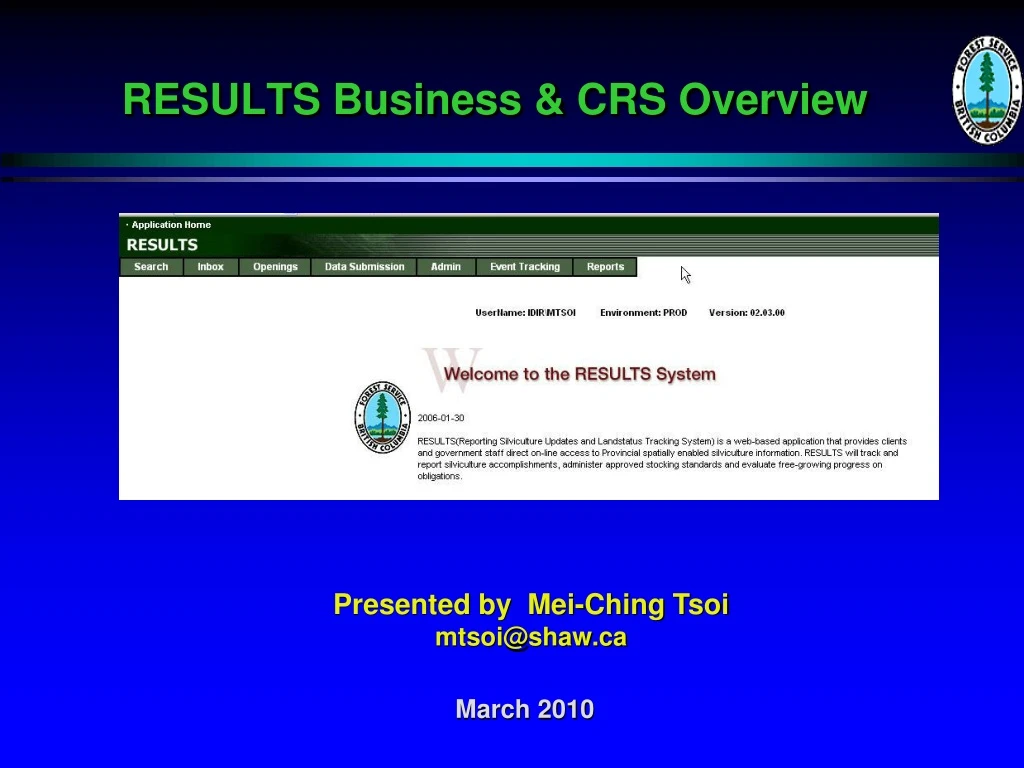
RESULTS Business & CRS Overview Presented by Mei-Ching Tsoimtsoi@shaw.ca March 2010
RESULTS – Learning Objectives Provide overview of RESULTS Business Views Understand RESULTS Spatial coverage and limitations Overview of how to access data from Data Distribution Service (for non-government users) Overview what CRS Reports are available and how to run them
RESULTS Scope • Area harvested under tenure – basic obligations • Major licensee • BCTS • Woodlots, Community Forest Agreements • Areas harvested with no silviculture obligations but reported due to specific reporting policies (eg. small scale salvage) • Free growing stands if managed under silviculture obligation or managed by the Ministry • Natural disturbance areas managed by the Ministry • Backlog areas (pre-1987 areas) • Shell openings where there are requirement to report to RESULTS (eg. Aerial fertilization, MSMA treated areas)
RESULTShttp://www.for.gov.bc.ca/his/results/ Business documentation Technical documentation Spatial Views Training materials Application support
RESULTS Business guidance • RESULTS Information Submission Specifications – Licensee Submissions • Silviculture Information Submission Specifications – Government Funded Silviculture Activities • Woodlot Licence Guide to Submission of Silviculture Reporting Requirements to RESULTS via ESF • Post Harvest Reporting Requirement for Small Scale Salvage Licences to Cut
RESULTShttp://www.for.gov.bc.ca/his/results/spatialviews.htm
RESULTShttp://www.for.gov.bc.ca/his/results/spatialviews.htm Overview provides RESULTS business context, description of views, historical context of spatial information availability, assumptions and limitations in business view usage.
RESULTShttp://www.for.gov.bc.ca/his/results/RESULTS_BVIViews.pdfRESULTShttp://www.for.gov.bc.ca/his/results/RESULTS_BVIViews.pdf RESULTS Business Views Data Dictionary
RESULTS – Raw Normalized Tables Note all Tables/Layers are represented. Illustration of how all the bits and pieces are stored and previous requirement for end-users Identify data in which table and understand how to link.
RESULTS - New Business Views RESULTS Business Views released in December 2008 “Flattened” datasets to simplify data access to minimize post-processing reduces complex table joins (improves ease, access and performance) Limitation in column widths requires still some joins Geometry Exist Indicator will make assessment of spatial data availability during analysis & reporting more obvious.
RESULTS – Efficiencies Gained through New Business Views - Examples RSLT_OPENING_SVW CONTAINS INFORMATION FROM OPENING CUT_BLOCK_OPEN_ADMIN PROV_FOREST_USE FOREST_MGMT_UNIT ACTIVITY_TREATMENT_UNIT STOCKING_ECOLOGY ORG_UNIT CLIENT OPENING_POLY RSLT_FOREST_COVER_INV_SVW CONTAINS INFORMATION FROM FOREST_COVER FOREST_COVER_LAYER FOREST_COVER_LAYER_SPECIES STOCKING_STANDARD STOCKING_ECOLOGY FOREST_COVER_POLY
RESULTS – Efficiencies Gained through New Business Views - Examples RSLT_STANDARDS_UNIT_SVW CONTAINS INFORMATION FROM STOCKING_STANDARD_UNIT STOCKING_LAYER STOCKING_LAYER_SPECIES STOCKING_ECOLOGY STOCKING_MILESTONE STOCKING_STD_UNIT_POLY
RESULTS – Spatial Genesis Pre-RESULTS (ISIS) • Attribute only database. • No spatial in system. • All mapping done through inventory. RESULTS • November 2003 created capability for ESF spatial data capture • Attempt to mine inventory maps to recreate spatial information - use mapsheet & opening number if matched - merged forest cover inventory polygons to create opening boundary - successful conversion populated OPENING_POLY with meta-data as RESULTS Opening Spatial Conversion Entry Userid: “ROSC-AGENT” - limited TFL spatial data to convert
RESULTS – Spatial Genesis • RESULTS – Inventory Conversion created 111,000 spatial records in OPENING_POLY (out of 186,000 openings in 2004). There is currently 226,000 openings. • Linework originated from MOFR inventory mapping based on digitizing off of paper maps. • Must be careful about data origin if concern about data quality – need to review meta-data on Update Userid – ROSC vs. licensee submission? Should not ask licensee to correct ROSC spatial linework as this was done by MOFR.
RESULTS – Spatial Completeness Opening & Forest Cover Scenarios: • No Opening and no Forest Cover spatial; attribute only • Opening only, no Forest Cover spatial • No Opening, Forest Cover spatial only • Both Opening and Forest Cover spatial
RESULTS – Spatial Completeness Activity Treatment Unit (optional) • Some form of generalization will need to occur to infer where an activity took place using some other spatial information
RESULTS - Data Quality & CompletenessScenario 1: Missing RESULTS Spatial • There are approximately 36,000 Openings in RESULTS that do not have ANY spatial represented • Depending on type of analysis, there may be requirement to quantify records missing in spatial component. Example Opening ID’s: -499850000
RESULTS - Data Quality & CompletenessScenario 2: ESF Opening & Submitted FC Opening Spatial (red) and Forest Cover Spatial (grey) matches. ESF submission of both spatial. Meta Data Entry User ID = “idir” or “bceid” Example Opening ID’s: 71586, 83174, 97500
RESULTS - Data Quality & CompletenessScenario 3: SP – ROSC Spatial Only (outline) ROSC is based on matches with inventory spatial based on matches of mapsheet and opening numbers. If opening number matched, all associated forest cover polygon for the opening was merged to create outer opening boundary. No internal linework for Standards Units available. Example Opening ID’s: 49707, 92973
RESULTS - Data Quality & CompletenessScenario 4: No Opening Spatial & Submitted FC No Opening Spatial ROSC conversion was not successful or Opening spatial not required yet. All Forest Cover Spatial submitted by ESF Meta Data Entry User ID = “idir” or “bceid” Mapview search is uses Opening spatial and therefore would not locate this opening. Example Opening ID’s: 1249, 4371, 27077, 32719
RESULTS - Data Quality & CompletenessScenario 5: ROSC Converted Opening & Submitted FC Opening spatial (red) – RESULTS Opening Spatial Conversion (ROSC) derived linework based on vegetation inventory based on Mapsheet & Opening number match. Meta Data Entry User ID = “ROSC_AGENT” --------------------------------------------------------- Forest Cover boundary (grey) – submitted By ESF Licensee, contractor working on behalf of Licensee, MOF staff, or MOF contractor. Meta Data Entry User ID = “idir” or “bceid” ---------------------------------------------------------- Must check on meta data where data quality is questioned. Cannot request to fix ROSC linework! Example Opening ID’s: 27419, 95607, 102089
RESULTS – Spatial data completeness • Wide range of spatial completeness (by org unit, by management, by time period) • Mandatory opening definition and forest cover submissions with map for most forest tenure openings as of April 2007. • Best coverage is to use combined OPENING_SVW & FOREST_COVER_INV/SILV_SVW – but there are trade offs in terms of level of resolution and “generalizations”. • Must verify against attribute only to determine % of spatial coverage available to inform level of spatial data completeness. • GEOMETRY_EXISTS_IND helps with qualifying of spatial information in analysis
RESULTS – Moving Forward • RESULTS Strategic Data Clean up Project located missing Forest Cover attribute reporting for not free growing stands where data was obtainable. • Assumption is that missing forest cover attribute indicates that inventory does not have any information regarding these openings (no depletions and potential over-estimation of volume in current inventory) • If opening is missing forest cover spatial, if not yet free growing, we will get this through normal reporting cycle (at regeneration or at free growing.
RESULTS – Moving Forward • Licensee can submit and update their spatial information at any time. • New openings: Licensee must supply Opening/Standards Unit & Forest Cover map for any new harvesting. • Not free growing openings: Licensee do not have to supply any spatial for any older components (eg. Opening/Standards unit boundaries unless undergoing an amendment which impacts SU boundaries) but must meet mandatory requirements for any s.86 reporting requirements or RG/FG forest cover updates with map. • Combination of Opening/Standards Unit Poly and Forest Cover Poly will give the most complete coverage.
RESULTS - Verify Analysis Outcomes Against Data Source LRDW has no checks on your outcomes Your responsibility will be to review outcome against RESULTS to check correct methodology and assumptions.
RESULTS - Spatial Data Quality • Spatial Data Quality is specified in submission requirements document within Mapping Standards section. • Geomatics staff are front-line people working with RESULTS Spatial Data and would potentially identify issues with spatial data quality. • Any obvious errors beyond mapping standards tolerances should be tracked. Remember that ROSC - is based on Ministry’s old inventory data - therefore no authority to ask licensees to correct.
RESULTS – Quality Assurancehttp://www.for.gov.bc.ca/his/results/business.htm#Quality_Assurance Protocol provides direction to MOF staff how to resolve any attribute or spatial errors.
RESULTS - Spatial Data Evolution • RESULTS Spatial Data: • RESULTS LRDW Business Views will be available to any users who can accesses the LRDW • RESULTS Forest Cover information is being leveraged by Vegetation Resource Information Management System (VRIMS). More timely data to support inventory update process & Timber Supply Review. • Most up-to-date information on forest management on Crown land accessible for wider audience – “on demand” reporting
RESULTS - Spatial Analysis – Special Cases – Overlapping Openings Overlapping allowed as response to MPB and Catastrophic Fires over pre-existing openings Presents challenges for spatial analysis
RESULTS - Spatial Analysis – Special Cases – Aerial Fertilization Vast Areas Activity Areas RESULTS openings used as shells to track aerial fertilization application reporting. Coded as: Base = FE Technique = CA Irregular line work is due to GPS of the swaths during aerial application. Objective is to track these stands as they should not be logged until volume gains have been realized otherwise investment is not optimized. For new shell openings – there will not be any Opening or Forest Cover Spatial. Example Opening ID’s: 1097310 ,1091836, 1113376
RESULTS - Spatial Analysis – Special Cases – MSMA* “Crop Circles” – Odd Shape Activity Maps reported into RESULTS for MSMA* Tracking. Based on Policy Requirement that trees treated with MSMA must not be harvested. Used by ILRR. Coded as: Base = PC Technique = CG Method = MSM *Monosodium Methanearsenate Treatments Example Opening ID’s: 1186282, 1162950, 88644
RESULTS - Spatial Analysis – Special Cases – Retired Openings • Retirement of old openings Opening Status Code – RMD (Removed) Linework remains but considered to no longer be applicable but kept for historical reference purposes/ • There very few openings 112.
RESULTS – Business View Model OPENING_SVW OPENING_VW join via Opening ID FOREST_COVER_ RESERVE_SVW (2) FOREST_COVER_INV_SVW FOREST_COVER_SILV_SVW STANDARDS_ UNIT_SVW ACTIVITY_ TREATMENT_SVW PLANTING_SVW join via stocking_standard_unit_id(1) join via Forest_Cover_ID Forest_Cover_Layer_ID FOREST_COVER_ SPECIES_VW Key • Not all forest cover polygons have SU link, only use if required, must create an outer join/link • If require additional forest cover information, must connect through OPENING_VW & FOREST_COVER_INV_SVW Attribute View Spatial View Join/Key/Link
RESULTS – Accessing Business Views • In government • Citrix https://dts.gov.bc.ca/Citrix/AccessPlatform/auth/login.aspx • IDWPROD1
RESULTS – Accessing Business Views • Non-government • Requires bceid account • Data Distribution Service • https://apps.gov.bc.ca/pub/dwds/acceptTerms.do
Access to Business Views – Limitations Data Distribution Service – Access OPENING_VW – dumps entire province’s data *_SVW – is based on spatial overlay process ------------------------------------------------------- As of April 1, 2010 – Temporarily disabled availability for ACTIVITY_TREATMENT_SVW until further notice
Access to Business Views – ExternalData Distribution Service Search for “RESULTS” to get RESULTS Business Views Click on “Add” for layer of interest. Then “View Your Order”
Access to Business Views – ExternalData Distribution Service • For Spatial Views have three options: • Enter Mapsheet • Draw Custom Area of • Interest (AOI) • Upload Shapefile
Access to Business Views – ExternalData Distribution Service – Using Draw a Custom AOI Draw a Custom AOI Click Draw AOI Icon Draw area of interest Select OK Select Accept AOI Draw AOI Icon Accept AOI
Access to Business Views – ExternalData Distribution Service – Using Draw a Custom AOI Submit AOI Order Enter email details then Submit Order
Access to Business Views – ExternalData Distribution Service Order will appear in the email specified
Access to Business Views – ExternalData Distribution Service Demo
RESULTS - Future • Managing spatial data is a new challenge for the Project Team. • Process will be evolving – will get feedback on new business views. • Increasing interest in the data usage – sharing business understanding, training and communication. • New Business Views simplifies data access but does not take away requirement for baseline business knowledge on how to relate the data, data context and data limitations when performing analysis.
Corporate Reporting System (CRS) RESULTS authorities are linked to CRS