Download
1 / 10
100 likes | 128 Views
Join us for an engaging presentation on the value of piloting courses, practical benefits, and tools used for navigation. Learn from educators and see captivating photos from our navigation trip. Discover the importance of traditional and electronic navigation tools.

E N D
Presentation and Discussion Outline • An Educator’s View of Value of P/AP Courses • Photos from the Trip that Raise Navigation Issues – Everyone Participates • What Navigation Tools we Used • More Photos from the Trip – Mainly for Enjoyment
An Educator’s View of Value of FVSPSPiloting and Advanced Piloting CoursesWhy You Should Take Them! • Analogy to Teaching Statistics – My Experience • Practical Benefits (most to least important) • Increased Facility with Navigation Charts and Concepts • Increased Facility using Electronic Tools • Actual Use of Charting as Taught in P/AP
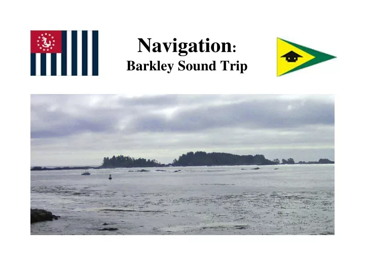
Photos from the Trip that Raise Navigation Issues – Everyone Participates! - Show Photos -
What Navigation Tools we Used Traditional: • Charts? • Route Planning? • Tide Tables? • DR Plotting? • Plot Fixes? • Steer Compass Heading? • Convert True/Magnetic? • Maintain Logbook? • VHF Weather Forecasts/Observations?
What Navigation Tools we Used Electronic: • Web Weather Forecasts/Observations? • GPS? • Chartplotter? • Radar? • AIS? • VHF Radio? Demo / Illustrate Smartphone Apps: • Navionics: Marine & Lakes, US & Canada, $15 • Ship Finder (Pinkfroot Limited), $5
More Photos from the Trip,Mainly for Enjoyment - Show Photos -