Download
1 / 13
130 likes | 239 Views
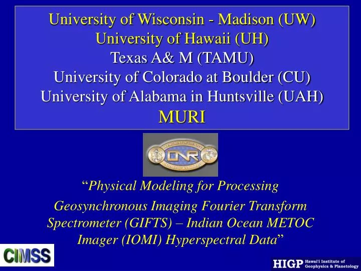
University of Wisconsin - Madison (UW) University of Hawaii (UH) Texas A& M (TAMU) University of Colorado at Boulder (CU) University of Alabama in Huntsville (UAH) MURI. “ Physical Modeling for Processing

E N D
University of Wisconsin - Madison (UW)University of Hawaii (UH) Texas A& M (TAMU)University of Colorado at Boulder (CU)University of Alabama in Huntsville (UAH)MURI “Physical Modeling for Processing Geosynchronous Imaging Fourier Transform Spectrometer (GIFTS) – Indian Ocean METOC Imager (IOMI) Hyperspectral Data”
Revised Tasks • 1 Mathematical Quantification of Useful Hyperspectral Information • 2 Radiative Transfer Modeling • Clear Sky Emission/Absorption • Atmospheric Particulate Emission/Absorption • Surface Emission/Absorption • Cloud modeling • Aerosol/Dust Modeling • 3 Mathematical Retrieval Algorithm Development • Atmospheric Parameters • Suspended Particulate Detection and Quantification • Sea Surface Temperature • Surface Material Identification • 4 Product Research • Ocean Surface Characterization • Lower Tropospheric Temperature, Moisture and Winds • Surface Material Products • Aerosols/Dusts • Derived (Second Order) Products • visibility andClouds
Co-I and Subcontract Tasks • Prof. Paul Lucey (UH-HIGP) • Surface Characterization • Prof. Ping Yang (TA&M) • Cloud Modeling • Prof. Irina Sokolik (CU) • Aerosol/Dust Modeling • Prof. Gary Jedlovec & Sundar Christopher (UAH) • Cloud and Aerosol products, & Wind Tracking Analysis
Surface Characterization • Co-Investigator: Prof. Paul Lucey (UH-HIGP) • Tasks and Goals: • Surface Materials Properties • Airborne hyperspectral data reduced to emissivity • Laboratory data collection of materials spectral properties • Directed airborne hyperspectral data collection • Specialized surface materials properties of interest to GIFTS/IOMI MURI • Data collections in support of atmospheric model validation • Hyperspectral analysis methodologies • Target detection and surface materials classification algorithms.
Surface Characterization • Co-Investigator: Prof. Paul Lucey (UH-HIGP) • Progress: • Continuing compilation of non-classified airborne hyperspectral data sets in units of surface emissivity in accessible on-line form • Continued collection of laboratory data in support of surface emissivity library • Test data collection of airborne hyperspectral data in Hawaii for atmospheric model validation. • Plan-Completion of on-line data base with simple data ingestion (may add Hawaii laboratory spectra to Arizona State University data base as an alternative). • Continue collection of directed validation airborne data runs
Surface Characterization • Co-Investigator: Prof. Paul Lucey (UH-HIGP) • Planned Tasks: • To complete the surface materials data archive and provide access to GIFTS-MURI team members and other users. • To finalize our plan to reproduce the Arizona State library model, or to contribute our laboratory data to this archive, and implement the final disposition of spectra • On complete reduction of the field data, we will plan a model validation run with MURI team members, this time focussing on aerosols and water vapor
Cloud Modeling • Subcontractor: Prof. Ping Yang (University of Texas A&M) • Tasks and Goals: • Develop State of the Art Cloud Model for GIFTS/IOMI • 1. Water Cloud Radiative Property Modeling • 2. Ice Cloud Radiative Property Modeling • 3. Full Fast Physical Cloudy Radiative Transfer Modeling • 4. Cloud Property Retrieval
Cloud Modeling • Subcontractor: Prof. Ping Yang (University of Texas A&M) • Progress (three deliveries): • Optical properties of Water Clouds in spectral regions of • 685-1130 and 1650-2250 cm-1 • Optical Properties of Ice clouds in longwave infrared • Window (8-13 µm) region • Optical Properties of Ice clouds in 1667-2500 cm-1 region
Cloud Modeling • Subcontractor: Prof. Ping Yang (University of Texas A&M) • Planned Tasks: • 1. Improve cloud optical models (in particular, for cirrus clouds) • Current delivery simplifies the geometry of ice crystals • More realistic ice crystal habits will be used • Improve the efficiency of computational model and increase • spectral resolution in light scattering computation • 2. Mixed-phase cloud • How to model the situation when ice crystals and supecooled • liquid droplets coexist • 3. Sensitivity of infrared radiance to cloud optical properties • 4. Explore algorithms to retrieve cloud properties
Aerosol/Dust Modeling • Subcontractor: Prof. Irina Sokolik (University of Colorado) • Tasks and Goals: • Establish a framework for the development of a new physically-based • treatment of mineral dust for IR hyperspectral remote sensing • analyze NAST-I spectra along with other observations performed in • the East China Sea region during Spring of 2001 to identify an Asian • dust spectral radiative signature • perform detailed forward modeling to determine the sensitivity of • GIFTS observations to regional dust properties and develop an • atmospheric correction algorithm in the dust laden conditions • develop and test a new algorithm to retrieve dust from GIFTS observations
Cloud and Aerosol Product Research • Subcontractor: Prof. Gary Jedlovec & Prof. Sundar Christopher • (University of Alabama in Huntsville) • Tasks and Goals: • The development of a real-time cloud product that exploits • the high spectral resolution information content of the • GIFTS/IOMI to improve the detection and characterization • of clouds, aerosols, and surface features • 1. Cloud detection and product generation • Description of the Bi-spectral Threshold (BTH) method for GOES • Example comparing GOES product to MODIS cloud product • Applications to GIFTS/IOMI
Cloud and Aerosol Product Research • Subcontractor: Prof. Gary Jedlovec & Prof. Sundar Christopher • (University of Alabama in Huntsville) • Tasks and Goals: • The development of a real-time cloud product that exploits • the high spectral resolution information content of the • GIFTS/IOMI to improve the detection and characterization • of clouds, aerosols, and surface features • 2. Feature tracking accuracy • Sources of satellite wind track errors • Lower limit on wind tracking accuracy • definition of Tracking Error Lower Limit (TELL) parameter • Spatial-temporal resolution trade-offs TELL diagrams
Summary • 1.Surface modeling and Characterization • Progress been made in compilation of surface data base • and laboratory surface emissivity library • Test data set for validation of modeling and algorithm • 2.State of the Art Cloud Modeling • Fast parameterization of both ice and water cloud property • 3.State of the Art Aerosol/Dust Modeling • Aerosol/dust modeling expert join MURI team • 4.Geo (high temporal) Cloud and Aerosol Products Research • The use of Geo data experts join MURI team