Download
1 / 38
450 likes | 1.19k Views
COSMO-SkyMed Products and Services. IICWG October 22-26 Frascati Italy Giorgio Apponi e-GEOS. CONTINUITY. RELIABILITY. PERFORMANCE. COSMO-SkyMed X- band (fully funded by It. Gov). CSM-1 launched 7 June 2007 CSM-2 scheduled 5 Dec. 2007.

E N D
COSMO-SkyMedProducts and Services IICWG October 22-26 Frascati Italy Giorgio Apponi e-GEOS
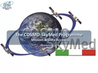
CONTINUITY RELIABILITY PERFORMANCE COSMO-SkyMed X- band (fully funded by It. Gov) CSM-1 launched 7 June 2007 CSM-2 scheduled 5 Dec. 2007 SAOCOM L- band (fully funded by Arg.& It. Gov) SABRINA (fully funded by It. Gov) COSMO-SkyMed 2nd G 2007 2008 2009 2010 2011 2012 2013 2014 An Operational System
PERFORMANCE Very High Resolution: 1m from 20º–59º; multiple modes High quality images Guaranteed Image Acquisitions (day/night & all weather) Fast Response Large Daily Area Collection Unmatched Revisit Complementary missions Interferometric & polarimetric capabilities FEATURES 1.7 ton satellite class, active array antenna with steerable beam Wider bandwidth (400MHz) High geolocation accuracy with worldwide fiducial GPS network High orbit altitude (620 Km) Right & left looking acquisition Large memory capacity (300 Gb) Multiple imaging modes (resolution 1m – 100m) A new era of Operational Applications
Program management & infrastructure • Dual system: funded by Italian MoD and ASI • Three main program elements: • Italian Defence • Italian Civil Institutions • Commercial Customers • Program management: • Industrial structure: • Satellite (sensor & spacecraft) • Ground Segment (MCC, CPCM, UGS, operations)
Commercialization • e-GEOS is in charge of commercial promotion and exploitation of COSMO-SkyMed data • e-GEOS is a Joint Venture with majority shareholders ASI and Telespazio • e-GEOS will promote sales at worldwide level through: • Ground Station Partners • VA Service Partners • Reseller Network • Data Policy approved by Italian Government
Multiple Modes Flight Direction Swath MODE-2 HUGEREGION WIDEREGION HIMAGE PINGPONG Resolution – single look 30 m 16 m 3 m 15 m 1 m Resolution – standard multi-look 100 m 30 m 5 m 15 m Swath 200 km >2,000 km 100 km >2,000 km 40 km >2,000 km 30 km >2,000 km 10 x 10 km Strip length STRIPMAP SPOTLIGHT SCANSAR
Multiple modes Wide Field Narrow Field SCANSAR HUGEREGION 200 x 200km 100m resolution WIDEREGION 100 x 100 km 30m resolution STRIPMAP HIMAGE 40 X 40 km 3—15m resolution PINGPONG 30 x 30 km 15m resolution SPOTLIGHT 10 x 10 km 1m resolution Tokyo, Landsat 7 ETM+
High Resolution Capability • With 400 MHz of Chirp Bandwith, very high resolution is guaranteed at low incidence angles
Po River delta Image owned by ASI and Italian MoD
Mount Etna Image owned by ASI and Italian MoD
Migliore capacità di individuare gli edifici, le infrastrutture, le strade… Image owned by ASI and Italian MoD Image owned by ASI and Italian MoD
Kiruna Matera Cordoba Fast response time • Fixed (C-UGS) & mobile (C-MAPS) terminals • External stations (X band + S band for TT&C) • Direct downlink service • Directly receive raw data at customer ground station • Encryption key • Station setup support • Operator training
Large daily area collection • Each satellite can acquire, on a daily basis: • Up to 75 SPOTLIGHT images • Up to 375 STRIPMAP or 150 SCANSAR images or 80 HUGEREGION • Daily total for 4 satellite constellation: • 1800 cloud free images, e.g.: • 300 SPOTLIGHT images = 30,000 km2 at 1m resolution • PLUS • 1500 STRIPMAP images = 2,400,000 km2 at 5m resolution • 560 GBytes/day • Peak operational profile: on a single orbit: • up to 10 minutes continuous operations in StriMap or ScanSAR Mode • up to 20 consecutive images in Spotlight Mode • any linear combination of the above
Unmatched revisit 48 7 Daily acquisition opportunities, with 4 satellites 4 7 48
Fast response time Planning Image Acquisition Data Downlink Process- ing Request Submission 24 (12 in crisis) 16 (8 in crisis) 0 —> 4 < 1 Time (hours) 0 —> 13 Processed Image Uplink Downlink SAR Image
66 Km 39 Km Continuity between acquisitions • Minimum interval between two successive datatakes or images STRIPMAP or SCANSAR SPOTLIGHT 20º 3 seconds 59º 3 seconds
Polarimetric capability • Polarization modes enable better target discrimination and improved classification • STRIPMAP mode in PINGPONG configuration • 15m resolution, 30km swath • HH, VV or HH,HV or VV, VH • Application areas: • Agriculture: crop monitoring, yield estimates • Marine Surveillance: ship detection, marine pollution • Defence: terrestrial surveillance, target identification • Mapping: geological, land use, wetlands, topographic mapping • Sea Ice: mapping, iceberg detection, ship routing
HH VV HV Multi-Polarization: Ice Classification Selective polarization modes provide more information from a single band
SAR Standard Products Level 1A Level 0 Level 1B Level 1C/1D Level 1C Level 1D Examples from ERS–1
COSMO-SkyMed COSMO-SkyMed Revisit Analysis for Monitoring Services Version 7 COMPANY CONFIDENTIAL
Number of cumulative acquisitions in 1 week 40 35 30 25 20 15 10 5 0 1 2 3 4 5 6 7 COSMO-SkyMed 1 COSMO-SkyMed 1+2 COSMO-SkyMed 1+2+3+4 Target monitoring @ 1 m • Caspian Sea
PM Desc PM Desc PM Desc PM Desc PM Desc PM Desc AM Asc AM Asc AM Asc AM Asc AM Asc AM Asc PM Desc AM Asc Left look COSMO-SkyMed 1 Right look Left look COSMO-SkyMed 2 Right look Left look COSMO-SkyMed 3 Right look Left look COSMO-SkyMed 4 Right look 3 Dec 2007 4 Dec 2007 5 Dec 2007 1 Dec 2007 6 Dec 2007 2 Dec 2007 7 Dec 2007
Mapping • Zhejiang region (China) • 100,000 Km2 • Only Right looking for mapping consistency • Himage strips @ 3 m Example of COSMO-SkyMed 1 Himage strips on 4 Dec 2007
Mapping • Approximate number of days needed to complete the area (starting 1 Dec 2007)
Monitoring • Sicily channel • 210,000 Km2 • Scansar Wideregion @ 16 m Example of COSMO-SkyMed 1 Scansar strips on 1 Dec 2007
Monitoring • Cumulative Km2 that maximize the coverage in 1 week time
Ice Monitoring • Combined use of Multi Satellite SAR platforms / Multi imaging modes • Data Delivery: <2 hours from sensing • Data Characteristics: • Resolution: 1-150m • Ortho • Integration with Optical VHR • Revisit: weekly • Data Delivery: GIS ready 16m QuickLook in less than 12 hours from sensing, full resolution image in less than 24 hours • Data Characteristics: • Resolution: 0.50-16m • Ortho
CONTINUITY RELIABILITY PERFORMANCE An Operational System Thank you giorgio.apponi@e-geos.it