Download
1 / 20
200 likes | 305 Views
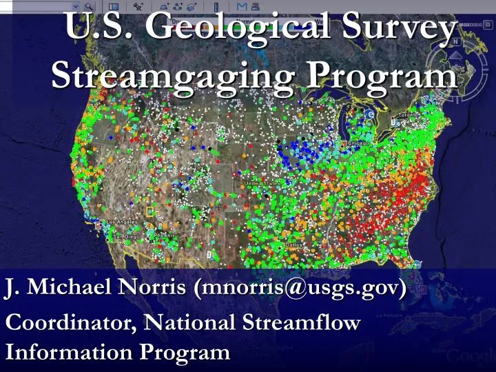
U.S. Geological Survey Streamgaging Program. J. Michael Norris (mnorris@usgs.gov) Coordinator, National Streamflow Information Program. Discuss:. USGS streamgaging program Uses of streamflow information National Streamflow Information Program (NSIP).

E N D
U.S. Geological Survey Streamgaging Program J. Michael Norris (mnorris@usgs.gov) Coordinator, National Streamflow Information Program
Discuss: • USGS streamgaging program • Uses of streamflow information • National Streamflow Information Program (NSIP)
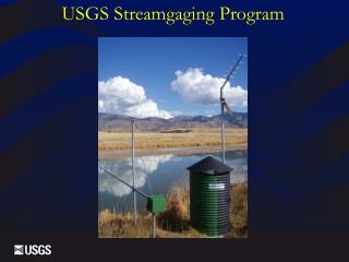
*3,200,000 river reaches – 1 streamgage per 430 river reaches San Francisquito Cr. nr. Stanford, CA Pacific Cr. nr Moran, WY . The U.S. Geological Survey currently collects streamflow data at over 7,500 streamgages*
Expanding Uses of Streamflow Information • Resource appraisal and allocation • Design of Nation’s water infrastructure • Flood hazard planning and forecasting • Reservoir and power operations • Water quality management • Instream flows for habitat conditions • Understanding changes of streamflow • Recreational safety • More . . . .?
Use of Streamflow Information for Resource Appraisal And Allocation • Municipal water supply • Irrigation • Manufacturing • Hydropower • Habitat
Use of Streamflow Information for the Design of the Nation’s Water Infrastructure • Dams • Navigational locks and dams • Bridges • Culverts • Water Treatment facilities
Use of Streamflow Information for Flood Hazard Planning and Forecasting • NWS • Streamflow Forecast Model Calibrations • Model Verification • Streamflow Forecasting • FEMA • Flood plain delineations • Food Insurance Rate Maps
Use of Streamflow Information for Reservoir and Power Operations • Amount of water available in low-flow conditions. • Amount of water available today. • Amount of water expected in the future both short and long term
Use of Streamflow Information for Water Quality Management and Instream Flows for Habitat Conditions • TMDL’s • Quantity and timing of flows critical for habitat
Use of Streamflow Information for Understanding Changes of Streamflow and Recreational safety • Land use, water use, and climate changes • Recreational safety and enjoyment
What are the Issues? • Network’sability to meetlong-standing Federalgoals declinedbecause of: • An increasing instability in the networkcaused by a loss of critical streamgagesdue to the way the streamgaging program is funded. • New issues and new technologies haveincreasedthe demand for streamflow information. • New technologies are needed to: • Improve reliability • Decrease costs • Decrease uncertainty
Funding for USGS Streamgaging Network, FY 2008 Total $136.6M
Five National Streamflow Information Program Goals • 1. Stabilize the streamgaging network • National backbone network of streamgages to meet Federal needs • Modernize and harden the network streamgages 4,744 NSIP Federal Goal Streamgages (914 streamgages meet more than one need)
National Streamflow Information Program (cont.) • 2.Floods and droughts • 3. Regional assessments of streamflow characteristics • 4. Improved information delivery • 5. Methods development and research
SECURE Water Act Stakeholder Support