Download
1 / 6
60 likes | 165 Views
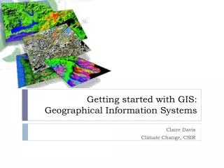
SUPERMAPPING Geographical information systems. Date 14.08.13 Presenter name/other information. Challenge overview. You are asked to develop an idea based on the mapping of places using Geographical Information Systems. This can be related to: Your school or local area

E N D
SUPERMAPPINGGeographical information systems Date 14.08.13 Presenter name/other information
Challenge overview • You are asked to develop an idea based on the mapping of places using Geographical Information Systems. • This can be related to: • Your school or local area • A wider project that is already being taught (mapping data from a field trip) • A bigger question such as population data for health versus economic data • Natural landscapes and data that can either be acquired from the internet or generated by the students • The aim of this is to give students a practical insight into the use and value of GIS systems for a range of Geographical and other Earth Science-based questions. • Students will get hands on training on GIS based software. • We will use freeware so that schools and students can work away from RHUL but there will be Gepgraphystaf support. • We will try to provide both the GIS based expertise but also expert knowledge on the research area
Curriculum links • Core Curriculum links • The use of Geographic software as a geographical skill • Practical hands on experience of using Geographic data and could be incorporated into a GCSE project • Can provide core training for a future As or A level project where use of data analyses and GIS systems is an important skill. • Wider Curriculum Links The project is flexible so students can develop an idea that fits any area of the Geography curriculum Clear potential areas include: • Health and populations • Physical systems such as rivers and flooding or coastal erosion • Geohazards • Environmental protection • Urban spaces and urban issus
Added value • GIS is a key Geographical tool that is becoming more and more common in both specific Geographic projects and jobs, and teaching. • By using this approach students will get practical hands on experience on software that will allow them to think differently about how geography works • It will allow them new insights into how space is a critical factor in thinking about Geography and other areas of study • They will have the added value of designing a project and realising it with a piece of software We have developed experience of similar projects working with sixth formers and now want to develop this idea with other year groups. Working closely with a University team will also allow the students to start to think beyond the school learning environment We will help to develop the core skills of thinking about a suitable research project and then developing and realising it.