Download
1 / 47
510 likes | 704 Views
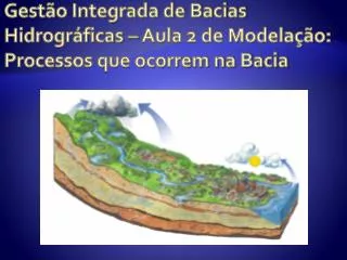
Gestão Integrada de Bacias Hidrográficas – Aula 2 de Modelação: Processos que ocorrem na Bacia. Hydrology in SWAT. Ea. R day. Q surf. Q gw ( baseflow ). W seep. The Rain. Must be measured in rain gauges. In how many? How to interpolated/extrapolated? .

E N D
Gestão Integrada de Bacias Hidrográficas – Aula 2 de Modelação: Processos que ocorrem na Bacia
Hydrology in SWAT Ea Rday Qsurf Qgw(baseflow) Wseep
The Rain • Must be measured in rain gauges. In how many? • How to interpolated/extrapolated?
Comparing 3 interpolation methods in Trancão THIESSEN POLYGON Inverse of the Distance Weight Regression Model
Evapo-Transpiration • Depends on: • Atmospheric conditions (HR, Temperature, radiation & wind) • Available soil water (above wilting point) • Transpiration surface (Leaf Area Index – LAI)
Evapo-Transpiration • Depends on plants Development and soil cover.
Penman - Monteith • Rn is the net radiation, G is the soil heat flux, (es - ea) ris the vapour pressure deficit of the air, r a is the mean air density at constant pressure, cp is the specific heat of the air, D is the slope of the saturation vapour pressure temperature relationship, g is the psychrometric constant, and rs and ra are the (bulk) surface and aerodynamic resistances. http://www.fao.org/docrep/X0490E/x0490e06.htm
Water Dynamics • Richards Equation http://www.mohid.com/wiki/index.php?title=Module_PorousMedia#Water_retention
10cm 30cm 50cm 70cm Teores de água simulados – Gráficos Tempo/Profundidade Tempo
ETR P-V P-V P-V Chuva 1º ANO 2º ANO 3º ANO Rega 50cm O-I O-I O-I 35cm 15cm P-V Efeito da ETR, chuva e rega nos teores de água Primavera-Verão O-I Outono-Inverno
MOHID LandWatershed Water Content Runoff Rain Intensity IST – MARETEC 2008
Runoff • Is the Rain that does not infiltrate. • Flows at soil surface, can infiltrate (and sometimes exfiltrate. • Flow is controlled by friction.
Scientific Modules that must compose an integrated model • Hydrology • Vegetation (evapotranspiration, nutrients, pesticides, erosion,….) • Mineralisation of Organic matter in the soil (bacterial loop) • Irrigation • Salts dynamics/chemical equilibrium • Rivers, • Reservoirs/lakes, • Estuaries and Coastal Lagoons.
Types of Models • All models compute Evapo-transpiration on the same way. Differences on results depend on the detail of the input data. • Process oriented models (e.g. Hydrus, Mohid, Mike, RZWQM) compute percolation using the Richards Equation. They need fine grids. • Other models use coarse grids and empirical formulations to compute flow (e.g. SWAT, HSPF, BASINS).
Technical modules required • Meteorological data processor, • Climate (seasonal/daily solar evolution), • GIS, • Chemical Equilibrium, • Plants Optimal Growth, • Management Practices, • Graphical interfaces.
Vegetation Module • Production of plants is the major role of catchments. • Diffuse pollution is mostly due to plant growth improvement: • Fertilisation, Phyto-sanitation, irrigation.
Soil Organic Matter http://www.fao.org/docrep/009/a0100e/a0100e05.htm
CO2 N2 CH4 NH4+ Psol LABILE OM REFRACTORY OM NO3- ANAEROBIC BIOMASS AEROBIC BIOMASS CO2 Pfix Psol AUTOTROPHIC BIOMASS NH4+ NH3 Urea Soil Nutrient Model
More information • http://www.mohid.com/wiki/ • http://en.wikipedia.org/wiki/MOHID_Land
1D Drainage network 2D Overland flow 3D Porous Media Precipitation Variable in Time & Space Distributed vs partially distribuited models MOHID Land SWAT HRU CN, Lag time Watershed picture to farm plots; Vegetation and Erosion Flush events
Processos de qualidade da água em Rios CO2 O2 Nitrato Respiração Amónia Nutrientes Ortofosfato Consumo Sílica Bactérias Produtores Primários Excreção Morte Detritos / MO Consumo Deposição Sedimentos Produtores Secundários
Hydrodynamics • Kinematic wave equation • (equilibrium between gravity and friction) • Trapezoidal shape for channels in both models • Rchisthehydraulicradius for a givendepthofflow (m), • slpchistheslopealongthechannellength (m/m), • n isManning’s “n” coefficient in channel • vcistheflowvelocity (m/s). If inertia is important:
MOHID LandWatershed WaterContent Runoff Rain Intensity IST – MARETEC 2008
MOHID Land River Sediment Rain Intensity WQ models in river IST – MARETEC 2008
SWAT: Percolation • wperc,lyis the amount of water percolating to the underlying soil layer on a given day (mm H2O), • SWly,excessis the drainable volume of water in the soil layeron a given day (mm H2O), • Δtis the length of the time step (hrs), • TTpercis the travel time for percolation (hrs). • SATlyis the amount of water in the soil layer when completely saturated (mm H2O), • FClyis the water content of the soil layer at field capacity (mm H2O), • Ksatis the saturated hydraulic conductivity for the layer (mm·h-1).
Base flow • Qgw,iis the groundwater flow into the main channel on day i (mm H2O), • Qgw,i-1 is the groundwater flow into the main channel on day i-1 (mm H2O), • αgwisthe baseflow recession constant, • Δt is the time step (1 day), and • wrchrgis theamount of recharge entering the aquifer on day i (mm H2O).
CN – Curve Number (0% -100% runoff) Run Off • O CN is a function of: i) permeability, ii) land use and iii) previous soil water content. CN can change between 0.0 (no runoff) and 100 (all precipitation transformed into runoff).
Run Off • S – Soil water retention parameter (mm H2O) • Knowing Qsurf (acumulated runoff) it is possible to estimate infiltration
Bacia do Sado (Plano de Bacia) IST- MARETEC 2009
Delineação • Com base na topografia foram geradas 700 sub-bacias para a RH6 com áreas entre 0.001 km2 e 100 km2 • Sub-bacias foram geradas em função das massas de água 1
Flow Precipitation IST- MARETEC 2009 1
Definição de HRU Cada sub-bacia comporta-se como uma Unidade de Resposta Hidrológica (HRU) com o mesmo uso de solo, tipo de solo e declive 1
Águas de Transição: Tipologias e massas de água • RH6 • Tipologia A2 • Estuário mesotidal homogéneo com descargas irregulares de rio • Estuário do Sado • 6 massas de água • Estuário do Mira • 3 massas de água IST- MARETEC 2009 8
Estuário do Sado: Massas de Água IST- MARETEC 2009 28
Poucos dados - estações da Sado WB1 Poucos dados - estações da Sado WB2 Poucos dados - estações da Sado WB2 (individualmente e com a média das estações)
Canal de Alcácer IST- MARETEC 2009