Download

1 / 15
150 likes | 342 Views
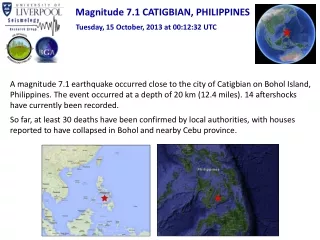
MAGNITUDE 7.2 EARTHQUAKE STRIKES BOHOL ISLAND, THE PHILIPPINES (8:12 am, October 15, 2013). Walter Hays, Global Alliance for Disaster Reduction, Vienna, Virginia, USA . LOCATION MAP. BOHOL: THE PHILIPPINE’S 10 TH LARGEST ISLAND. 8:12 AM, OCTOBER 15, 2013.

E N D
MAGNITUDE 7.2 EARTHQUAKE STRIKES BOHOL ISLAND, THE PHILIPPINES(8:12 am, October 15, 2013) Walter Hays, Global Alliance for Disaster Reduction, Vienna, Virginia, USA
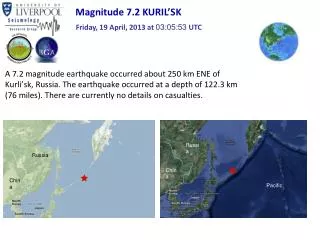
8:12 AM, OCTOBER 15, 2013 • At 8:12 am, a magnitude 7.2 earthquake occurred at a depth of 20 km (12 miles) near Carmen and Cebu city. • 43,000 people impacted. • At least 93 dead. • Rescuers struggled to reach patients in a collapsed hospital. • Power outages over a wide area.
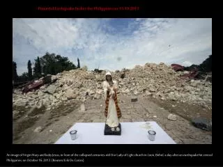
8:12 AM, OCTOBER 15, 2013 • Historic Basillica del Sto Nino damaged. • Heavy damage in Cebu City. • Damaged houses leave many displaced victims.
TECTONIC SETTING The Philippines has experienced destructive earthquakes and volcanic eruptions in the past
LIKELY FAULT ZONE: THE EAST BOHOL FAULT As reported by Renato Solidum, Director of the Philippine Institute of Volcanology and Seismology
THE EAST BOHOL FAULT • The East Bohol Fault, which crosses southern Bohol Island, helps relieve some of the tectonic pressure on The Philippines. • The islands are crumpling between three tectonic plates: the Philippine, Sunda, and Eurasia plates.
COLLPSED HOSPITAL • The most deaths — 18 — were in the municipality of Loon, 42 kilometers (26 miles) west of Carmen, where an unknown number of patients were trapped inside the partially collapsed Congressman Castillo Memorial Hospital.
EMERGENCY RESPONSE PROBLEMS • Many roads and bridges were damaged, making rescue operations difficult. • Power outages left the entire province in the dark. • High winds and rain prevented operations of military helicopters. • Tents were set up for displaced victims; others moved in with relatives