Download
1 / 32
320 likes | 517 Views
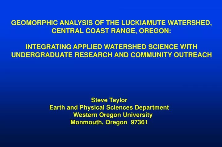
GEOMORPHIC ANALYSIS OF THE LUCKIAMUTE WATERSHED, CENTRAL COAST RANGE, OREGON: INTEGRATING APPLIED WATERSHED SCIENCE WITH UNDERGRADUATE RESEARCH AND COMMUNITY OUTREACH. Steve Taylor Earth and Physical Sciences Department Western Oregon University Monmouth, Oregon 97361. Introduction

E N D
GEOMORPHIC ANALYSIS OF THE LUCKIAMUTE WATERSHED, CENTRAL COAST RANGE, OREGON: INTEGRATING APPLIED WATERSHED SCIENCE WITH UNDERGRADUATE RESEARCH AND COMMUNITY OUTREACH Steve Taylor Earth and Physical Sciences Department Western Oregon University Monmouth, Oregon 97361
Introduction • Watersheds as Undergraduate Service Learning Laboratories • Geomorphic Significance of the central Oregon Coast Range • Luckiamute River Study Area • Results of Geomorphic Analyses • Summary and Conclusion
WATERSHEDS AS SERVICE LEARNING LABORATORIES: Natural outdoor science laboratories with defined boundaries Local, place-based contextual learning facilities Promote university-community linkages Complex multivariate systems w/ process-response feedbacks Amenable to quantitative techniques and geospatial technology
SIGNIFICANCE OF THE LUCKIAMUTE WATERSHED TO WOU: “THE” local WOU watershed, socially relevant Close proximity to campus, logistically accessible Amenable to long-term studies in fluvial geomorphology, environmental geology, conservation biology, and hydrology Opportunities for cross-collaboration and community outreach
SUMMARY OF LONG-TERM RESEARCH AND COMMUNITY SERVICE INITIATIVES IN THE LUCKIAMUTE BASIN 1999-Present WOU Earth Science-Biology-Chemistry Class Field Trips and Contextual Learning Modules (Fluvial Geomorphology, Geologic Mapping, Hydrogeology, Environmental Geology, Botany, Aquatic Invertebrates, Environmental Chemistry, Water Quality, Geographic Information Systems) 2001 Environmental Science Institute Course (Geomorphology, Env. Chemistry, Botany, Climatology) 2002 Proposal Development (Watershed Learning Model) 2003-2004 Watershed Assessment with Luckiamute Watershed Council 2003-Present Community Support of Luckiamute Watershed Council 2004-Present Funded Research: Hydrogeomorphic Analysis (USGS / CWest) 2004-Present Funded Research: Spatial Distribution of Invasive Plants (OCF)
Geomorphic Significance of the Oregon Coast ange Oregon Coast Range Unglaciated, forested landscape Paleogene-Neogene marine volcanic and sedimentary rocks (Walker and MacLeod, 1991) Long history of oblique convergence and tectonic accretion (Wells et al., 1984) Active mountain building during the past 10-15 Ma (Snavely et al., 1993) Pleistocene uplift rates = 0.1-0.3 mm/yr (Kelsey et al., 1996) Historic uplift rates = 1-3 mm/yr (Mitchell et al., 1994) Eastward tilting = 1 x 10⁻⁸ rad/yr (Adams, 1984) Holocene erosion rates = 0.05-0.33 mm/yr (Roering et al., 2005) Study Area
SAMPLINIG OF PREVIOUS WORK IN TYEE LANDSCAPES OF “THE OCR” University of Washington – UC Berkeley Geomorphic Offspring and Related Cousins Pierson (1977) Debris flow processes Dietrich and Dunne (1978) Sediment budgets Jackson and Beschta (1982) Bedload transport Burroughs (1985) Landslide modeling Dietrich and others (1986) Hillslope processes Montgomery and Dietrich (1988) Landscape evolution Benda (1990) Debris flow processes Benda and Cundy (1990) Debris flow processes Reneau and Dietrich (1990) Debris flow processes Reneau and Dietrich (1991) Landscape evolution Personius and others (1993) Terrace chronologies Montgomery and Dietrich (1994) Landslide modeling Benda and Dunne (1997) Debris flow processes Montgomery and others (1997) Hillslope process experiments Roering and others (1999) Hillslope process experiments Montgomery and others (2000) Landslide modeling Heimsath and others (2001) Weathering processes Schmidt and others (2001) Slope stability Anderson and others (2002) Weathering processes May (2002) Debris flow processes Casebeer (2003) Sediment budgets Lancaster and Hayes (2003) Debris flow processes May and Gresswell (2003) Sediment production Roering and others (2003) Slope stability Schmidt and others (2003) Slope Stability Kobor and Roering (2004) Bedrock-channel processes Roering and others (2005) Slope processes / Landscape Evolution
Study Area Salem Oregon Luckiamute Study Area Focus of Existing Coast Range Studies (27+ yrs) Eugene Coos Bay Tyee Fm Outcrop Belt (Eocene, arkosic ss, delta-submarine fan) 0 50 km
Yamhill Domain (23%) Spencer Domain (29%) Tyee Domain (29%) Siletz Domain (19%) 0 5 km Hillslope- Colluvial Valley Floor- Alluvial Hillslope- Colluvial Hillslope- Colluvial
Luckiamute River at Helmick State Park Bankfull Stage 3/27/05 3800 cfs
Spencer-Valley Fill Domain Ts el 470 ft Max Missoula Flood El. = 400 ft) el 220 ft Qtm (Bela, 1981) Qff2 (O’Connor et al., 2001) Willamette Silt
Siletz Domain Spencer Domain
Willamette Valley Yamhill-Intrusive Domain
Total Luckiamute Ad = 815 km2 Avg Subbasin Ad = 10-20 km2
Methodology • GIS analysis of USGS 10-m DEMs • Software: ArcGIS and Terrain Analysis System (TAS v1.5; Lindsay, 2002) • Subbasin boundaries and channel network derived by the Coastal Landscape Analysis and Modeling (CLAMS) group at PNW Forest Research Lab (Miller et al., 2001)
Average Median
Average Median
Summary of Slope Parameters for the Luckiamute Watershed Valley Fill- Siletz Yamhill- Tyee Spencer Intrusive Max Slope 56.8o 61.9o 59.0o 62.0o Avg Slope 3.2o 12.7o 11.9o 14.5o Std Dev 3.98o 7.90o 7.97o 9.18o Variance 15.84o 62.49o 63.51o 84.25o 90th 9o 24o 24o 28o Percentile % Cells >20o 0.7 18.3 15.4 25.9 % Cells >25o 0.2 7.7 7.9 14.3 No. Cells 2290702 1510287 1926899 2409140
Little Luckiamute Tyee Domain Luckiamute Yamhill Domain
Tyee Domain in the Luckiamute Basin: • Steeper, rugged hillslopes • More finely dissected by low-order channels • Tendency to spawn debris flow • Lower stream-power index compared to Yamhill Domain • Higher average valley widths, increased sediment accommodation space • Working Hypotheses for Tyee Domain: • Hillslope transport rates are greater • than the ability of the channel • system to export sediment • Steep hillslopes and increased • valley widths result in comparative • decrease of net sediment-transport • efficiency
Concluding Statements (1) The Luckiamute Watershed represents a model outdoor laboratory for contextual and service learning opportunities in the Natural Sciences at Western Oregon University Geomorphic analysis suggests that spatial variation of bedrock lithology is a primary factor controlling slope gradients, hillslope delivery rates, and resulting sediment-transport efficiency of the channel system. The Luckiamute Watershed is uniquely positioned at the northern terminus of the Tyee outcrop belt, thus providing an opportunity for comparative geomorphic analysis. The rich body of work from other Tyee landscapes in the OCR will serve as the platform from which to extend future research into other bedrock domains. (2) (3) (4)
ACKNOWLEDGMENTS Funding Sources: OSU Institute for Water and Watersheds (IWW) USGS Water Resources Small-Grants Program Oregon Community Foundation Western Oregon University Faculty Development Fund WOU Student Research Assistants: Diane Hale, Jeff Budnick, Jamie Fisher, Chandra Drury, Katie Knoll, Rachel Pirot, Jeff Kent WOU Faculty Colleagues 2001 Environmental Science Institute: Bryan Dutton (Biology), Pete Poston (Chemistry), Jeff Myers (Earth Science), Adele Schepige (Education) Ongoing Research Collaboration: Bryan Dutton (Biology)