Download
1 / 33
330 likes | 448 Views
Learn how land surveying is essential for forestry practices, including establishing cutting lines, researching records, and resolving boundary disagreements. Presenters will cover the PLSS system, accuracy of equipment, field reconnaissance, and more.

E N D
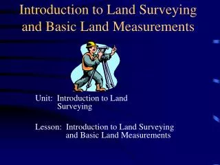
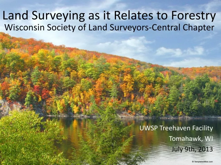
Land Surveying as it Relates to Forestry Wisconsin Society of Land Surveyors-Central Chapter UWSP Treehaven Facility Tomahawk, WI July 9th, 2013
Presenters: • Chris Fieri • Registration: - Licensed as a Registered Land Surveyor in Wisconsin • Education: - Land Surveying Technician – Nicolet College • Current Employment: - Registered Land Surveyor – Riverside Land Surveying, LLC in Weston, WI - Current Vice President of WSLS - Central Chapter • Experience Summary: - 10 years of experience in property boundaries, subdivisions plats, construction layout, section remonumentation surveys.
Presenters: • Jay Dick • Registration: - Wisconsin Registered Land Surveyor • Education: - Land Surveying – Nicolet College - Surveying Engineering – Michigan Tech • Current Employment: - Marathon County Surveying Technician & Town Board Supervisor, Town of King, Lincoln County - Side note: Treehaven is in my town • Experience Summary: - 18yrs of exp. in boundary surveying, topographic surveying, subdivision design & construction layout, and PLSS remonumetation.
Presenters: • Ted Sommer • Registration: - Wisconsin Registered Land Surveyor #2964 • Education: - Forestry & Wildlife / Natural Resource Technology Degree – Vermilion CC - Land Surveying Degree – Nicolet College • Current Employment: - Land Surveyor and Forester – Steigerwaldt Land Services, Tomahawk • Experience Summary: - 12 years of Natural Resource related experience in both the public and private sector as Logger; NRCS Conservation Technician; Project Forester Technician with Clark County; Land Surveying Tech, Forester, and Wildland Firefighter with the US Forest Service - Current President of Northern Lakes Chapter of WSLS - Regularly performs surveys in conjunction with Timber Sales and other Natural Resource related projects
Overview • How Land Surveying relates to Forestry • PLSS system and other Surveying terms • Proper methods of researching records • Accuracy of equipment new and old • Field reconnaissance • Establish lines • Problems and Disagreements/Resolutions • Questions and Answers
How Land Surveying relates to Forestry • Harvesting the timber from public and private lands by setting up timber sales • Establishing Cutting Lines along approximate boundary lines • Management plans in relationship to property boundaries
PLSS System • Why do we have the PLSS system • Simplified way to dispose of public land • Fundraising mechanism for newly formed government • Simplified system to identify new boundary lines • Fence rolls come in 1320’ (length of a “40”) • Measurements • Chains- 1 chain to 66 feet • 80 chains to mile • Rods- 1 rod to 16.5 feet • Link- 100 links to chain • Mile- 1 mile to 5280 feet
PLSS System • Sections, Townships, Ranges and (Town, Village or City) • Section • 1 Mile by 1 Mile with 8 corners set at ½ mile around the exterior • Sections are not 5280 feet and not N, S, E, W. • Fractional Sections • “40’s” and Government Lot
PLSS System • Boundary Lines, Property Lines, and Occupation Lines • They do not mean the same thing but they can be the same location.
Proper Methods of Researching • Plat Books • Online • GIS Mapping • Wisconsin State Cartographers Office • Register of Deeds Office • Deeds and Subdivisions • Property Description • County Land Surveyors Office · Tiesheets and Plats of Survey
GIS Mapping Considerations • Public On-line GIS maps are excellent sources of general property information • Public On-line GIS maps are NOT SURVEYS • On-line parcel mapping have inherent inaccuracies • Coordinates generated from on-line GIS sources may or may not be tied to actual surveyed coordinates • Air photos as represented on On-line GIS sources may have large shifts from actual locations
Accuracy of Equipment Old and New • Compass and Tape • Electric Distance Meter with a transit • Total Stations • GPS • Handheld (30 foot accuracy) • Standard • Meter • Sub-meter • GIS grade • Survey Grade (0.04 foot accuracy)
Field Reconnaissance • Figure out your location and plan • Look for monuments, improvements, and evidences • Section Corners • Fences • Tree lines • Gather all the evidences before marking
When is it appropriate to request a survey? • If you are going to cut up to a property/ possession line. • Make improvement at or near a property line. • At the time of a real-estate transaction. • If anything is in question.
What is the basis of cost for a survey? • Terrain • Vegetation, topography, and ease of access • Survey Records • Previous surveys available • PLSS corner maintenance • Location of courthouse • Online records • Use of technology • Cell phone coverage • GPS vs. Conventional
Marking the “Cut” line • Use good judgment • Talk to all the property owners • If the cut line is questionable ……stop. • Make owner aware that the cut line is not the boundary line • If the owners don’t agree get a land surveyor involved
Problems and Disagreements/Resolutions • Once the line is marked it effects all of the surrounding property owners • Fences • Line fence • Cattle fence • Uneducated land owners • When the cut line is not agreed upon all parties get a Land Surveyor involved. • Professional opinion • Consequences
Questions and Answers Thank you