1 / 3
0 likes | 14 Views
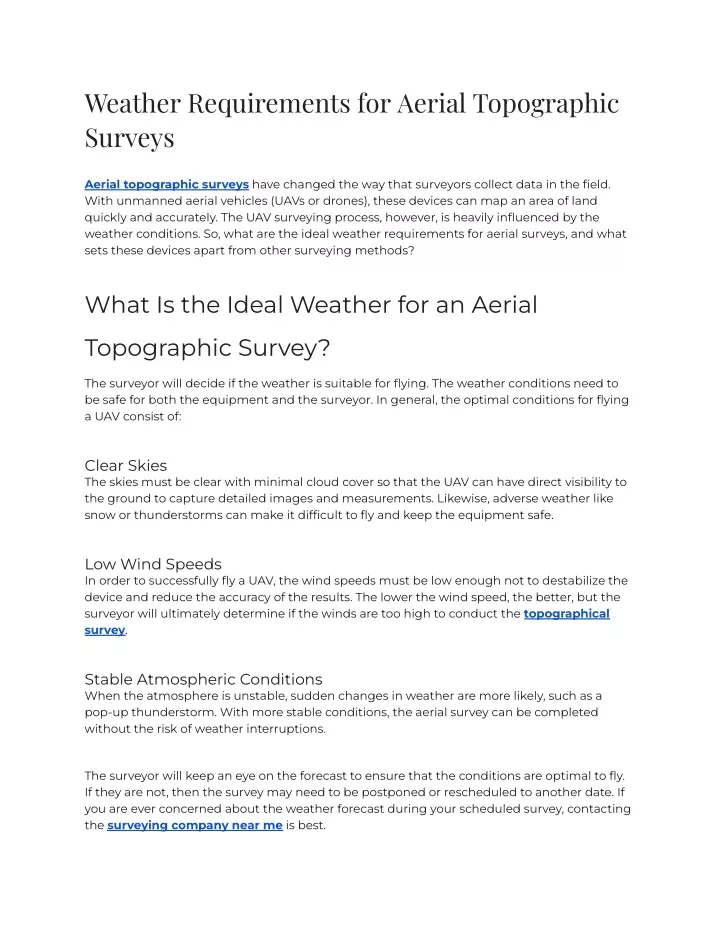
Aerial topographic surveys have changed the way that surveyors collect data in the field.<br>With unmanned aerial vehicles (UAVs or drones), these devices can map an area of land<br>quickly and accurately. The UAV surveying process, however, is heavily influenced by the<br>weather conditions. So, what are the ideal weather requirements for aerial surveys, and what<br>sets these devices apart from other surveying methods?

E N D
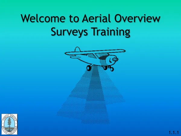
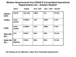
Weather Requirements for Aerial Topographic Surveys Aerial topographic surveys have changed the way that surveyors collect data in the field. With unmanned aerial vehicles (UAVs or drones), these devices can map an area of land quickly and accurately. The UAV surveying process, however, is heavily influenced by the weather conditions. So, what are the ideal weather requirements for aerial surveys, and what sets these devices apart from other surveying methods? What Is the Ideal Weather for an Aerial Topographic Survey? The surveyor will decide if the weather is suitable for flying. The weather conditions need to be safe for both the equipment and the surveyor. In general, the optimal conditions for flying a UAV consist of: Clear Skies The skies must be clear with minimal cloud cover so that the UAV can have direct visibility to the ground to capture detailed images and measurements. Likewise, adverse weather like snow or thunderstorms can make it difficult to fly and keep the equipment safe. Low Wind Speeds In order to successfully fly a UAV, the wind speeds must be low enough not to destabilize the device and reduce the accuracy of the results. The lower the wind speed, the better, but the surveyor will ultimately determine if the winds are too high to conduct the topographical survey. Stable Atmospheric Conditions When the atmosphere is unstable, sudden changes in weather are more likely, such as a pop-up thunderstorm. With more stable conditions, the aerial survey can be completed without the risk of weather interruptions. The surveyor will keep an eye on the forecast to ensure that the conditions are optimal to fly. If they are not, then the survey may need to be postponed or rescheduled to another date. If you are ever concerned about the weather forecast during your scheduled survey, contacting the surveying company near me is best.
What Else Is Needed to Fly a Drone for an Aerial Topographical Survey? Alongside a weather assessment, there are specific needs that a surveyor must meet or follow to fly a drone. These include: Obtaining the Appropriate Licensing and Training. To conduct an aerial survey, a surveyor must hold a Part 107 certification from the Federal Aviation Administration (FAA). ● Submitting the Flight Plans. Surveyors may need to submit a flight plan to the FAA prior to the survey to gain permission to fly in a specific area or time. ● Follow FAA Regulations. The FAA has specific regulations in place that a surveyor must follow before and during the flight. ● Choosing the Right Equipment. The right type of aerial equipment must be used to capture the data needed for the client’s project. ● The Benefits of UAVs Over Traditional Surveying Equipment UAVs have numerous advantages that can make them ideal for certain surveying projects. A surveying company near me might utilize UAVs over traditional surveying equipment because: 1. UAVs Survey With Greater Efficiency Depending on the size of the land, a survey may take several days or weeks when using traditional equipment. Aerial surveying technology can gather thousands of measurements during a single flight, speeding up the timeline of the project. 2. UAVs Are Safer With traditional equipment, surveyors must carry and set up the equipment, sometimes across dangerous terrain. UAVs provide a safer option, as they can easily survey a site from the air and return to the launch location when finished. 3. UAVs Have Enhanced Accuracy The technology used in aerial topographic surveys is highly advanced, so the results
are captured with a high degree of accuracy. UAVs can also provide extensive land information, such as real-time contours and grade breaks, with great precision. While UAVs are a highly accurate and efficient tool for surveyors, they are not a complete replacement for traditional equipment. A surveyor may use one over the other, or a combination of both, to conduct a survey and meet the project’s needs. Are You in Need of UAV Mapping From a Surveying Company Near Me? If you are in need of a topographical survey in Oklahoma, reach out to us at Sisemore & Associates. Our team utilizes state-of-the-art technology to produce high-quality results, including UAVs, 3D Laser Scanning, and more traditional equipment like TopCon Total Stations. We are prepared to partner with you to meet your surveying needs.