1 / 3
0 likes | 3 Views
A topographical survey is a vital resource for understanding the physical features of a<br>property. It provides precise information about the land's contours, structures, and natural<br>features, making it indispensable for planning construction, development, or landscaping<br>projects. Here, we will explore what is included in a topographic survey and highlight its<br>critical role in ensuring the success of various projects.

E N D
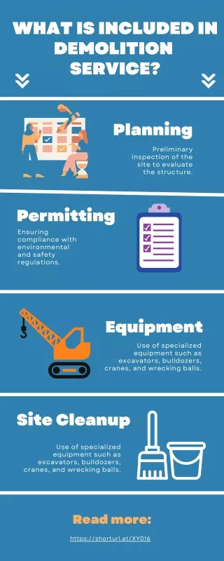
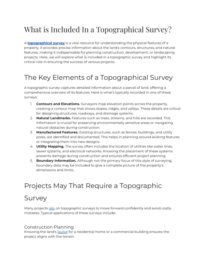
What is Included In a Topographical Survey? A topographical survey is a vital resource for understanding the physical features of a property. It provides precise information about the land's contours, structures, and natural features, making it indispensable for planning construction, development, or landscaping projects. Here, we will explore what is included in a topographic survey and highlight its critical role in ensuring the success of various projects. The Key Elements of a Topographical Survey A topographic survey captures detailed information about a parcel of land, offering a comprehensive overview of its features. Here is what's typically recorded in one of these surveys: 1. Contours and Elevations. Surveyors map elevation points across the property, creating a contour map that shows slopes, ridges, and valleys. These details are critical for designing structures, roadways, and drainage systems. 2. Natural Landmarks. Features such as trees, streams, and hills are recorded. This information is crucial for preserving environmentally sensitive areas or navigating natural obstacles during construction. 3. Manufactured Features. Existing structures, such as fences, buildings, and utility poles, are identified and documented. This helps in planning around existing features or integrating them into new designs. 4. Utility Mapping. The survey often includes the location of utilities like water lines, sewer systems, and electrical networks. Knowing the placement of these systems prevents damage during construction and ensures efficient project planning. 5. Boundary Information. Although not the primary focus of this style of surveying, boundary data may be included to give a complete picture of the property's dimensions and limits. Projects May That Require a Topographic Survey Many projects rely on topographic surveys to move forward confidently and avoid costly mistakes. Typical applications of these surveys include: Construction Planning Knowing the land's layout for a residential home or a commercial building ensures the project aligns with the terrain.
Infrastructure Development Roads, bridges, and utility installations need precise land data to meet design specifications and regulatory requirements. Environmental and Landscaping Projects A topographic survey guides decision-making in reshaping land or preserving natural features. Real Estate Transactions Buyers and developers rely on surveys to evaluate a property's potential and limitations, providing all parties with a clear understanding of the land's characteristics and suitability for future plans. How Topographical Surveys Contribute to Your Project These surveys do more than map out the land; they provide essential insights that help projects succeed. Some of the key benefits of topographic surveys include: 1. They help parties make informed decisions. Accurate land data helps developers, architects, and engineers design projects that align with the land's characteristics. 2. They provide data related to compliance. Surveys can reveal if the proposed project meets zoning laws, building codes, and environmental regulations. 3. They can help keep projects on time and on budget. A survey can minimize unexpected issues during construction by identifying potential challenges such as unstable terrain or hidden utilities early. This prevents costly mistakes and keeps projects on schedule. 4. They can improve the project's safety. Understanding the land's features allows engineers and developers to design safer, more sustainable projects by considering risks like flooding or erosion. What About Aerial Topographic Surveys? An aerial topographic survey offers a highly efficient alternative for larger or more complex properties. Through the use of advanced tools like drones or aerial imaging technology, these surveys capture accurate data over expansive areas in a fraction of the time. They are particularly beneficial for identifying significant elevation changes or surveying hard-to-reach
locations. A surveyor may use an aerial survey in addition to ground-based surveying methods to provide a broader perspective while maintaining accuracy. For example, aerial surveys can quickly highlight key features in commercial developments that cannot be easily surveyed with traditional methods, streamlining the planning process and reducing project delays. Why Professional Expertise From a Surveying Company Near Me Matters Partnering with a reputable surveying company near me ensures you receive reliable and accurate results. Professional surveyors utilize advanced tools and techniques to gather precise data tailored to your project's requirements. At Sisemore & Associates, we combine nearly 30 years of experience with cutting-edge technology to provide our clients with reliable results. As a trusted name in land surveying, we specialize in traditional and aerial topographic surveys, providing the data you need to help your project succeed. Contact us today to see how our surveying company near me can help make your next project a success.