Download
1 / 52
520 likes | 550 Views
This comprehensive guide focuses on managing riparian resources to ensure the sustainable health of rivers and their surrounding ecosystems. Covering topics such as water quality, vegetation, and soil composition, it provides insights and strategies for preserving natural landscapes. Ideal for environmentalists, conservationists, and land managers looking to enhance riparian areas for the benefit of wildlife and ecosystems.

E N D
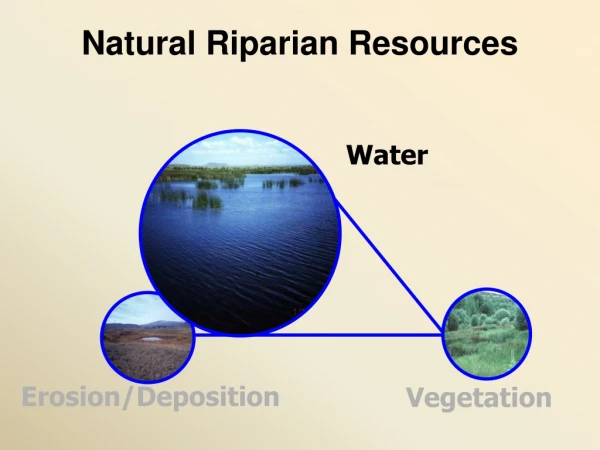
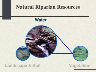
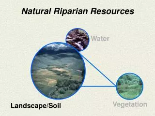
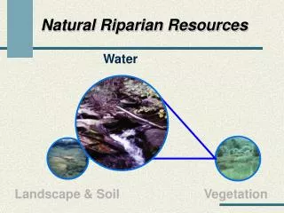
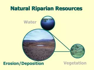
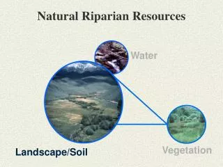
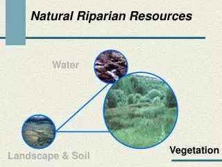
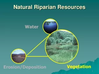
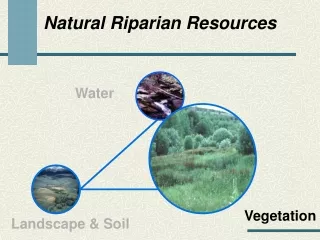
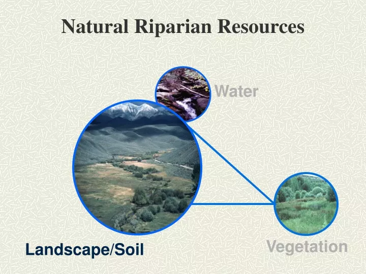
Natural Riparian Resources Water Vegetation Landscape/Soil
Landform Little Salmon River Riggins Salmon River
Upward Movement of Water in Soil I n c h e s Days
13) Flood plain and channel characteristics (i.e., rocks, overflow channels, coarse and/or large woody material) are adequate to dissipate energy • Proper function lotic riparian-wetland areas must dissipate energy • Appropriate channel size and shape • Fully developed floodplain • Adequate roughness • Appropriate vegetation cover
Is the floodplain fully developed (see question 1)? • Is there sufficient overflow channels, vegetation, rock, and woody debris to handle high flows without degrading? • Is the floodplain capable of growing woody species? • Are woody riparian species present on the floodplain and/or streambanks? • Is the sinuosity and width/depth ratio appropriate for the site (see Question 3)?
Is the floodplain fully developed (see question 1)? • Is there sufficient overflow channels, vegetation, rock, and woody debris to handle high flows without degrading? • Is the floodplain capable of growing woody species? • Are woody riparian species present on the floodplain and/or streambanks? • Is the sinuosity and width/depth ratio appropriate for the site (see Question 3)?
Is the floodplain fully developed (see question 1)? • Is there sufficient overflow channels, vegetation, rock, and woody debris to handle high flows without degrading? • Is the floodplain capable of growing woody species? • Are woody riparian species present on the floodplain and/or streambanks? • Is the sinuosity and width/depth ratio appropriate for the site (see Question 3)?
Is the floodplain fully developed (see question 1)? • Is there sufficient overflow channels, vegetation, rock, and woody debris to handle high flows without degrading? • Is the floodplain capable of growing woody species? • Are woody riparian species present on the floodplain and/or streambanks? • Is the sinuosity and width/depth ratio appropriate for the site (see Question 3)?
14) Point bars are revegetating with riparian-wetland vegetation
Is there a distinct and relatively continuous line of stabilizing riparian vegetation on the point bar? • Is there sprout and/or young woody species on the point bar? • Is herbaceous stabilizing riparian species expanding?
Is there a distinct and relatively continuous line of stabilizing riparian vegetation on the point bar? • Is there sprout and/or young woody species on the point bar? • Is herbaceous stabilizing riparian species expanding?
Is there a distinct and relatively continuous line of stabilizing riparian vegetation on the point bar? • Is there sprout and/or young woody species on the point bar? • Is herbaceous stabilizing riparian species expanding?
Is there a distinct and relatively continuous line of stabilizing riparian vegetation on the point bar? • Is there sprout and/or young woody species on the point bar? • Is herbaceous stabilizing riparian species expanding?
Is there a distinct and relatively continuous line of stabilizing riparian vegetation on the point bar? • Is there sprout and/or young woody species on the point bar? • Is herbaceous stabilizing riparian species expanding?
Question 15 - Lateral stream movement is associated with natural sinuosity • The channel is appropriate for the landform and in balance with normal processes • Channel movement is a slow process • Appropriate vegetation and/or streambank cover • Channel aggrading • Multi-thread channel vs. single thread channel
Does the streambanks have an adequate amount of stabilizing vegetation (see Questions 9 & 11)? • Is there evidence of rapid point bar growth (see question 3?) • Is the channel widening? Is the channel aggrading? • Is the channel multi-thread (“D” channel type)? • Is sinuosity appropriate for the valley type (see Question 3)?
Does the streambanks have an adequate amount of stabilizing vegetation (see Questions 9 & 11)? • Is there evidence of rapid point bar growth (see question 3?) • Is the channel widening? Is the channel aggrading? • Is the channel multi-thread (“D” channel type)? • Is sinuosity appropriate for the valley type (see Question 3)?
Does the streambanks have an adequate amount of stabilizing vegetation (see Questions 9 & 11)? • Is there evidence of rapid point bar growth (see question 3? • Is the channel widening? Is the channel aggrading? • Is the channel multi-thread (“D” channel type)? • Is sinuosity appropriate for the valley type (see Question 3)?
Does the streambanks have an adequate amount of stabilizing vegetation (see Questions 9 & 11)? • Is there evidence of rapid point bar growth (see question 3? Is the channel widening? • Is the channel aggrading? • Is the channel multi-thread (“D” channel type)? • Is sinuosity appropriate for the valley type (see Question 3)?
16 - System is vertically stable • Is the down-cutting within natural rates or accelerated • Accelerated erosion, down-cutting • Headcut • Potential to move up through a wetland • Lower water table
Flat Canyon Creek • Is there a head cut capable of moving upstream within or below the reach? • Are there hydrologic modifiers such as abandon beaver dams, logs, or structures that have water moving under them? • Is sediment or debris accumulation causing the water to flow out of the channel?
Sage Creek • Is there a head cut capable of moving upstream within or below the reach? • Are there hydrologic modifiers such as abandon beaver dams, logs, or structures that have water moving under them? • Is sediment or debris accumulation causing the water to flow out of the channel?
Is there a head cut capable of moving upstream within or below the reach? • Are there hydrologic modifiers such as abandon beaver dams, logs, or structures that have water moving under them? • Is sediment or debris accumulation causing the water to flow out of the channel?
Is there a head cut capable of moving upstream within or below the reach? • Are there hydrologic modifiers such as abandon beaver dams, logs, or structures that have water moving under them? • Is sediment or debris accumulation causing the water to flow out of the channel?
17 - Stream is in balance with the water and sediment being supplied by the watershed (i.e., no excessive erosion or deposition) • Streams transport water and sediment • Increases or decreases in water • Channel degradation • Sediment transport • Channel erosion • Erosion increases sediment • Channel • Upland or side channels
Is there evidence of increased water flow such as channel degradation or channel erosion (see Question 5)? • Are there mid-channel bars, sediment filled pools, sand/silt/clay channel bottoms (see question 3)? • Is there channel braiding? • Are streambanks stable (see Question 11)?
James Creek • Is there evidence of increased water flow such as channel degradation or channel erosion (see Question 5)? • Are there mid-channel bars, sediment filled pools, sand/silt/clay channel bottoms (see question 3)? • Is there channel braiding? • Are streambanks stable (see Question 11)?