Download
1 / 27
270 likes | 421 Views
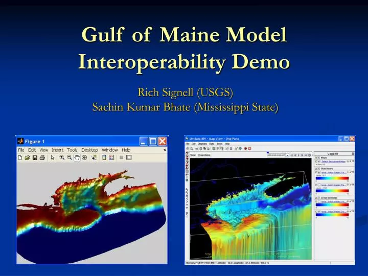
Gulf of Maine Model Interoperability Demo. Rich Signell (USGS) Sachin Kumar Bhate (Mississippi State). Why interoperability tools?. The GoMOOS Nowcast/Forecast Circulation Model (University of Maine). Why interoperability tools?. Massachusetts Bay Environmental Forecast System (UMASS-Boston).

E N D
Gulf of Maine Model Interoperability Demo Rich Signell (USGS)Sachin Kumar Bhate (Mississippi State)
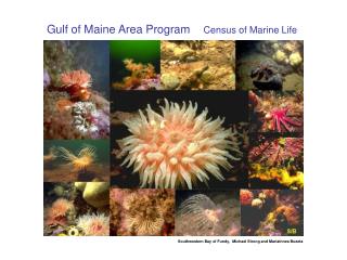
Why interoperability tools? The GoMOOS Nowcast/Forecast Circulation Model (University of Maine)
Why interoperability tools? Massachusetts Bay Environmental Forecast System (UMASS-Boston)
Purpose of GoMODP To promote and coordinate the sharing, linking, electronic dissemination, and use of data in the Gulf of Maine region. The participants have decided that a coordinated effort is needed to enable users throughout the Gulf of Maine region and beyond to discover and put to use the vast and growing quantities of data.
Purpose of GoMODP To promote and coordinate the sharing, linking, electronic dissemination, and use of data and model products in the Gulf of Maine region. The participants have decided that a coordinated effort is needed to enable users throughout the Gulf of Maine region and beyond to discover and put to use the vast and growing quantities of data and model products.
GoMODP Modeling Needs • A catalog of models and contacts • Methods to obtain numerical output from these models as opposed to just pictures • Model output from diverse models supplied using standards so that common software apps can be developed • A neat application showing model interoperability
NetCDF • Machine independent, self-describing, binary format for multidimensional scientific data • Interfaces: Fortran, C, C++, Java, Perl, Matlab, IDL, Python • Free, supported by NSF at Unidata
Need for Conventions • One of the greatest things about NetCDF is that it places few demands on the data provider - they are free to specify whatever attributes they want, or none at all • This is also one of the worst things, making it hard to develop flexible software • Software for ROMS won’t work for POM, NCOM, HOPS, ECOM, etc (and vice versa)
Climate and Forecast (CF) Metadata Conventions Groups adopting CF: GO-ESSP: Global Organization for Earth System Science Portal IOOS: Integrated Ocean Observing System ESMF: Earth System Modeling Framework OGC: Open Geospatial Consortium
DODS/OpenDAPhttp://www.opendap.org • Open Data Access Protocol for delivery of multidimensional scientific data via http • DODS allows efficient slicing from data via the web, just as NetCDF works for local files. • DODS serves not just NetCDF, but also Matlab, HDF, GRIB, and more.
A possible “best practice”: deliver CF-compliant data via OPeNDAP
Recommendations • Make your model output CF-compliant • Distribute your model output via DODS • Make a THREDDS catalog for DODS data • Allow “packing” of data for efficient internet delivery (and disk utilization) • Develop software for CF-compliant data
NetCDF-Java • Machine independent, requires no compiling • Works with regular HTTP in addition to DODS • Handles CF conventions • Works with NcML (an XML language for NetCDF)
GoMODP activities • Catalog existing modeling efforts in the Gulf of Maine • Develop “best practices” guidelines for delivering large model data sets • Arrange a training class for model product providers on how to implement “best practices” • Pilot Project: Adopt “best practices” for two forecast modeling systems and an application which demonstrates model interoperability
Integrated Data Viewer (IDV) http://www.unidata.ucar.edu/software/idv • Free software developed/supported by the Unidata Program Center at NCAR • 100% Java, utilizing Java3D and VisAD • Runs on Windows, Mac, Solaris • Reads local & remote NetCDF, DODS, ADDE, GeoTiff, Arc Shapefiles • Slices, dices, animates
Once you have the power… Calculated from 1 year of UMAINE-POM model results
The Way Forward • Use feedback from the Gulf of Maine Modeling Interoperability Pilot Project to enhance the system • Work with CF Conventions Group, IOOS MAST, and ESMF Developers to ensure that developing CF Standards meet ocean community needs • Build tools now in Matlab using NetCDF-Java • Future: tools in Python using CF-lib • Support analysis and visualization tools that work with CF standards (e.g. IDV)
Try the Matlab & IDV demos yourself! • Gulf of Maine Modeling Pilot Project Page:http://www.gomodp.org/modeling-committee/gulf-of-maine-model-interoperability-pilot-project