Download
1 / 21
210 likes | 429 Views
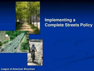
SACOG & Complete Streets. Technical Assistance and Tools Complete Streets: The Road to Safer Healthier, Livable Communities. Accessibility Planning Perspective on Complete Streets . Geometrics, cross-sections, design speeds, and other design elements of complete streets are important, but…

E N D
SACOG & Complete Streets Technical Assistance and Tools Complete Streets: The Road to Safer Healthier, Livable Communities
Accessibility Planning Perspective on Complete Streets • Geometrics, cross-sections, design speeds, and other design elements of complete streets are important, but… • 1: How do complete streets affect people’s ability to get around? • 2: How do we include complete streets concepts into our long range planning process?
Complete Streets:How SACOG Does It Incentives Flexible funding Multimodal focus Education Technical tools Data and analysis
Complete Streets & the MTP2035:Community Design Funding Community Design program 3 rounds of funding so far ($43M) About one-half of funding for Complete Streets, street re-modeling projects $12M program open now—due mid August 2009 (www.sacog.org)
Complete Streets & the MTP2035:Transit Funding Funding(cont’d) Increased funding for transit Complete Streets need to accommodate/include transit… …but you need to fund operations of transit to make it real! MTP 2035 includes $10B for transit operations
Complete Streets & the MTP2035:Roadway Funding Funding(cont’d) Roadway capacity New road projects, widenings, reconstructions, etc. will be influencedby Complete Streets principles $11B for road capacity, $14B for road M&O
SACOG Complete Streets Technical Assistance Program • Reference Materials (available, in use) • GIS, Modeling and Forecasting (in use) • Bicycle Trip Planner (in development) • Walkability Auditing & Accessibility Index (in development)
Reference Materials:Complete Streets Library • Case studies, Best Practices Guides, Sample Policies, Technical Guides • Available at no cost to local agency staff and planning partners
Reference Materials:Images, Photo Simulations, Etc. • Image library • 1,500 web-accessible photos of smart growth, streetscapes, etc. • Useful for workshop materials, staff presentations, etc. • Photo simulations • Show how an existing street can be transformed into a Complete Street
0 Sacramento County, CAHurley Way
0 Sacramento County, CAHurley Way
0 Sacramento County, CAHurley Way
0 Sacramento County, CAHurley Way
GIS & Modeling:Showing Value of Street Pattern in Forecasts • Body of research on “street pattern” • Street pattern measures the level of connectivity provided by the streets serving an area • Highly influential in increasing bike and walk trips, and shortening vehicle trips • SACOG has developed innovative ways of directly including street pattern in our long range forecasts
GIS & Modeling:Details are Important—All Data at Parcel Level
GIS & Modeling:Intersection Density • Green=“Good” Intersections (3 or 4 legs) • Red=“Bad” Intersections (cul de sacs) • Density of “good” and “bad” intersections used in forecasting
Bicycle Trip Planner:In Development • “GOOGLE-like” map interface for bike trip planning • Route suitability (data collection…) • CMAQ funded • SACOG Bike/Ped Comm.
Walkability Auditing & Accessibility Index:In Development • Inventory pedestrian & bicycle environment • Train/utilize local community groups to do audits • SACOG tech support in assembling, mapping inventory • Safe Routes to schools focus • In support of WalkSacramento • SACOG work funded thru Caltrans Blueprint Planning grant