Download
1 / 22
230 likes | 403 Views
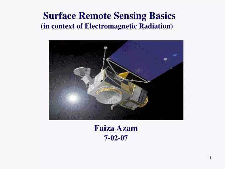
Surface Remote Sensing Basics (in context of Electromagnetic Radiation). Faiza Azam 7-02-07. Outline. Definition Elements of Remote sensing Sensors and Plaforms Electromagnetic Radiation Spectrum Classification of Remote sensing on the basis of Electromagnetic spectrum.

E N D
Surface Remote Sensing Basics (in context of Electromagnetic Radiation) Faiza Azam 7-02-07
Outline • Definition • Elements of Remote sensing • Sensors and Plaforms • Electromagnetic Radiation Spectrum • Classification of Remote sensing on the basis of Electromagnetic spectrum. • Some talk about Orbits. • Conclusion
Definiton: The techniques for acquisition of information about the features of earth (at different time scales), without any physical contact using devices that use electromagnetic energy, acoustic waves and force fields. • Classified as Active or Passive. Main Elements of remote sensing 1. A PLATFORM to hold the instrument.2. A target OBJECT to be observed.3. An instrument or SENSOR to observe the target . 4. Key element is INFORMATION (Data).
REMOTE SENSING ELEMENTS 4 http://ccrs.nrcan.gc.ca/resource 1 5 7 2 2 6 3 5 - Transmission, Reception, and Processing 6 – Interpretation and analysis 2 - Radiation and the atmosphere 3 - Interaction with the target 4 - Recording of energy by sensor 7 – Application 1 - Energy Source or Illumination
Sensors Active and Passive sensing: Active systems:- • Remote sensing systems that provide their own energy source of illumination. • Measure amplitude as well as the phase of the reflected signal. • Operated any time and cover wavelentghs not provided by sun. http://ccrs.nrcan.gc.ca/resource
Sensors Active and Passive sensing: Passive systems:- • Remote sensing systems that measure naturally available energy • Measure incoherent energy. • For reflective energies, passive sensors can only be used when sun is lluminating earth. http://ccrs.nrcan.gc.ca/resource
Platforms Air borne platforms: • Fixed wings aircrafts • Used to collect detailed images (photographic).
Satellite Platforms • Remote sensing is conducted from space shuttle or orbiting satellites. • Provide repetitive coverage of earth‘s surface on continuous basis. Space Shuttle Satellite
Energy Spectrum Wavelengths used in Remote Sensing • Ultraviolet – 0.3 to 0.4 μm • Visible – 0.4 to 0.7 μm • Near Infrared – 0.7 to 1.3 μm • Middle Infrared – 1.3 to 2.8 μm • Thermal Infrared – 2.4 to14 μm • Microwave – 1 mm to 1 m
Electromagnetic Spectrum Infomation about Sun and stars
Radio waves • Wavelength range: < 1 cm – 10, 100 m. • Transmit radio and t.v. signals. • Radar imaging: Waves are transmitted from a satellite or airplane antenna. The reflected waves (brightness) is used to form an image of the ground in complete darkness or through clouds because as they can pass through clouds and dry desert sand.
Microwaves • Wavelengths range: approx. 1 mm (the thickness of a pencil lead) - 30 cm (one foot). • Emitted from the Earth, from objects such as cars and planes, and from the atmosphere. • Two types; Active (scatterometers, alimeters)or Passive(Radiometers) • Can be detected to give information, such as the temperature of the object that emitted the microwaves.
Infrared • Wavelengths range: approx. 0.7 to 300 µm • NIR (0.7 - 1.5 µm) & SWIR (1.5 - 3 µm) reflected IR, solar rad. refleced from earth‘s surface. • MWIR (3 - 8 µm) & LWIR (8 - 15 µm) thermal infrared (heat). • Can be detected to give information, such as reflectance
Visible • Wavelengths range: 400 - 700 nm • Coincides with the wavelength of greatest intensity of sunlight • great utility for the remote sensing of vegetation and for the identification of different objects by their visible colors.
Ultravoilet • Wavelengths range: 0.3 µm - 3.0 nm. • Emitted from the sun, most of it is blocked by ozone in the upper atmosphere. • Used extensively in astronomical observatories. Also concerned with the measurement of ozone.
Orbits Geostationary orbits Satellites (geostationary), at altitudes of approximately 36,000 kilometres, revolve at speeds which match the rotation of the Earth (so seem stationary). • Usage: • Collect information continuously over specific areas. (Weather and communications satellites) • Due to high altitude, some satellites can monitor weather and cloud patterns covering an entire hemisphere of the Earth. http://ccrs.nrcan.gc.ca/resource
Orbits Near Polar Orbits: Platforms follow an orbit (north-south) which, in conjunction with the Earth's rotation (west-east), Cover most of the Earth's surface. Most such orbits are also sun-synchronous. Usage: Being sun synchronous, ensures consistent illumination conditions when acquiring images in a specific season over successive years, or over a particular area over a series of days. So important for monitoring changes http://ccrs.nrcan.gc.ca/resource
OrbitsNear Polar Orbits In near polar orbits, satellite travels northern pole to the southern pole. The paths at poles are called ascending and descending passes, respectively. For sun-synchronous orbit: Ascending pass shadowed side of the Earth Descending passsunlit side of the Earth http://ccrs.nrcan.gc.ca/resource
Conclusion • What is remote sensing in general. • Main elements of remote sensing • Sensors, platforms • Electromanetic spectrum (used for remote sensing) • Classified remote sensing in terms of wavelengths. • Orbits