Download
1 / 19
190 likes | 285 Views
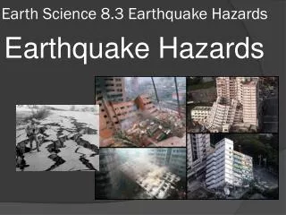
Rapid Detection of Rare Geospatial Events: Earthquake Warning Applications. A Review by Zahid Mian WPI CS525D Septembe r 10, 2012. Problem/Goal. Are Inexpensive Sensors Capable Of Detecting Seismic Events? Cheap Sensors (16-bit MEMS accelerometer) Cell Phones (Android)

E N D
Rapid Detection of Rare Geospatial Events:Earthquake Warning Applications A Review by Zahid Mian WPI CS525D September 10, 2012
Problem/Goal • Are Inexpensive Sensors Capable Of Detecting Seismic Events? • Cheap Sensors (16-bit MEMS accelerometer) • Cell Phones (Android) • Distributed Event Based (DEB) • Community-Wide Participation • Cloud Computing
Why Cell Phones? Most Cells Phones Today Have Accelerometers (used to obtain seismic measurements) Cell Service Increasing Around the World, Even in Impoverished Regions like Haiti Cost of Such Devices Decreasing The Denser the Network of “Sensors”, the More Accurate the Results
Sensors • Sending Messages (“picks”); Limitations • 16-bit MEMS accelerometer • Relatively Inexpensive • More Accurate (than phones) • Stationary • Cell Phones (Android) • “No” Expense (practically) • Less Accurate (someone can drop a phone) • Truly Mobile
Why Use Many Sensors (“Dense Network”) Increased Number of Sensors Makes it Easier to Visual the Propagation Path of an Earthquake
Cloud Based Infrastructure • Google App Engine • Many Benefits of PaaS; Scalable, Distributed, etc. • Handles Registration of Sensors • Handles Messages • Checks Heartbeat • Datastore • Computational Analysis • Detection
Limitations of App Engine Synchronization: Use Entity Groups & Task Queue Jobs Timeframe Limitation: no single points of failure & tolerant of data loss Query Limitation: Numeric Geocells
Encoding Geospatial Data • How to Store Latitude and Longitude Pairs • AND • Create Flexible Query? • Solution: Create a Binary String to encode Information • What does “011011” mean? • Defines Location and Resolution
Encoding a Geocell Encoding Rule: If point lies east of mean longitude, set longitude bit to 1 If point lies north of mean latitude, set latitude bit to 1 11 01 Example: 43.14 N, 118.12 W 00 10 10 01 01 10 01
Sensor-side Picking Algorithms • STA/LTA (Short Term Average over Long Term Average) • “Pick” when ration reaches above a threshold • Anomaly Detection using Density Estimation (ADDE) • Use sensory data to determine anomalies • Several factors need to be considered • Ultimately used to determine false positives and the number of messages to send
Server-side Pick Aggregation • Detection Algorithm must be • Insensitive to the reording of messages • Insensitive to the loss of small number of messages • Solution: Use 2-Second Buckets • When Geocell Activated, a Task Queue job performs further Analysis
Simulation: Naive Event Association Acceptable for Determining Lower Bound
Related Work (Seismic Networks) • Quake Catcher Network (QCN) • USB sensors attached to laptops • No Cloud Computing • NetQuakes • expensive stand-alone seismographs
Community and Participatory Sensing Traffic Monitoring Environmental Monitoring Use Sensors to Capture Data, But Not Predict Rare Events
Conclusion • Cell Phone Service May Not Work When Needed • Too much “Noise” • May Generate False Alerts • Earthquake Detection is “Difficult” • Many theories over the years and many false claims • Collecting Data Via Sensors is Useful • Can Lead to Better Modeling for Future • Can Validate Certain Claims • Infrastructure Can be Used for Something Else