Download

1 / 33
350 likes | 548 Views
Explore the spatial relationships in GIS through topology components like connectivity, containment, and contiguity. Learn how data structures like coverages, grids, shapefiles, and geodatabases play a crucial role in GIS applications.

E N D
ArcGIS TopologyShapefiles, Coverages, Geodatabases Friday 03/03/06 GEOG 4103
Topology in GIS • generally defined as the spatial relationships between adjacent or neighboring features • implemented through data structure
Components • Connectivity: Arcs are connected to others (at nodes). This identifies possible routes and networks, such as rivers and roads.. • Containment: An enclosed polygon has a measurable area; lists of arcs define boundaries and closed areas. • Contiguity: The adjacency of polygons can be determined by shared arcs.
Polygon A has arcs a1,a2, a3 Node 1 is connected with arcs a2, a1, a6 arc a5 has polygons C (right) and B (left)
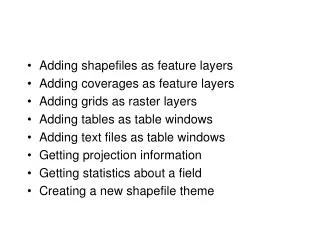
Data Structures • COVERAGE • Files are stored in two directories • Coverage name – unique files for the coverage • INFO – files for all the coverages in that workspace/directory • Exchanged using ARC/INFO Exchange Files (.E00)
Coverages • Coverages can be point, line or polygon • A single coverage can have points and lines, or lines and polygons, but never points and polygons • Polygon coverages partition the area into polygons • No overlap allowed between polygons • All areas in the coverage are part of some polygon
Coverages • Coverages are created using the BUILD and CLEAN commands • CLEAN attempts to fix problems in topology, sometimes moving points and lines • BUILD assumes the topology is “clean” and fails if topological problems are encountered • It creates Point, Arc and Polygon attribute tables (PAT, AAT)
Arc Attribute Table (AAT) • arcs have attributes which identify the polygons on either side • "left" and "right" by reference to the sequence in which the arc is coded • topological relationships stored in AAT • I.e. adjacent polygon IDs in the LPoly and RPoly fields.
Grids • Deal with RASTER (gridded) data • Each grid cell contains a single number • Files are stored in several directories, so to move a grid it is safest to EXPORT it • Grids have a .VAT or Value Attribute Table that relate codes in the grid to associated attributes
Shapefiles • Shapefiles • Comprised of 4 files – coverage.shp, .sbn, .sbx and .dbf • The .dbf file contains the attribute data and can be opened with Excel, Access and other database editors that understand the .dbf format
Shapefiles • Polygons in shapefiles CAN overlap, while in a COVERAGE they CANNOT • so: to convert SHAPEFILES to COVERAGES • Overlaps need to be eliminated
Geodatabases • “Geodatabase = An object-oriented geographic database that provides services for managing geographic data. E.g relationships, and topological associations. • contains feature datasets and is hosted inside of a relational database management system.”
Geodatabases • Geodatabases are stored in relational databases • Many large GIS users have large Oracle-based database systems that are used for GIS data using the ESRI Spatial Database Engine for conversion • You can also have “Personal Geodatabases” that are maintained on the local machine
ArcGIS Components • ArcCatalog • Manage data • ArcMap • Create maps • Analysis • ArcToolbox • Stand-alone Analysis and Conversion • ArcScene • 3-D display
ARCGIS Components • ARC Catalog
ArcCatalog • Locate Data for use with ARCGIS • What data is available? • Local Disks • Databases • Internet/Online • What are the properties of that data?
ArcCatalog - Preview • Preview Geodata and Tables
Metadata • ArcCatalog will also display or allow editing of simplified Metadata
ARGIS Components • ARCMAP
ArcMap advantages • better map quality • Projections • Automatically reprojects data to match the map projection (now you can mix and match UTM and Lat-Lon coverages) • But only if the source projection is defined • Transparency: can see through one layer
ArcMap Toolbars • Movable toolbars • You select the toolbars you want from the View menu
Tips • Adding more buttons (customizing ArcMap) • Continuous pan/zoom
ArcToolbox • The ArcToolbox component of ArcGIS contains sets of stand-alone wizards designed to help you perform specific tasks
ArcScene – 3 D Data Viewer • ArcScene is a 3-D data viewer that allows you to get different perspectives on three-dimensional landscapes • Tilt and rotate • View from a point
ArcReader Free!
ArcReader • ArcReader is a FREE stand-alone tool designed for DISPLAY and printing of local and web-accessible geodata • It requires that the map to be displayed be “published” to a special PMF file using an ARCGIS extension