Download
1 / 28
280 likes | 402 Views
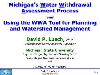
An Overview of Michigan’s Water Withdrawal Assessment Tool and a few comments about the Groundwater Mapping Project. David P. Lusch , Ph.D. Distinguished Senior Research Specialist Michigan State University Dept. of Geography and Institute of Water Research.

E N D
An Overview of Michigan’s Water Withdrawal Assessment Tool and a few comments about the Groundwater Mapping Project David P. Lusch, Ph.D. DistinguishedSenior Research Specialist Michigan State University Dept. of Geography and Institute of Water Research
Using Michigan’s Water Withdrawal Assessment Tool for Planning and Watershed Management Ground-water divide gaining stream Cone of depression stream gains less Q2 > Q1 Ground-water divide losing stream • Modeling pumping flow reduction Source of water to a pumping well Decrease in the dischargefrom the system, resulting from the lowered head in the system, the decreased gradients in the discharge areas and shifts in the groundwater divide.
Using Michigan’s Water Withdrawal Assessment Tool for Planning and Watershed Management • How to assess water withdrawal impacts on streams? • Which stream segments will be impacted by a proposed withdrawal (distance matters)? • Temp- and size-class of the affected streams. • How much flow is available (specified by statute) in these stream segments. • For groundwater pumpage, how much will the proposed withdrawal reduce the flow in the affected streams.
Using Michigan’s Water Withdrawal Assessment Tool for Planning and Watershed Management • Stream segments
Using Michigan’s Water Withdrawal Assessment Tool for Planning and Watershed Management Flow estimates for 5,418 stream segments • Stream-flow Estimates
Michigan’s Water Withdrawal Assessment Process for Planning and Watershed Management
Michigan’s Water Withdrawal Assessment Process for Planning and Watershed Management • Stream-flow Estimation • Explanatory variables in the regression model included • Glacial aquifer transmissivity groups • Hydrologic-soil groups • Forest land cover • Runoff Curve Number • Normal annual precipitation (1971 – 2000) • Normal annual snowfall depths (1971 – 2000)
Michigan’s Water Withdrawal Assessment Process for Planning and Watershed Management • Stream-flow Estimation
Michigan’s Water Withdrawal Assessment Process for Planning and Watershed Management Hydrologic Soil Groups estimate soil runoff potential. Group A soils generally have the smallest runoff potential, while Group D soils have the greatest. • Stream-flow Estimation NRCS Curve Numbers
Michigan’s Water Withdrawal Assessment Process for Planning and Watershed Management • Stream-flow Estimation
Using Michigan’s Water Withdrawal Assessment Tool for Planning and Watershed Management Cool stream Cool small river Cool large river • Temp- and size-class of streams
Using Michigan’s Water Withdrawal Assessment Tool for Planning and Watershed Management Temp Size Zone A (% Index Flow) Zone B (% Index Flow) Zone C (% Index Flow) Zone D (% Index Flow) Cold Stream Reduction < 14 None 14 ≤ Reduction < 20 Reduction ≥ 20 Sm. River Reduction < 10.5 None 10.5 ≤ Reduction < 21 Reduction ≥ 21 Cold Trans Stream None Reduction < 4 None Reduction ≥ 4 Sm. River None Reduction < 2 None Reduction ≥ 2 Large R. None Reduction < 3 None Reduction ≥ 3 Cool Stream Reduction < 6 6 ≤ Reduction < 15 15 ≤ Reduction < 25 Reduction ≥ 25 Sm. River Reduction < 15 15 ≤ Reduction < 19 19 ≤ Reduction < 25 Reduction ≥ 25 Large R. Reduction < 14 14 ≤ Reduction < 19 19 ≤ Reduction < 25 Reduction ≥ 25 Warm Stream Reduction < 10 10 ≤ Reduction < 18 18 ≤ Reduction < 24 Reduction ≥ 24 Sm. River Reduction < 8 8 ≤ Reduction < 13 13 ≤ Reduction < 17 Reduction ≥ 17 Large R. Reduction < 10 10 ≤ Reduction < 16 16 ≤ Reduction < 22 Reduction ≥ 22 • Available streamflows
Using Michigan’s Water Withdrawal Assessment Tool for Planning and Watershed Management http://www.miwwat.org/
Using Michigan’s Water Withdrawal Assessment Tool for Planning and Watershed Management System User or • WWAT Conceptual Model Dynamically Retrieve Location Specific Data Input Information • Withdrawal Information • Water Source • Pumping Frequency • Pumping Capacity • Aquifer Type Rerun Model • Administrative Agency • Real-time Updates • Water Accounting Real-time Modeling Registration ----------- ------------ --------- --------- Updated Water Availability Adverse Resource Impact Zones A B C D Request Site-Specific Review From MDEQ
Using Michigan’s Water Withdrawal Assessment Tool for Planning and Watershed Management • Water Withdrawal Assessment Tool • User enters the location for a new groundwater withdrawal. • GIS software determines the “home” catchment. • If the proposed well is in bedrock, the bedrock type for the catchment is identified from the GIS database.
Using Michigan’s Water Withdrawal Assessment Tool for Planning and Watershed Management Pass, saline comment stored Switched to glacial aquifer Pass, no restrictions Evaluated using GWIM bedrock properties; streambed conductance with bedrock estimated from the properties of the glacial deposits overlying the bedrock.
Overview of Michigan’s Water Withdrawal Assessment Tool • Water Withdrawal Assessment Tool • From the GIS database, the aquifer properties of the catchment and whether it is a Great Lake shoreline catchment are identified. • Nearest-neighbor stream segments to the proposed withdrawal site are identified. • Distances from the proposed well to the nearest stream segments are computed.
Overview of Michigan’s Water Withdrawal Assessment Tool • Water Withdrawal Assessment Tool • Groundwater flow model runs for each stream segment using aquifer properties for the catchment containing the well and the distances to the nearest stream segments. • The solution is evaluated after 5 years of simulation.
Overview of Michigan’s Water Withdrawal Assessment Tool • Water Withdrawal Assessment Tool • The streamflow depletion is apportioned to the neighboring stream segments using inverse distance weighting. • Estimated streamflow depletions are compared to the “available” streamflows and determination is provided to the user.
Overview of Michigan’s Water Withdrawal Assessment Tool Added Info 2 1 3 4 5 6 7
Overview of Michigan’s Water Withdrawal Assessment Tool http://www.miwwat.org/getflow.asp? trans=5400 &shore=0 &bdrkf=1 &bdrkt=99999 &aline=0.000 &bline=25.460 &cline=25.523Allowable catchment depletion (gpm) &dphzoned=125 &estdphbdrk=458 &pctdrift=100 &pctrock=0 &kvw=233.693 &type=Cold transitional stream &wsid=12269 &x=-84.105415 &y=44.613435 &mapx=650155.8847889714 &mapy=453061.31356536905
Overview of Michigan’s Water Withdrawal Assessment Tool • Screening Tool Results
Overview of Michigan’s Water Withdrawal Assessment Tool • Screening Tool Results
Overview of Michigan’s Water Withdrawal Assessment Tool • Screening Tool Results
gwmap.rsgis.msu.edu Groundwater Mapping Project
Overview of Michigan’s Water Withdrawal Assessment Tool The End www.miwwat.org gwmap.rsgis.msu.edu lusch@msu.edu