Download
1 / 7
70 likes | 287 Views
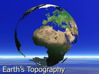
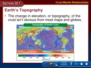
Topography. The shape of the earth’s surface. Topography. Elevation- Height above sea level Relief- change in elevation Maps represent the earth’s surface Scales – compare distances Legend – explains the symbols on the map. Topographical Maps. Show relief of the land

E N D
Topography The shape of the earth’s surface.
Topography • Elevation- Height above sea level • Relief- change in elevation • Maps represent the earth’s surface • Scales – compare distances • Legend – explains the symbols on the map.
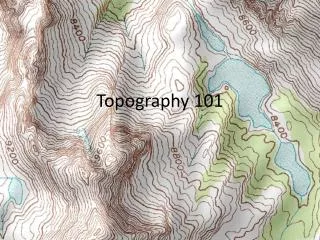
Topographical Maps • Show relief of the land • Contour lines – Line of equal elevation • Contour Interval – change in elevation from one line to the next • Index Contours – elevations in rounded units indicated by darker lines
Rules for Topographical Maps • A contour line of one elevation never crosses another contour line. • Closely spaced contour lines represent steep slopes. Lines that are far apart represent gentle slopes. • Contour lines that cross a valley are “V” shaped and the V points to higher elevations. If the V points to lower elevations you have a ridge.
Rules Cont. 4. Contour lines form closed loops around hill tops. Depressions are shown with hachure marks.