Download
1 / 9
90 likes | 214 Views
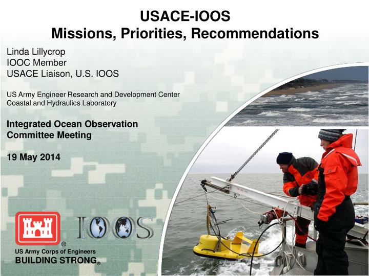
USACE-IOOS Missions, Priorities, Recommendations. Linda Lillycrop IOOC Member USACE Liaison , U.S. IOOS US Army Engineer Research and Development Center Coastal and Hydraulics Laboratory Integrated Ocean Observation Committee Meeting 19 May 2014.

E N D
USACE-IOOS Missions, Priorities, Recommendations Linda Lillycrop IOOC Member USACE Liaison, U.S. IOOS US Army Engineer Research and Development Center Coastal and Hydraulics Laboratory Integrated Ocean Observation Committee Meeting 19 May 2014
USACE Civil Works Program: Missions~$9 Billion/yr, 22,000 Employees, 9 Divisions, 46 DistrictsMissions supported by R&D labs • Navigation • Hydropower • Flood Risk Management & Shore Protection • Ecosystem Restoration • Water Supply • Regulatory (Wetlands / US Waters ) • Recreation • Disaster Response Dredge ESSAYONS ( Coos Bay, OR ) Beach Erosion, Nags Head, NC Miami Beach Nourishment, FL) Lake Seminole ( Mobile District ) Everglades Bonneville II Powerhouse ( Washington )
Civil Works Value to the Nation • US Ports & Waterways convey > 2B Tons Commerce • Foreign Trade alone creates > $160 B Tax Revenues Recreation areas 376 M Visitors/yr Generate $15 B in economic activity, 500,000 jobs 299 Deep Draft Harbors ¼ of Nation’s Hydropower: $500 M+ in power sales 11,000 miles of Commercial Inland Waterways: ½ the cost of rail 1/10 the cost of trucks 400 miles of Shore protection Destination for 75% of U.S. Vacations 627 Shallow Draft Harbors 8500 Miles of Levees Stewardship of 11.7 Million Acres Public Lands
Example Basic Requirements Along the Shoreline 0 – 2 m 2 – 4 m 4 – 6 m 6 – 8 m
USACE Organization: Districts and Divisions Inland District Coastal District Funding & Activities are Project-Based
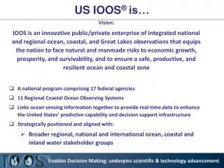
USACE IOOS Priorities • Data (Federal/non-Federal) • - USACE access to more data & data types • Improved access to USACE data using IOOS standards (USACE DIF) • Data requirements: Offshore andNearshore along the shoreline • (daily operations, model validation) • Long-term, continuous, archived data for decision making • Waves, Water-levels, Currents, Wind, Elevation, Sediments (properties/transport) • - Biological, environmental, water quality • (endangered species, ecosystem restoration, environmental assessments) • Standardized formats with common access location (portal) • - Regional & Local • 2) Integrated Products that include spatial data • 3) Access to Model Data & exchange of USACE models/products • We use models for planning, engineering, and operations • 4) USACE influence on data collection, products, models to assist in • meeting our missions: We are IOOS data users and providers
USACE – Regional Association Participation Board Representative – 4 Board Rep - Identified/Issue - 1 RA Participation – 13/21 Coastal Districts
USACE Perspective & Recommendations: • Recommendation: • Strategic implementation of IOOS across Federal Agencies • Member Agencies should present their IOOS expectations & engagement • Understand Agency missions • Requirements relevant to IOOS • Current engagement in IOOS, RAs, IOOC • Reach beyond IOOC into organizations for participation (support virtual liaisons) • More RA-Agency interaction beyond IOOC
Moving Forward: USACE Actions • Participate through the IOOC • Continue IOOS Liaison • Continue to participate in IOOS committees/meetings • Increase Focus on RAs • Look for intersections between build-out plans & USACE requirements • Data, tools, models, R&D, etc • Increase USACE participation on RA Boards & committees • Continue internal outreach • Improve messaging of USACE Mission & Capabilities to regions • Continue efforts to share USACE data, data products, and expertise