Download

1 / 21
210 likes | 226 Views
Detailed report on verification of buoy locations using GPS readings overlaid on nautical charts, updating dock shapes, and identifying new structures along Kelley's Island.

E N D
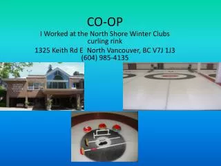
Co-op Charting • This represents the work of Akron Power Squadron Aug 25, 2007 • To verify the location of buoys, we brought the boat alongside the buoy, keeping the buoy to port. GPS readings from Garmin-GPS-72 were used. • The GPS reading has been overlayed on the chart in the attached pages • In some cases, when we couldn’t get alongside the aid or feature, we took a bearing and noted it on our write-up • Pictures from air are from Windows Local Live, http://local.live.com/ • Our chart was 14844. • Changes to the chart as printed are: • Shape of dock by old Coast Guard Station • Several new docks on north side of Kelley’s Island that do not appear on chart. P-1 – overview of attachment
R “8” L 41° 29.533’ N Lo 82° 41.575’ W R “10” L 41° 29.397’ N Lo 82° 41.822’ W G “5” L 41° 29.681’ N Lo 82° 41.012’ W G “9” L 41° 29.410’ N Lo 82° 41.658’ W Lo 82° 41.00’ W G “11” L 41° 29.24’ N Lo 82° 41.81’ W R “12” L 41° 29.174’ N Lo 82° 41.920’ W P-2. Verify location of existing aids
L 41° 29.316’ N Lo 82° 41.747’ W Visual sighting – boat off dock in channel P-3. Verify location of existing dock structure. Shape incorrect - more like “L” than “T” – see photo pg 4
P-4 – dock on P-3 viewed from air by Windows Local Live, “bird’s eye” view, http://local.live.com/. Photo verifies it is not “T” shaped, as shown in chart.
R “2” L 41° 30.385’ N Lo 82° 39.800’ W G “1” Bell L 41° 30.338’ N Lo 82° 39.758’ W R “4” L 41° 30.037’ N Lo 82° 39.535’ W R “6” L 41° 29.737’ N Lo 82° 41.139’ W Sandusky Light L 41° 29.967’ N Lo 82° 40.431’ W Lo 82° 41.00’ W G “5” L 41° 29.681’ N Lo 82° 41.012’ W P-5. Verify location of existing aids. Verify bell at G”1” is audible.
G C “3” L 41° 38.428’ N Lo 82° 39.521’ W G “1” L 41° 38.714’ N Lo 82° 37.960’ W G C “1” L 41° 37.438’ N Lo 82° 40.019’ W P-6. Verify location of existing aids.
R “4” L 41° 39.284’ N Lo 82° 41.327’ W P-7. Verify location of existing aids.
Wreck not marked by aids – correct as shown P-8. Verify – no aids around wreck . Northern shoreline Kelley’s – see following pages
P-9. Marina/dock observed, but not on chart. Sign at dock says “Rogers Landing”. Aerial photos/location next pages – P10-12
P-10 GPS position – range on dock L 41° 36.962’ N Lo 82° 41.135’ W Estimate dimensions of dock (from boat) X 50’ 100’ From Widows live local, http://local.live.com/
P-11 Estimate dimensions of dock GPS position – range on dock L 41° 36.947’ N Lo 82° 41.152’ W X 50’ 100’ From Widows live local, http://local.live.com/
P-12. View of dock from Camp Patmos web site, http://www.camppatmos.com/tour.html . This better represents the view from sea. The photos on Windows live are not dated. We suspect this photo is more recent
P-13. Location verified on private aid (lighthouse at Camp Patmos) Aerial photos next page
P-14 – location verified on private aid (lighthouse) Range perpendicular to shore. GPS location approx 100’ off shore L 41° 36.891’ N Lo 82° 41.195’ W X
P-15. Private docks not seen on chart. Aerial photos and location pages P-16-
GPS position – range on dock L 41° 36.762’ N Lo 82° 41.455’ W Rocks x P-16 . Location of private dock not on chart
GPS position – range on dock L 41° 36.750’ N Lo 82° 41.667’ W GPS position – range on dock L 41° 36.785’ N Lo 82° 41.744’ W P-17 . Location of private docks not on chart
P-18. Verify light on end of breakwall Aerial photos next page
Bearing to light --258T GPS position L 41° 37.013’ N Lo 82° 42.051’ W Bearing to light --308T GPS position L 41° 36.909’ N Lo 82° 42.120’ W P-21. Aerial photo – Windows Live Local “bird’s eye” view – maximum zoom. Range on that light, and vessel position when range taken.