Download

1 / 32
320 likes | 425 Views
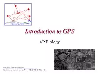
Introduction to GPS. Seth Warburton Technical Support Analyst. Learning Objectives. Upon completion of this module you will: Understand the science behind GPS positioning. Understand the factors affecting coverage/accuracy. Know of methods to improve GPS accuracy.

E N D
Introduction to GPS Seth Warburton Technical Support Analyst
Learning Objectives Upon completion of this module you will: • Understand the science behind GPS positioning. • Understand the factors affecting coverage/accuracy. • Know of methods to improve GPS accuracy. • Understand the requirements of RTK GPS. Objectives
Presentation Outline • GPS Basics • Sources of error • Reducing error • Improving accuracy • RTK GPS • Survey planning • Summary
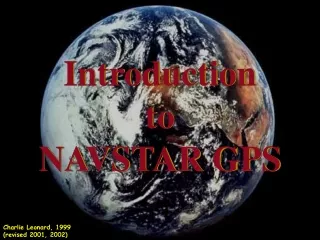
The Navstar Global Positioning System (GPS) • A satellite-based system developed by the US Department of Defence (DoD). • ALL WEATHER, 24 Hour, global time and positional information service. • Uses trilateration to determine location. • You need at least 4 satellites to get an accurate position. The Global Positioning System
GPS Constellation • 28 – 32 satellites. • 12 Hour Orbits. • 20,200km altitude. • Each transmits a timing signal (2 separate CA & P(Y)) and positional info. (ephemerides). The Global Positioning System
More Information • Vertical Accuracy 1.5 times less accurate than horizontal. • Coverage goes back roughly 3 minutes each day. • Good / Bad times of the day. • Clouds (i.e. rain) do not effect coverage! The Global Positioning System
GPS Positioning - 5 Steps • Ephemeris message from each satellite is stored (Almanac) for rapid satellite (re)acquisition. • Timing signal compared with receiver generated copy to determine delay. • D = Ct (Distance = Celeritas x time). • 3 known distances = position by trilateration. • Signal can then be corrected for errors. GPS Summary
Sources of Error ? Sources of Error
Sources of Error These factors are not easily controlled: • Obstruction. • Multipath. These factors may be mitigated: • Atmospheric effects. • Orbital degradation (Ephemeris). Sources of Error
Obstructions Sources of Error
Multipath Sources of Error
Atmospheric Delay • GPS signals are slowed • (C) as they pass through • the atmosphere Ionosphere Troposphere Rover Base Baseline < 10 km > 10 km Sources of Error
Reducing Error ? Reducing Error
Determining Atmospheric Delay We can calculate the error from atmospheric delay by: • Observing the affect on frequency (L1 and L2). • Observing the affect at a known fixed point. Reducing Error
Accuracy Factors ? Accuracy Factors
Accuracy These factors can be accounted for by the GPS receiver: • Satellite geometry (DOP). • Obstructions (Elevation mask). • Signal to Noise Ratio (SNR). Accuracy Factors
Satellite Geometry (DOP) • A measure of satellite dispersion, expressed as DOP (Dilution of Precision). • The lower the DOP the more spread out the satellites are. • Lower DOP= greater accuracy. • DOP is shown as PDOP (3D) or HDOP (2D). • For sub-meter accuracy, a HDOP of 4.0 less is required. Accuracy Factors
Good Satellite Geometry (Low DOP) Accuracy Factors
Poor Satellite Geometry (High DOP) Accuracy Factors
Elevation Mask 15 Degrees above the horizon Atmosphere Accuracy Factors
Signal to Noise Ratio (SNR) • A measure of satellite signal strength against background noise. • Measured in decibel hertz (dBHz). • For the GPS receiver to acknowledge a satellite, a SNR of 39 dBHz or better is required. Accuracy Factors
Summary of GPS Accuracy Factors • Clear view of the sky required. • Minimum of 4 Satellites, < DOP. • Be aware of multipath error sources and obstructions. • Good / Bad times of the day. • Trimble Planning Software Accuracy Factors
DGPS and RTK ? DGPS and RTK
Differential GPS (DGPS) • GPS positions from a single receiver are known as Autonomous (uncorrected). • To improve accuracy requires error correction of our GPS positions (DGPS, RTK). • Achieved through differential measurements. DGPS and RTK
Types of GPS Positions • Autonomous • 10-15m horizontal. • DGPS (Differential) • 0.5 - 3m horizontal. • “Float” • 1.0m to decimeter. • “Fixed” • 1-3cm.
Differential GPS • Requires a GPS receiver at fixed location (Base). • The Base receiver measures the positional error. The measurement is used to correct the signal received by the Rover. • Corrections are either transmitted to the Rover in real-time or applied later. • DGPS gives a precise measurement of the relative positions of two or more receivers. DGPS and RTK
RTK Corrections Real Time Kinematic correction required for Float/Fixed. Like DGPS, but using a phase fix instead of a code fix. RTK corrections require: • At least five satellites. • Dual-frequency Base and Rover (L1 & L2). • A baseline <10 KM.
VRS – (Virtual Reference Station) Trimble VRS NOW • Real-time RTK corrections from OS & Trimble. • Corrections sent by GPRS/3G. • Subscription fee & mobile phone costs. • Cm accurate with RTK GPS Systems. DGPS and RTK
VRS – How it works – 3 Steps • Rover sends VRS server its location (5 or more satellites). • VRS server finds 3 nearest base stations and creates a ‘virtual base station’ within 10km of the Rover. • VRS server sends corrections back to the Rover. Requires phone network (data) coverage! DGPS and RTK
Planning Software • Free download from www.trimble.com • Allows user to predict satellite coverage at a given location. • Plan up to 30 days in advance. • Provides DOP prediction as well as number of satellites. Survey Planning
Summary • GPS provides positions worldwide. • A least 4 satellites required for a code fix, 5 for a phase fix. • Physical obstructions are the major factor in reception. • Satellite geometry affects accuracy. • Differential corrections reduce error in positions. • Planning software can predict satellite coverage. Summary
Questions? ? Questions