Download
1 / 62
620 likes | 743 Views
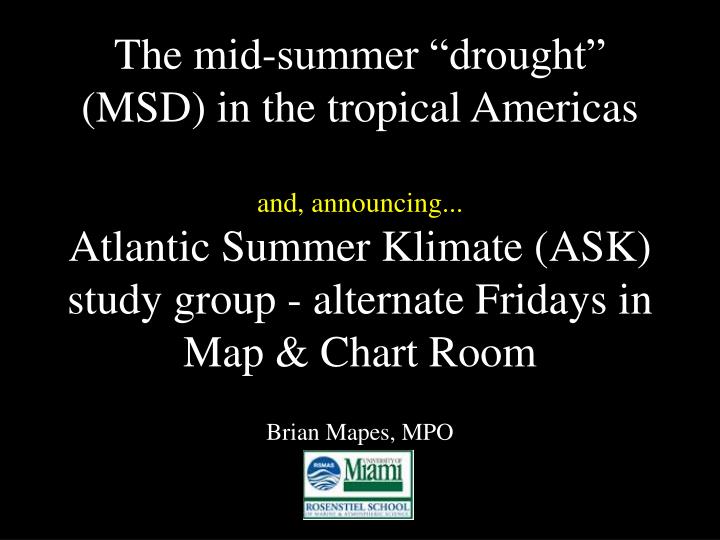
The mid-summer “drought” (MSD) in the tropical Americas and, announcing... Atlantic Summer Klimate (ASK) study group - alternate Fridays in Map & Chart Room. Brian Mapes, MPO. Key West. midsummer drought. 30-year climatology. Miami. * 1 Aug. 1999. a.k.a. veranillo, canicula. MSD.

E N D
The mid-summer “drought” (MSD) in the tropical Americasand, announcing...Atlantic Summer Klimate (ASK) study group - alternate Fridays in Map & Chart Room Brian Mapes, MPO
Key West midsummer drought 30-year climatology Miami *1 Aug
1999 a.k.a. veranillo, canicula MSD
OK, a 10-20% notch in mean rain. Who cares? • Has some societal impacts • to be honest... not my main motivation • A distinctive specimen of summer (convective) season hydro-climate variability • slippery, like so much CliVar • modest amplitude, low frequency • requires statistics to discern • a sporting challenge • real, mysterious, tractable (since GCMs have it)! • use to calibrate understanding of mechanisms
26y mean Observations (CMAP) Mean climatology of 10 GCMs
What causes the MSD? • Global, vague: • Insolation seasonality ultimately drives all aspects of the seasonal cycle. • Continent-ocean contrasts involved • Local, begs questions: • The ingredients for convection get worse (moisture, instability, lifting mechanisms). • useful explanation lies in betweenA
H500 H EPAC/WATL (IAS-centric) summer climate system qV
NASH Z field peaks in Jul-Aug Romero et al. 2008 Z_500 Z_600 Z_700 Z_850
rain - CMAP Carib easterly jet Midsummer nose on N. Atlantic Subtropical High (NASH) H late May- early June H wet July wet dry wet
Key West Valparaiso, FL midsummer drought Miami
a “corner” on the NASH... 850 mb Z and winds at peak of MSD (NCEP clim.) “bubble” in mean anticyclone dry
“Bubble” high moves around mean NASH date of clim. HF SLP bump
Carib easterly jet ...or “jet extension” 850 mb Z and winds at peak of MSD (NCEP clim.)
scatterometer winds (Romero et al 2007) ...or should we avoid jet and bubble talk and just use neutral “field anomalies” language?
rain - TRMM 3B43 rain - CMAP high frequency anomaly fields(midsummer - broad summer) SLP
H late May- early June NAM H wet July wet Carib easterly jet dry wet OK, an “explanation” (story) about the mean annual cycle. But mean is a fiction of averaging!
Can we predictlate summer NAM rain from NASH SLP rise in early summer? “Bubble” high moves around mean NASH date of clim. HF SLP bump
Can we predict late summer NAM rain from NASH SLP rise in early summer?
What causes the MSD? • Global, vague: • Insolation seasonality ultimately drives all aspects of the seasonal cycle. • Continent-ocean contrasts involved • Local, begs questions: • The ingredients for convection get worse (moisture, instability, lifting mechanisms). • useful explanation lies in betweenA
Gets stronger in a (good) GCM when continents are made hotter in summer reproduced by many GCMs e.g. this 11-model superensemble: MSD MSD dominant WH precip response Different perspectives on the MSD • A local curiosity? • A regional phenomenon? • An aspect of the global monsoon system?
What causes the MSD? • Suppose it’s regional low-level flow • NASH enhancement • Process-level mechanisms of rainfall reduction still need elaboration... • (...but for now, accept High Dry connection) • Then what causes the NASH enhancement?
H v ~S “The usual explanation”: anticyclone driven by east basin cooling cooling, vortex tube shrinking S cool ocean (upwelling, adv.) Rossby waves on beta plane
“push” by east basin cooling S S H H
Beyond the Usual Explanation I • Hoskins (1996): • “the usual explanation for the subtropical anticyclones (radiative cooling)” in summer is “inadequate” • “monsoon latent heat release over the neighboring continent” is essential
H H “pull” from the west Q Q
2001 Model experiments, forced by realistic heating (above), in realistic JJA zonal mean flow, with real topography
Its pure effect: ?? Rossby Kelvin Dynamical model of response to heatingRodwell and Hoskins 2001 Asian Heating ??
2-3 m/s Caribbean easterlies “pulled” from west (by Kelvin wave from Asia)
?? Rossby Kelvin Red: global Q Americas Heating Q: (from Rodwell & Hoskins 2001 again) forced by NAm Q as above, +NPac Q Local heatings (push + pull) can explain most of the NASH
Similar results: response to specific MSD heating anomaliesSmall et al. 2007 MSD NASH enhancement partly “pushed” from east use observed heating anomalies here The Central American Midsummer Drought: Regional Aspects and Large-Scale Forcing Richard Justin O. Small, Simon P. de Szoeke, and Shang-Ping Xie Journal of Climate Volume 20, Issue 19 (October 2007) pp. 4853–4873
response to MSD heating anomaliesSmall et al. 2007 push + pull can explain most of MSD flow anomaly positive feedback: MSD (reduced) heating --> anticyclone & easterlies • MSD Need to calibrate that second step more carefully! (moist processes, maybe surface couplings too) dry
Beyond the Usual Explanation II • Zonal mean flow • basic state for heating-induced circulations
MSD ultimate driver: [u] changes in midsummer? Heating Eddy Z1000 w/o shear Eddy Z1000 July u(y,p) Chen, Hoerling & Dole 2001
time slice u300, zonal mean Jul-Aug time slice 60N Westerlies retreat to >30N in midsummer <0 Eq J F M A M J J A S O N D easterlies protrude to 30N suddenly in mid summer • WHY, in terms of [u] budget? • Not f[v]: ~barotropic; [v](t) wrong • [u’v’]: Tilted TUTTs, Tibetan High, Transients?
summer TUTTs pump u momentum v >0, u >0 v <0, u <~0
TUTTs: driven by Asian monsoonheating largely... Global/ Asian ultimate cause for MSD? A Model of the Asian Summer Monsoon. Part I: The Global Scale Brian J. Hoskins and Mark J. Rodwell Journal of the Atmospheric Sciences Volume 52, Issue 9 (May 1995) pp. 1329–1340
Beyond the Usual Explanation III • Stationary waves coming through the midlatitude westerlies • more barotropic
Hudson Bay contributes too west coast thermal gradient Stationary wave activity flux 2006
Apparent exp. for Japan’s midsummer drought (“Bonin High”)“Formation mechanism of the Bonin High in August”(Enomoto, Hoskins, & Matsuda 2003)
Beyond the usual explanation Rossby waves NAM H500 H [u] sweep push Q? qV pull Qconv
Summary • Our midsummer dryness is an interesting, unexplained, tractable specimen of cli. var. • simulated in many GCMs • dynamics must not be tooo subtle or fine-scale! • Occurs with low-level anticyclone/E’ly anom. • largely self-forced • MSD amplified by pos. feedbacks, but what is source? • moist process “amplifier” needs study, MSD could calibrate it • Three dyn. hypotheses offered • cooling push, heating pull, [u] shear, st’y wave flux • Other ideas out there • feedbacks to ocean, land
Atlantic Summer Klimate (ASK) study group • Will misspell anything for acronym • Not overawed by “climate” grandeur • Va. Key expertise sufficient to get to the bottom of all this science, and to bring students along from scratch - don’t be shy! • Asking, refining and following questions is the job
other seasonal processes? • Winter before (via SST? NAO/ENSO?) • African and North American monsoons • have onsets/transitions about same time • push, pull; transports of q, dust • Asian monsoon • via its zonal mean impacts, & ultralong waves • Study Asian or Brazilian (SACZ) analogues... • Hurricane season
MSD relationships to the weather SYNOPTIC EXPERIENCE/ TEXTURE NEEDED courtesy Jason Dunion
linkages/ analogies to other scales? • Timescale: • TAV, AMO, AMM, MOC, AGW, Paleo • Reframings of spatial scale/region? • IAS • EPac • NAtl • Pan-Atlantic
ASK group • Fridays, Map & Chart Room, 12-1:30 • STARTING THIS WEEK • Agenda: • chat, snacks, swap stories/code/data/ideas • followup on last time’s dangling questions • assigned - students or others • some topic, w/ discussion leader • a paper, presentation, etc. • discussion, dangle questions for next time • Email if interested: mapes@miami.edu all journaled on web for steady progress