Download
1 / 10
100 likes | 112 Views
Explore the use of unmanned aircraft equipped with gravimeter capabilities to gather gravity data for the GRAV-D Project, aiming for a 1 cm accurate vertical datum by 2022. Learn about the technology, capabilities, and potential impacts on society.

E N D
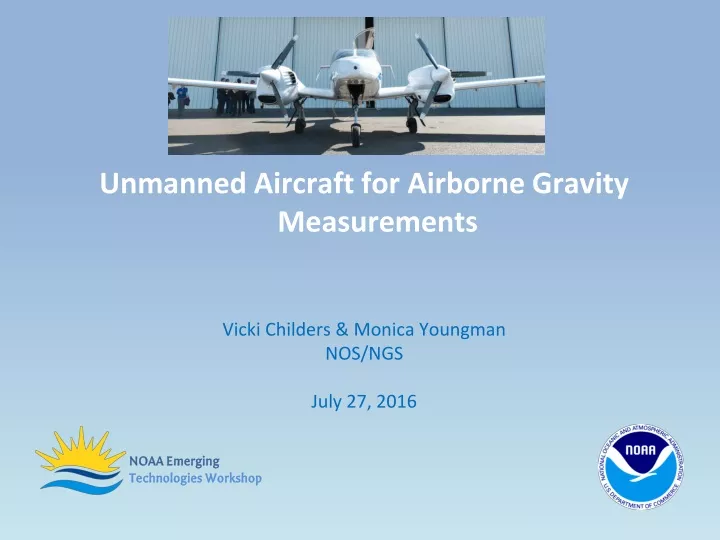
Unmanned Aircraft for Airborne Gravity Measurements Vicki Childers & Monica Youngman NOS/NGS July 27, 2016
National Geodetic Survey’s Mission To define, maintain and provide access to the National Spatial Reference System (NSRS) to meet our nation’s economic, social, and environmental needs. In 2022, NGS will be modernizing the NSRS to address known systematic issues.
GRAV-D Project: Gravity for the Redefinition of the American Vertical Datum Project • GRAV-D will update elevations by 2022 • Requires “airborne gravity snapshot” of the U.S. and territories. • To achieve a 1 centimeter accurate vertical datum, the GRAV-D project requires gravity data accurate to 1 mGal. 52% Complete as of July 2016
Current Operational Capabilities – GRAV-D • Aircraft • “Portfolio” of Federal and contract aircraft, and contract data collection • Scientific Payload • Gravimeter • GNSS receiver & antenna + IMU • Dimensions: 28” x 22” x 33”, 309 lbs
Unmanned Aircraft for Airborne Gravity – Aurora Centaur • Goal: To develop an unmanned aircraft/gravimeter combination that meets GRAV-D specifications • Capability Name: Unmanned Aircraft for Airborne Gravity Measurements – Aurora Centaur OPA • Capability Brief Description/Status: • Successful SBIR Phase I & II with Aurora Flight Sciences, including flight tests; • Miniaturize sensor • Transitioning to operations • Capability Owner (NOAA funding organization): Transitioning from OAR to NOS, Phase III SBIR • Partners in Development: OAR UAS Program, OAR Technology Partnerships Office, NGS GRAV-D Project, Aurora Flight Sciences, Micro-g LaCoste
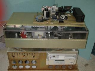
Unmanned Aircraft for Airborne Gravity – Aurora Centaur • Key capability-distinguishing innovation: • Successful gravimeter integration on an optionally-piloted aircraft • Very precise, stable optionally-piloted platform • Early Successes: • SBIR Phase I documented feasibility • SBIR Phase II conducted field tests in Virginia (April 2016) proving capability • Phase III test produced very good, repeatable gravity data Micro-g LaCoste TAGS-7 Gravimeter in the Aurora Centaur OPA. Gravimeter is: >60% smaller >30% lighter Unmanned (safety pilot) test flights
Anticipated Impacts: • Which NOAA mission services could be improved with this capability?
Anticipated Impacts: • What GRAV-D efficiencies could be realized with this capability? • Increased flight time with decreased fuel costs • Reduced environmental impact from improved fuel efficiency • Unmanned capability and flight accuracy benefits in all airspace
Anticipated Impacts: • What anticipated user needs are satisfied by this capability? • Gravity data to improve height measurements • Transportation systems • How will society ultimately benefit from this capability? • Protecting life and property based on accurate, specifically improving: floodplain mapping, coastal intelligence and resilience planning, storm surge and inundation modeling, precision agriculture, transportation development, and more
Unmanned Aircraft for Airborne Gravity – Aurora Centaur • Additional Information: • Gravity Project: http://www.ngs.noaa.gov/GRAV-D/ • Aircraft: http://www.aurora.aero/centaur/ • Gravity Sensor: http://www.microglacoste.com/tags-6.php • Phase II SBIR Award: https://www.sbir.gov/sbirsearch/detail/691079 • Development Team: • Principal Investigator: Vicki Childers - NOAA/NOS/NGS • Co-PIs: Monica Youngman - NOAA/NOS/NGS • Robbie Hood - NOAA/OAR/USPO • Kelly Wright – NOAA/OAR/TTO • Larry Wirsing – Aurora Flight Sciences • Transition Team: • JustynaNicinska - NOAA/OAR/USPO • Vince Garcia - NOAA/OAR/TTO • John “JC” Coffey – Supporting NOAA/OAR/USPO • Jeff Harlan – Aurora Flight Sciences • Photos by Derek Parks – NOAA/OAR/TPO