Download
1 / 24
240 likes | 374 Views
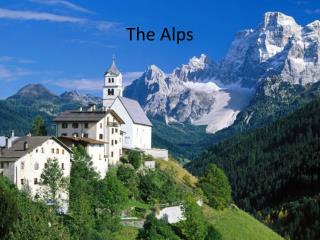
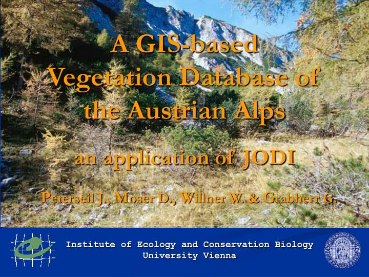
Institute of Ecology and Conservation Biology University Vienna. A GIS-based Vegetation Database of the Austrian Alps an application of JODI. P eterseil J., M oser D., W illner W. & G rabherr G. Organisation. Project leader Georg Grabherr Wolfgang Willner

E N D
Institute of Ecology and Conservation Biology University Vienna A GIS-based Vegetation Database of the Austrian Alpsan application of JODI Peterseil J., Moser D., Willner W. & Grabherr G.
Organisation • Project leader Georg Grabherr • Wolfgang Willner Johannes Peterseil Dietmar Moser Andreas Exner Christine Jakomini Siegrun Ertl • Financed by the Austrian Academy of Science
Project aims • Development of the database structure • Input of relevés from the Austrian Alps • Linking of the relevés with GIS • Exemplary analysis
What are the main problems? • Different sampling approaches • Systematic errors • Missing data • Different methods and scales • Different accuracy of localisation • Assigned vegetation types • many others …
How to deal with them? • Design a consistent and flexible database structure • Building of central definiton lists, e.g. species • Design of tools for the selection, edit and aggregation of data • Design of interfaces to other commonly used vegetation databases, e.g. TURBOVEG, VegBank or analysis programs, e.g. MEGATAB, VEGI, JUICE, SYNTAX, ...
JODI • Microsoft Access database application splitted into • User Interface • Definition lists • Link to Spatial Data • Data (project, literature, species, environmental data) • Flexibility • Original data are stored unchanged • Translation done via Central Definition Lists
DEFINITION LIST [value_id] METHODS Data fields, default values PROJECT [proj_id] Site data Environ.data, structure, … RELEVÉ [sample_id] Header data (sampling date, descriptions, …) Vegetation Species and abundance Tables [table_id] Classification alliance, vegetation type LITERATURE [publ_id] Localisation coordinates, maps (GIS) Data model
New! Data are structured as records DATA FIELD UNIT VALUE METHOD elevation CLS alpine DEFINTION LIST PROJECT Data model Normal structure
Methods What are methods? A summary of • DATA FIELD, e.g. slope • UNIT, measured as ° • DEFINITION LIST, e.g. a list of free entries • Additional information, e.g. type of device What are they for? Used for the generation of user defined input forms Documentation of the used methods
Data model S1_SAMPLE_DATA VALUE ROW TEXT DATA FIELD SAMPLE_ID SCALE_ID Category, text or numerical value COVER % LAYER UNIT 1 1 1 1 2 2 All All All HL All All Altitude Slope Aspect Layercover Altitude Slope m ° ° % CLS CLS Seehöhe in m Neigung in ° Expostion Schichtdeck.% Altitude Slope category Free Free Free Free RA01 SL02 250 – 300 - 350 10 - 15 180 75 montanous slightly 100 100 100 100 100 100
Data Model DATA FIELDS RELEVÉ HEADER DEFINITION LISTS Fixed table structure Flexible data structure
Transformation done Original values unchanged Definition List A Definition List B Data Central Definition List Definition Lists Problem: Different Lookup Tables for the data Solution: Central Definition List
CLASS ORDER ALLIANCE ASSOCIATION Definition Lists Problem: Different thematic resolutions of the data Solution: Hierarchical structured definition lists Example: Syntaxonomical Units Assigment on different hierarchical levels possible Aggregation of the data on a certain hierarchical level
Definition Lists • each category is assigned to a parent category and a certain hierarchical level • with a special designed functions it is possible to aggregate data on certain hierarchical levels, e.g. on the alliance level.
Spatial Data • ArcView Shape Files • Accuracy of localisation • Coordinates • Most propable location • ArcView application for the communication to the vegetation database • POLYGON_ID
Data Selection Manage huge data amounts All data fields within the database can be used for the selection Selection can either done by data query or by spatial selection
Data Export Interfaces to : vegetation databases, e.g. TURBOVEG, VegBank, or analysis programs, e.g. MEGATAB, JUICE, SYNTAX, VEGI
Data Export • Transformation and aggregation based on the central definition list • Possibility of User defined aggregation of the values of a DATA FIELD • Aggregation files can be saved and used again
Data Export • Transformation and aggregation based on the central definition list • Possibility of User defined aggregation of the values of a DATA FIELD • Aggregation files can be saved and used again
Structure of the Application JODI97 - User Interface Entry, import, management, export, analysis, … SPATIAL DATA Location and accuracy of the samples DEFINITION LISTS Hierarchical structured defintion lists DATA Project, Literature reference, Vegetation, Environmental data, … ArcView Microsoft Access Database
Development of database structure and the design of input and export forms • Building up the Central Defintion Lists • Building up the literature database • Development of a new syntaxonomical checklist for Austria to alliance level exemplary analysis and presentation Data input and import 2001 2002 2003 2004 Timetable
Status Quo • Design of the database structure • Design and check of the input, selection and edit tools • Review of the existing literature for the Austrian Alps • 16.374 relevés • 9.891 polygons • …
Summary Advantages of this design of the data model • Flexibility • Original values preserved • Transformation of data is not nessecary at the stage of the data entry – only the link between the lookup table and the Central Defintion List has to be defined • Easy access on all data for selection and export • Integration of different data sources and methodological approaches into one database possible
Thank you! Departement of Conservation Biology, Vegetation and Landscape Ecology Institute of Ecology and Conservation Biology University of Vienna