Download
1 / 49
490 likes | 651 Views
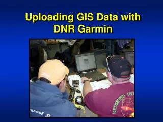
Managing Multiple Track Segments with DNR Garmin. Objectives. Using DNR Garmin: Download tracks Save track segments to shapefiles. Summary of Topics. Multiple Track Features Scenario Download Tracks Save Polygon Feature as Shapefile Save Line Features as Shapefiles.

E N D
Objectives Using DNR Garmin: Download tracks Save track segments to shapefiles
Summary of Topics • Multiple Track Features Scenario • Download Tracks • Save Polygon Feature as Shapefile • Save Line Features as Shapefiles
Data Collection Scenario Collected one polygon feature Saved Track (needed fire acres) Collected two line features Dozer Line Hand Line 3 Separate Track segments in the Active Track Log Fire Perimeter
Data Summary Have (GPS) 3 track segments polygon line line 1 saved track polygon Need (GIS) 1 fire perimeter polygon 1 dozer line 1 hand line
Select Track Download Download – transfers a copy of data, does not remove data from receiver verify Coordinate System
View Track Data Table show/hide data table scrollbar scrollbar resize window watch download
...As Text File First! A Text File should always be saved First as a back up file to the ESRI (ArcView) Shapefile Name should indicate all track points 20080319_rxwui_alltrackpts
Status Window Name: 20080319_rxwui_alltrackpts.txt
...As ArcView Shapefile... Note points files already there Projected shapefile uses projected coordinates. Unprojected shapefile uses WGS84 coordinates.
Status Window Name same as text file, extension different 20080319_rxwui_alltrackpts.shp
Locate Shapefile Note file path Note additional files
Select First Track Segment First segment is fire perimeter Second segment is dozer line Third segment is hand line Select the first Active Log track segment light blue-start of new track segment
...As Text File First! A Text File should always be saved First as a back up file to the ESRI (ArcView) Shapefile Name should indicate feature type 20080319_rxwui_perim.txt
...As ArcView Shapefile... Note all track points file already there Name should indicate feature and shape type 20080319_rxwui_perim_pts.shp
...As a Point - Save to a Point Shape to ensure integrity - Save to a Polygon ONLY if you are sure your data is perfect
...Save Again to ArcView Shapefile... Note all track points file and perimeter points listed Name should indicate feature and shape type 20080319_rxwui_perim_poly.shp
Check Saved Files Text file of all Active Log track points Point shapefile of all Active Log track points Point shapefile of fire perimeter track points Text file of fire perimeter track points Polygon shapefile of fire perimeter
Let’s Peek at your Work! Give both shapefiles to GIS Specialist Great! Point Shapefile: 20080319_rxwui_perim_pts.shp Polygon Shapefile: 20080319_rxwui_perim_poly.shp
Select Second Track Segment First segment is fire perimeter Second segment is dozer line Third segment is hand line light blue - start of new track segment
...As Text File First! A Text File should always be saved First as a back up file to the ESRI (ArcView) Shapefile Name should indicate feature type 20080319_rxwui_dzline
...As ArcView Shapefile... Note other shapefiles Name should indicate feature type 20080319_rxwui_dzline.shp
...As a Point or a Line??? Point Shape ensures integrity You can save to a Line ONLY if you are sure your data is perfect
Check Saved Files Text file of Dozer Line Shapefile of Dozer Line
Select Third Track Segment First segment is fire perimeter Second segment is dozer line Third segment is hand line last segment in table
...As Text File First! A Text File should always be saved First as a back up file to the ESRI (ArcView) Shapefile Name should indicate feature type 20080319_rxwui_handline
...As ArcView Shapefile... Note other saved shapefiles Name should indicate feature type 20080319_rxwui_handline.shp
...As a Point or a Line??? - Point Shape ensures integrity - Save to a Line ONLY if you are sure your data is perfect
Check Saved Files Text file of Hand Line Shapefile of Hand Line
Review of Topics • Multiple Track Features Scenario • Download Tracks • Save Polygon Feature as Shapefile • Save Line Features as Shapefile
Final Data Review & Question GPS 3 track segments polygon line line 1 saved track polygon GIS 1 fire perimeter polygon 1 dozer line 1 hand line All GIS shapefiles came from Active Track Why didn’t we use Saved Perimeter Track?
Compare Geometry Active Track Log Saved Track Which would be a better representation on a map?
Compare Area Calculations Active Track Acres Calculated in ArcGIS Saved Track Acres Calculated in GPS Saved Track – Good estimated Acres!
Review of Topics • Multiple Track Features Scenario • Download Tracks • Save Polygon Feature as Shapefile • Save Line Features as Shapefiles
Conclusions Active Track Log • Actual GPS positions • Good depiction of features Saved Track • Saves “critical” GPS positions only • Creates linear shapes for curved features • Good approximate acre calculation