Download

1 / 41
410 likes | 570 Views
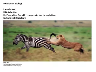
Ecology I. Ch 34. 34.1 Ecologists study how organisms interact with their environment at several levels . Ecologists study environmental interactions at the organism, population, community, and ecosystem levels

E N D
Ecology I Ch 34
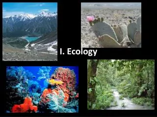
34.1 Ecologists study how organisms interact with their environment at several levels • Ecologists study environmental interactions at the organism, population, community, and ecosystem levels • Ecology is the scientific study of the interactions of organisms with their environment Figure 34.1
Ecosystem interactions involve living (biotic) communities and nonliving (abiotic) components • Abiotic components include energy, nutrients, gases, and water • Organisms are affected by their environment • But their presence and activities often change the environment they inhabit
34.2 The biosphere is the total of all of Earth's ecosystems • The global ecosystem is called the biosphere • It is the sum of all the Earth's ecosystems • The biosphere is the most complex level in ecology Figure 34.2A
except for energy obtained from the sun and heat lost to space • Patchiness characterizes the biosphere • Patchiness occurs in the distribution of deserts, grasslands, forests, and lakes • Each habitat has a unique community of species • The biosphere is self-contained Figure 34.2B
34.3 Connection: Environmental problems reveal the limits of the biosphere • Human activities affect all parts of the biosphere • One example is the widespread use of chemicals
34.4 Physical and chemical factors influence life in the biosphere • The most important abiotic factors that determine the biosphere's structure and dynamics include • solar energy • water • temperature
Disturbances such as fires, hurricanes, and volcanic eruptions are also abiotic factors Figure 34.4
34.6 Regional climate influences the distribution of biological communities • Climate often determines the distribution of communities • Earth's global climate patterns are largely determined by the input of solar energy and the planet's movement in space
This is a result of the variation in solar radiation at different latitudes • Most climatic variations are due to the uneven heating of Earth's surface North Pole 60º N Low angle ofincoming sunlight 30º N Tropic ofCancer Sunlight directlyoverhead 0º (equator) Tropic ofCapricorn 30º S Low angle ofincoming sunlight 60º S Figure 34.6A Atmosphere South Pole
The seasons of the year result from the permanent tilt of the plant on its axis as it orbits the sun MARCH EQUINOX(equator facessun directly) JUNE SOLSTICE(NorthernHemisphere tiltstoward sun) DECEMBERSOLSTICE(NorthernHemisphere tiltsaway from sun) SEPTEMBEREQUINOX Figure 34.6B
The tropics experience the greatest annual input and least seasonal variation in solar radiation • The direct intense solar radiation near the equator has an impact on the global patterns of rainfall and winds
Ascending moist airreleasesmoisture Descendingdry airabsorbsmoisture Descendingdry airabsorbsmoisture Trade winds Trade winds Doldrums 0º 23.5º 23.5º 30º 30º TROPICS TEMPERATEZONE TEMPERATEZONE Figure 34.6C
As the air rises, it cools and releases much of its water content • This results in the abundant precipitation typical of most tropical regions • After losing their moisture over equatorial zones, high altitude air masses spread away from the equator • Warm, moist air at the equator rises
They cool and descend again at latitudes of about 30° north and south • This explains the locations of the world's great deserts • As the dry air descends, some of it spreads back toward the equator • This creates the cooling trade winds that dominate the tropics
Temperate zones are located between the tropics and the Arctic Circle in the north and the Antarctic Circle in the south • They have seasonal variations in climate • The temperatures are more moderate than in the tropic or polar regions
Prevailing winds result from the combined effects of the rising and falling of air masses and Earth's rotation • In the tropics, Earth's rapidly moving surface deflects vertically circulating air, making the winds blow from east to west • In temperate zones, the slower-moving surface produces the westerlies, winds that blow from west to east Figure 34.6D
Ocean currents have a profound effect on regional climates by warming or cooling coastal areas • They are created by winds, planet rotation, unequal heating of surface waters, and the locations and shapes of continents
Local high temperatures for August 6, 2000, in Southern California Fresno100º 40 miles DeathValley119º Bakersfield100º Pacific Ocean Burbank90º Santa Barbara 73º San Bernardino 100º Key Riverside 96º Los Angeles(Airport) 75º 70s (ºF) Santa Ana84º Palm Springs 106º 80s 90s 100s 110s San Diego 72º Figure 34.6E
Landforms, such as mountains, can affect local climate East Winddirection PacificOcean CascadeRange CoastRange Figure 34.6F
34.7 Oceans occupy most of Earth's surface • Oceans cover about 75% of the Earth's surface • Light and the availability of nutrients are the major factors that shape aquatic communities
The saltiness of estuaries ranges from less than 1% to 3% • They provide nursery areas for oysters, crabs, and many fishes • They are often bordered by extensive coastal wetlands • Estuaries are productive areas where rivers meet the ocean Figure 34.7A
The intertidal zone is the wetland at the edge of an estuary or ocean, where water meets land • Salt marshes, sand and rocky beaches, and tide pools are part of the intertidal zone • It is often flooded by high tides and then left dry during low tides Figure 34.7B
Abiotic conditions dictate the kinds of communities that ocean zones can support Intertidal zone Continental zone Photiczone Pelagiczone Benthiczone(seafloor) Aphoticzone Figure 34.7C
It supports highly motile animals such as fishes, squids, and marine mammals • Phytoplankton and zooplankton drift in the pelagic zone • The benthic zone is the ocean bottom • It supports a variety of organisms based upon water depth and light penetration • The pelagic zone is the open ocean
The photic zone is the portion of the ocean into which light penetrates • Photosynthesis occurs here • The aphotic zone is a vast, dark region of the ocean • It is the most extensive part of the biosphere • Although there is no light, a diverse and dense population inhabits this zone
They support a huge diversity of invertebrates and fishes • Coral reefs are easily degraded by • pollution • native and introduced predators • human souvenir hunters • Coral reefs are found in warm tropical waters above the continental shelf Figure 34.7D
34.9 Terrestrial biomes reflect regional variations in climate • Climatic differences, mainly temperature and rainfall, shape the major biomes that cover Earth's land surface • Biomes tend to grade into each other • Within each biome there is local variation • This gives vegetation a patchy, rather than uniform, appearance
Major terrestrial biomes 30º N Equator 30º S Tropical forest Polar and high-mountain ice Temperate deciduous forest Savanna Chaparral Coniferous forest Desert Temperate grassland Tundra (arctic and alpine) Figure 34.9
34.10 Tropical forests cluster near the equator • Several types of tropical forests occur in the warm, moist belt along the equator Figure 34.10
The tropical rain forest is the most diverse ecosystem on Earth • Large-scale human destruction of tropical rain forests continues to endanger many species • It may also alter world climate
34.12 Savannas are grasslands with scattered trees • Drier, tropical areas and some nontropical areas are characterized by the savanna Figure 34.12
34.13 Deserts are defined by their dryness • Deserts are the driest of all terrestrial biomes • They are characterized by low and unpredictable rainfall • Desertification is a significant environmental problem Figure 34.13
34.14 Spiny shrubs dominate the chaparral • The chaparral biome is a shrubland with cool, rainy winters and dry, hot summers • Chaparral vegetation is adapted to periodic fires Figure 34.14
34.15 Temperate grasslands include the North American prairie • Temperate grasslands are found in the interiors of the continents, where winters are cold • Drought, fires, and grazing animals prevent trees from growing • Farms have replaced most of North America's temperate grasslands Figure 34.15
34.16 Deciduous trees dominate temperate forests • Temperate deciduous forests grow where there is sufficient moisture to support the growth of large trees • Nearly all of the original deciduous forests in North America have been drastically altered by agriculture and urban development Figure 34.16
34.17 Coniferous forests are often dominated by a few species of trees • The northern coniferous forest, or taiga, is the largest terrestrial biome on Earth Figure 34.17
The taiga is characterized by long, cold winters and short, wet summers • Coastal coniferous forests of the Pacific Northwest are actually temperate rain forests
34.18 Long, bitter-cold winters characterize the tundra • The arctic tundra lies between the taiga and the permanently frozen polar regions • It is a treeless biome characterized by extreme cold, wind, and permafrost • Permafrost is continuously frozen subsoil Figure 34.18
Polar ice • Permanently frozen polar regions • Polar regions are characterised by extremely cold temperatures, heavy glaciation, and extreme variations in daylight hours, with 24 hour daylight in summer (the midnight sun), and permanent darkness at mid-winter. Figure 34.18