Download
1 / 56
560 likes | 738 Views
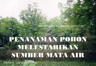
MENANAM POHON UNTUK MEMANEN AIR HUJAN GROUNDWATER. Soemarno - psdl ppsub 2013. GROUNDWATER USE AND RECHARGE

E N D
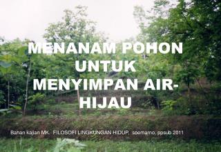
MENANAM POHON UNTUKMEMANEN AIR HUJANGROUNDWATER Soemarno - psdlppsub2013
GROUNDWATER USE AND RECHARGE There is a substantial amount of ground water recharge from surface water and ground water used to irrigate agricultural crops. Some of the irrigation water flowing in unlined ditches and some of the water that is applied to irrigate crops infiltrates into the soil, percolates through the root zone and recharges the ground water basins
Ground water Ground water occupies the zone of saturation. Ground water moves downward through the soil by percolation and then toward a stream channel or large body of water as seepage. The water table separates the zone of saturation from the zone of aeration. The water table fluctuates with moisture conditions, during wet times the water table will rise as more pore spaces are occupied with water. Ground water is found in aquifers, bodies of earth material that have the ability to hold and transmit water. Aquifers can be either unconfined or confined. Unconfined (open) aquifers are "connected" to the surface above.
AQUIFERS The rate of ground water flow depends on the permeability of the aquifer and the hydraulic gradient. Permeability is affected by the size and connectivity of pore spaces. Larger, better connected pore spaces creates highly permeable earth material. The hydraulic gradient is the difference in elevation between two points on the water table divided by the horizontal distance between them. The rate of ground water flow is expressed by the equation: Ground water flow rate = permeability X hydraulic gradient Groundwater flow rates are usually quite slow. Average ground water flow rate of 15 m per day is common. Highly permeable materials like gravels can have flow velocities of 125 m per day.
GROUNDWATER Ground water in an aquifer is under pressure called hydrostatic pressure. Hydrostatic pressure in a confined aquifer pushes water upward when a well is drilled into the aquifer. The height to which the water rises is called the peizometeric surface. If the hydrostatic pressure is great enough to push the peizometeric surface above the elevation of the surface, water readily flows out as an artesian well. www.uwsp.edu/geo/faculty/ritter/geog101/textb...
PROFIL LENGAS TANAH Following an infiltration event, in which the entire soil profile becomes saturated with water (indicated by a solid vertical line corresponding to a water saturation of 1.0), water will drain from the soil profile primarily under the influence of gravity (i.e., the pressure gradient is negligible). Assuming that no additional water enters the system, the soil water saturation profile at static equilibrium (dashed line) will decrease from a value of 1.0 in the saturated zone (groundwater and capillary fringe) to a value corresponding to field capacity below the root zone. In effect, the soil water profile is analogous to a soil water retention (pressure-saturation) curve. Hence, the solid and dashed lines represent the limits in water content (saturation) between which soil water percolation occurs in soils overlying an unconfined aquifer. www.informaworld.com/smpp/95829679-70617050/c...
Sumber: ga.water.usgs.gov/edu/earthgwdecline.html Water is recharged to the ground-water system by percolation of water from precipitation and then flows to the stream through the ground-water system.
. Water pumped from the ground-water system causes the water table to lower and alters the direction of ground-water movement. Some water that flowed to the stream no longer does so and some water may be drawn in from the stream into the ground-water system, thereby reducing the amount of streamflow.
Contaminants introduced at the land surface may infiltrate to the water table and flow towards a point of discharge, either the well or the stream. (Not shown, but also important, is the potential movement of contaminants from the stream into the ground-water system.)
Water-level declines may affect the environment for plants and animals. For example, plants in the riparian zone that grew because of the close proximity of the water table to the land surface may not survive as the depth to water increases. The environment for fish and other aquatic species also may be altered as the stream level drops.
SIKLUS HIDROLOGI DI ALAM The fate of applied water can be better understood if the total hydrologic cycle is understood first. The hydrologic cycle describes the movement of water through its different forms and locations. Important processes in the hydrologic cycle are: 1. Evaporation -the transformation of liquid water into water vapor from free water surfaces. 2. Precipitation (rain or snow). 3. Runoff -water moving overland or in a river or stream. 4. Infiltration -the movement of water into the soil. 5. Percolation -the movement of water through the soil. 6. Freezing - liquid water turning into ice 7. Thawing - melting of ice 8. Transpiration - the movement of water vapor out through plant/animal tissue surfaces into the atmosphere.
HUTAN DAN SIKLUS HIDROLOGI The surface water in a stream, lake, or wetland is most commonly precipitation that has run off the land or flowed through topsoils to subsequently enter the waterbody. If a surficial aquifer is present and hydraulically connected to a surface-water body, the aquifer can sustain surface flow by releasing water to it. In general, a heavy rainfall causes a temporary and relatively rapid increase in streamflow due to surface runoff. This increased flow is followed by a relatively slow decline back to baseflow, which is the amount of streamflow derived largely or entirely from groundwater. During long dry spells, streams with a baseflow component will keep flowing, whereas streams relying totally on precipitation will cease flowing. Generally speaking, a natural, expansive forest environment can enhance and sustain relationships in the water cycle because there are less human modifications to interfere with its components. A forested watershed helps moderate storm flows by increasing infiltration and reducing overland runoff. Further, a forest helps sustain streamflow by reducing evaporation (e.g., owing to slightly lower temperatures in shaded areas). Forests can help increase recharge to aquifers by allowing more precipitation to infiltrate the soil, as opposed to rapidly running off the land to a downslope area.
Penebangan pohon berdampak meningkatnya ancaman banjir Forests and prairies rarely yield runoff regardless of steepness, even when frozen Forested areas provide storm water protection and protect the quantity and quality of groundwater
Black Earth Creek Study • Black Earth Creek receives 80% of its water from groundwater • Main recharge occurs in spring and fall • Recharge from the agricultural uplands is highly variable • Forested slopes are significant recharge areas Wooded hill slopes generate no significant runoff
Pohon memperbaiki Kapasitas infiltrasi lapisan tanah permukaan Effects are greatest during the growing season Effects are greatest on sites whose soils are relatively impermeable
The impact of urban trees on hydrology is extremely variable and complex, in general increases in tree cover and tree size over a site will result in reduced total runoff amounts and peak runoff rates.
Pohon dan Storm Water • Trees have a relatively greater effect on smaller storm runoff amounts than on large storm events • Surface and below-ground effects on runoff are much more significant than the above-ground effects • All of the effects on runoff are greatest when urban trees are large and well-established on undisturbed sites
Pohon memperbaiki kenyamanan thermal lingkungan sekitarnya Contact Information: Mindy Habecker Dane County UW-Extension 224-3718 Habecker@co.dane.wi.us
Sumber: www.aucklandcity.govt.nz/.../hgiapp15.asp Typical root systems are made up of a combination of four types of roots: major lateral roots sinker roots woody feeder roots non-woody feeder roots.
Sumber: www.dof.virginia.gov/urban/landscape-manual.shtml Tajuk pohon mengamankan lingkungan di sekitarnya, di atas tanah dan di bawah tanah.
Tree and Root System on Bank of Darling River, Kinchega National Park, Outback, New South Wales, Australia
GROUNDWATER RECHARGE Groundwater recharge or deep drainage or deep percolation is a hydrologic process where water moves downward from surface water to groundwater. This process usually occurs in the vadose zone below plant roots and is often expressed as a flux to the water table surface. Recharge occurs both naturally (through the water cycle) and through anthropogenic processes (i.e., "artificial groundwater recharge"), where rainwater and or reclaimed water is routed to the subsurface. http://en.wikipedia.org/wiki/Groundwater_recharge
GROUNDWATER RECHARGE Processes Groundwater is recharged naturally by rain and snow melt and to a smaller extent by surface water (rivers and lakes). Recharge may be impeded somewhat by human activities including paving, development, or logging. These activities can result in loss of topsoil resulting in reduced water infiltration, enhanced surface runoff and reduction in recharge. Use of groundwaters, especially for irrigation, may also lower the water tables. Groundwater recharge is an important process for sustainable groundwater management, since the volume-rate abstracted from an aquifer in the long term should be less than or equal to the volume-rate that is recharged. Recharge can help move excess salts that accumulate in the root zone to deeper soil layers, or into the groundwater system. Tree roots increase water saturation into groundwater reducing water runoff. Flooding temporarily increases river bed permeability by moving clay soils downstream, and this increases aquifer recharge. http://en.wikipedia.org/wiki/Groundwater_recharge
GROUNDWATER RECHARGE http://en.wikipedia.org/wiki/Groundwater_recharge
Trees and groundwater This question of water sources for trees is not easy to answer. During the wet season, rainfall becomes surface run-off or enters the soil. Given the high rainfall of the Top End, the soil’s capacity to soak up water is soon exceeded and water drains from the soil recharging shallow groundwater aquifers or flowing through into streams. During the dry season therefore, trees could be using soil water exclusively, or groundwater, or a mixture of both. Excavations of root systems have revealed a concentration of roots in the top 1-1.5 m of soil. Further, large and small trees are able to flush their canopies with new leaves during September and October, periods when upper soil moisture levels (top 2 m) are at a minimum and the water table is around 10 m below the surface. This leaf growth requires a considerable amount of water and small trees do not have deep root systems. This suggests they have adequate access to water from the soil alone. http://savanna.org.au/savanna_web/publications/savanna_links_issue12.html?tid=29993
Trees and groundwater Hypothetical root distribution for a mature Eucalypt tree growing in the Darwin region. Figure modified from that of Kimber (1974) The root systems of Jarrah. Forests Department of Western Australia, Research Report No. 10, 5 pp . http://savanna.org.au/savanna_web/publications/savanna_links_issue12.html?tid=29993
Trees and groundwater Surplus groundwater? As part of the TS-CRC project, CSIRO scientists Drs Tom Hatton and Peter Cook constructed a water balance for the research catchment. Using changes to aquifer CFC concentrations with depth below ground, the rate of recharge was estimated to be 200 mm year-1. This includes a 20 mm ‘groundwater surplus’. An error analysis suggests that this surplus may be as small as zero, or as large as 140mm. If we assume it is about 20 mm for a catchment such as the Howard River, this represents a sustainable yield of at least 2500 Ml of water per year. While we currently think groundwater extraction is unlikely to threaten the eucalypt savanna, other ecosystems may be vulnerable, such as spring-fed monsoon vine forests. http://savanna.org.au/savanna_web/publications/savanna_links_issue12.html?tid=29993
Trees and groundwater Hydrological cycle and water balance of Top End tropical eucalypt savanna http://savanna.org.au/savanna_web/publications/savanna_links_issue12.html?tid=29993
deep drainage from tree belts The clearing of natural vegetation for agriculture in southern Australia has increased deep drainage, led to increased groundwater recharge and, hence, the salinisation of land and streams. Alley farming systems, comprising alternate belts of trees and crops, have been proposed for reducing deep drainage but their effectiveness is unknown. This paper describes an application of ecological optimality theory to estimate the equivalent no drainage (ENOD) width B (m) for a tree belt. The relative drainage RD from an alley farm, compared to conventional agriculture is, therefore, 1 − B/W, where W is the centre spacing of the belts. We present a method for estimating BLA from the leaf area per unit length of belt LLA (m2 m−1), divided by the leaf area index LAI (m2 m−2) of nearby natural vegetation. Preliminary evaluation of BLA showed good agreement with BWB measured from water balance and BDD measured from deep drainage. The estimation of BLA for calculation of RD allows rapid estimates of the relative drainage reduction expected from alley farms in water-limited environments. . An ecological optimality approach for predicting deep drainage from tree belts of alley farms in water-limited environments Tim Ellis, Tom Hatton, Ian Nuberg. Agricultural Water Management. Volume 75, Issue 2, 15 July 2005, Pages 92–116.
Schematic diagram of a typical tree belt vegetation community of an alley farm in a water-limited environment where Dc is the deep drainage under the crop/pasture. The ENOD concept is a ‘step’ approximation (bold dashed line) to the likely actual deep drainage (curvilinear line) such that areas a + b = c. . An ecological optimality approach for predicting deep drainage from tree belts of alley farms in water-limited environments Tim Ellis, Tom Hatton, Ian Nuberg. Agricultural Water Management. Volume 75, Issue 2, 15 July 2005, Pages 92–116.
Where ground water occurs Rock materials may be classified as consolidated rock (often called bedrock) and may consist of sandstone, limestone, granite, and other rock, and as unconsolidated rock that consists of granular material such as sand, gravel, and clay. Two characteristics of all rocks that affect the presence and movement of ground water are porosity (size and amount of void spaces) and permeability (the relative ease with which water can move through spaces in the rock). http://pubs.usgs.gov/gip/gw_ruralhomeowner/
Where ground water occurs Consolidated rock may contain fractures, small cracks, pore spaces, spaces between layers, and solution openings, all of which are usually connected and can hold water. Bedded sedimentary rock contains spaces between layers that can transmit water great distances. Most bedrock contains vertical fractures that may intersect other fractures, enabling water to move from one layer to another. Water can dissolve carbonate rocks, such as limestone and dolomite, forming solution channels through which water can move both vertically and horizontally. Limestone caves are a good example of solution channels. Consolidated rock may be buried below many hundred feet of unconsolidated rock or may crop out at the land surface. Depending upon the size and number of connected openings, this bedrock may yield plentiful water to individual wells or be a poor water-bearing system. http://pubs.usgs.gov/gip/gw_ruralhomeowner/
Where ground water occurs Unconsolidated material overlies bedrock and may consist of rock debris transported by glaciers or deposited by streams or deposited in lakes. It also may consist of weathered bedrock particles that form a loose granular or clay soil. Well-sorted unconsolidated material can store large quantites of ground water; the coarser materials—sand and gravel—readily yield water to wells. http://pubs.usgs.gov/gip/gw_ruralhomeowner/
Where ground water occurs http://pubs.usgs.gov/gip/gw_ruralhomeowner/
Using Trees to Control Groundwater Recharge: How Many are Enough? Trees are important in preventing groundwater recharge and are complementary to other methods, such as establishing perennial pasture, improving crop productivity and natural regeneration. Trees are recommended for land where either perennial pastures cannot b reliably established, will not persist or will be unable to provide adequate protection from groundwater recharge. http://www.dpi.vic.gov.au/agriculture/farming-management/soil-water/salinity/using-trees-to-control-groundwater-recharge-how-many-are-enough
Using Trees to Control Groundwater Recharge: How Many are Enough? How much water could trees use? The reduction of groundwater recharge by vegetation depends on its ability to use or evaporate water from the soil. the deep root systems and large, evergreen crowns of many native trees means they can use more water than other types of vegetation (e. g pastures, crops, shrubs).Nevertheless, trees do not have an unlimited capacity to use water. Evaporation of water from trees or any vegetation, depends upon three things: Water - a tree can only use as much water as it has access to in the soil (soil moisture). Soil moisture varies throughout the year and is lowest during late summer and early autumn. The maximum water use by a stand of trees growing in recharge areas will be the annual rainfall. Surface run-off and recharge that occurs between root systems, however, reduces the potential water use. Sunlight - the energy for evaporation comes mainly from the sun. In most parts of Victoria it has the potential to evaporate up to 1500 millimetres of water a year. Leaf area - most evaporation takes place through the leaves. As a tree grows its leaf area increases and so does its water use. http://www.dpi.vic.gov.au/agriculture/farming-management/soil-water/salinity/using-trees-to-control-groundwater-recharge-how-many-are-enough
Using Trees to Control Groundwater Recharge: How Many are Enough? How much water do trees use? The following information has come from recent research. Table 1 Results of some Victorian investigations into water use by eucalypts growing on recharge. Table 1 shows the variation in water use over a year by eucalypts on recharge zones. The lower figures areduring rainy days in winter and the higher figures are in early summer before the soil moisture is depleted. Daily water use by a tree therefore can vary considerably throughout the year. The averages over the year are given in brackets. Table 1 also shows that age (due to growing leaf area and root system) also has a significant effect on the ability of trees to use water. http://www.dpi.vic.gov.au/agriculture/farming-management/soil-water/salinity/using-trees-to-control-groundwater-recharge-how-many-are-enough
Using Trees to Control Groundwater Recharge: How Many are Enough? Table 2 shows the importance of stand density and water use. In a paddock the amount of water any one tree uses has little significance in recharge control. What is mostimportant is the water use by the whole stand. Table 2. Stand density and water use http://www.dpi.vic.gov.au/agriculture/farming-management/soil-water/salinity/using-trees-to-control-groundwater-recharge-how-many-are-enough
Using Trees to Control Groundwater Recharge: How Many are Enough? Opportunities for trees to control groundwater recharge Since a tree's capacity to use water is limited, careful planning is required to ensure that trees are effective in controlling recharge. Planning must achieve a balance between: the amount of water to be evaporated; the density of trees in the plantation; what is an acceptable delay before the control of recharge is achieved. To calculate the approximate number of litres per day each tree would have to average over the year, use this equation: This equation enables you to calculate whether or not you are 'asking too much' of your trees to achieve your required level of recharge control. If the most water we can expect a mature tree to evaporate averages 140 litres per day (Table 1), it follows that to use a given amount of water a minimum number of trees per hectare are required. For example at least 100 trees per hectare are needed to use 500 nun of rain per year. To reduce the amount of time to achieve a certain level of water use, more trees per hectare should be planted. http://www.dpi.vic.gov.au/agriculture/farming-management/soil-water/salinity/using-trees-to-control-groundwater-recharge-how-many-are-enough
Using Trees to Control Groundwater Recharge: How Many are Enough? How many trees are enough? Dense plantations (at least 500 trees a hectare) are clearly the best means of achieving rapid and effective control of groundwater recharge. However, recharge control will not always be compatible with other land management objectives, such as maintaining grazing or growing trees commercially. Therefore the answer to the question of 'how many trees are enough to control recharge?' must begiven for each general type of rural tree growing. http://www.dpi.vic.gov.au/agriculture/farming-management/soil-water/salinity/using-trees-to-control-groundwater-recharge-how-many-are-enough
Using Trees to Control Groundwater Recharge: How Many are Enough? Protection and landscape plantings Most tree growing in rural areas is for either protection (control of land degradation, stock shelter) or landscape (visual beauty, wildlife habitat) purposes. Dense plantations will generally be needed to meet theseobjectives. However establishment costs of these plantations can be expensive, since no direct commercial returns are expected. Assuming a stand density of at least 400 trees a hectare (5 x 5 metre spacing) is necessary for protection and landscape plantings, it may take around 10 years for the trees to control groundwater recharge (depending upon rainfall and rate of recharge). Higher densities, can be relatively easily and cheaply achieved through direct seeding or fencing areas off to allow natural regeneration.These techniques can significantly reduce the delay before achieving recharge protection. http://www.dpi.vic.gov.au/agriculture/farming-management/soil-water/salinity/using-trees-to-control-groundwater-recharge-how-many-are-enough
Using Trees to Control Groundwater Recharge: How Many are Enough? Trees in pasture There are two forms of tree growing in pasture that may play a role in the management of groundwater recharge areas: agroforestry - where both the trees and pasture are managed to provide a commercial return, and; low density protection plantings - where trees are planted at a wide spacing to allow grazing to continue but close enough so that some, and perhaps eventually, complete recharge control is achieved. Appropriate densities for tree growing over pasture are 20-200 trees a hectare. At the lower range, recharge control will only be very slowly achieved (50+ years) and will rely on the trees not significantly affecting the evaporation from the pastures below. At densities lower than 20 a hectare (23 x 23 metre spacing) the average daily water use to achieve a given level of annual evaporation issimply asking too much of the trees. http://www.dpi.vic.gov.au/agriculture/farming-management/soil-water/salinity/using-trees-to-control-groundwater-recharge-how-many-are-enough