Download
1 / 26
280 likes | 485 Views
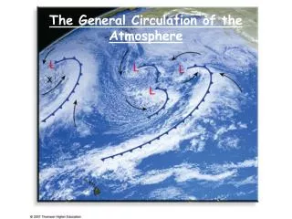
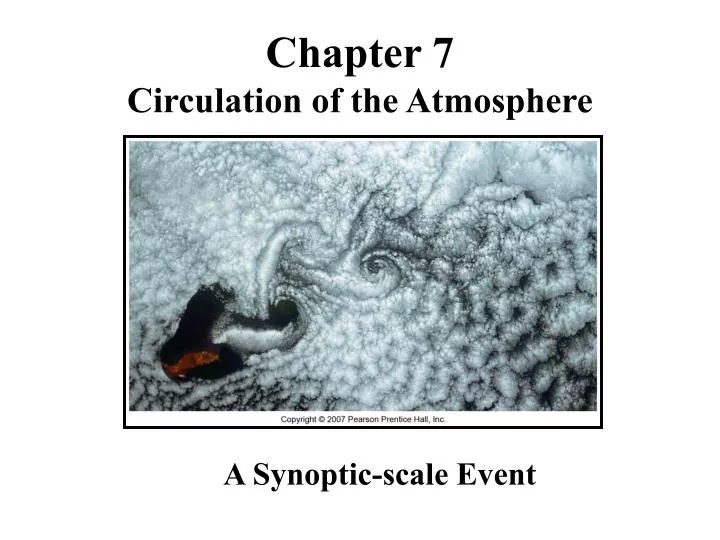
Chapter 7 Circulation of the Atmosphere. A Synoptic-scale Event. Planetary-scale wind patterns. macroscale winds are called synoptic scale , or weather-map scale . Mesoscale winds are thunderstorms, tornadoes, and breezes.

E N D
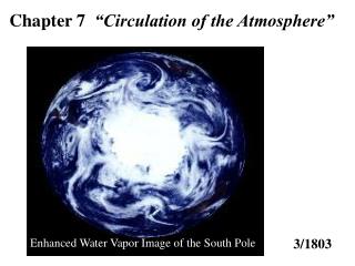
Chapter 7 Circulation of the Atmosphere A Synoptic-scale Event
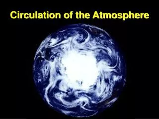
Planetary-scale wind patterns • macroscale winds are called synoptic scale, or weather-map scale. Mesoscale winds are thunderstorms, tornadoes, and breezes. • The smallest scale of air motion is the microscale. Examples of these winds include gusts and dust devils.
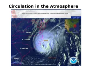
Hurricane Tornado Microscale Winds Macroscale Circulation Mesoscale System
Winds • Caused by differences in pressure and temperatures. In addition to land and sea breezes caused by the daily temperature contrast between land and water, other mesoscale winds include: • mountain and valley breezes, • chinook (foehn) winds, • katabatic (fall) winds, and • country breezes.
Winds & Breezes • Mountain and valley breezes develop as air along mountain slopes is heated more intensely than air at the same elevation over the valley floor. • Chinooks are warm, dry winds that move down the east slopes of the Rockies. • In the Alps, winds similar to chinooks are called foehns. • Katabatic (fall) winds or drainage winds originate when cold air is set in motion under the influence of gravity. • Country breezes are associated with large urban areas
Texas Norther’ • Not a real true local wind (mesoscale) as it deals more with a cold front and precipitation than wind production.
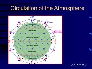
Global Circulation Three-cell Model Single-cell Model
Single-Cell Model • According to the single-cell circulation model proposed by George Hadley, the most important factor causing the global atmospheric circulation wastemperature contrasts between the equator and pole.
Global Circulation • According to the three-cell circulation model, atmospheric circulation cells are located between the equator and 30° latitude, 30 and 60° latitude, and 60° latitude and the pole.
Horse Latitudes • The areas in the zone between 20° and 35° are called the horse latitudes. • In each hemisphere, the equator ward flow from the horse latitudes forms the reliable trade winds.
Doldrums • The trade winds from both hemispheres meet near the equator in a region that has a weak pressure gradient called the doldrums.
Summertime wildfires in California are fanned by the Santa Ana Winds
Trade winds • Most of the United States is located in prevailing westerlies wind zone.
ITCZ Beginning at the equator, the four belts would be the (1) equatorial low, also referred to as the intertropical convergence zone (ITCZ), (2) subtropical high, at about 20 to 35° on either side of the equator, (3) subpolar low, situated at about 50 to 60° latitude, and (4) polar high, near Earth's poles.
Monsoon Circulation A monsoon is a wind system that exhibits pronounced seasonal reversal in direction.
The best-known and most pronounced monsoonal circulation is the Asian monsoon.
Jet Streams The temperature contrast between the poles and equator drives the westerly winds located in the middle latitudes. Embedded within the westerly flow are narrow ribbons of high-speed winds, called jet streams, that meander for thousands of kilometers.
Ocean Currents • ocean currents play a major role in maintaining Earth's heat balance. • In addition to producing surface currents, winds may also cause vertical water movements, or upwelling of cold water from deeper layers to replace warmer surface-water.
El Niño El Niño refers to episodes of ocean warming caused by a warm countercurrent flowing southward along the coasts of Ecuador and Peru that replaces the cold Peruvian current.
El Niño events influence weather at great distances from Peru and Ecuador.
When surface temperatures in the eastern Pacific are colder than average, a La Niña event is triggered. A typical La Niña winter blows colder than normal air over the Pacific Northwest and the northern Great Plains, while warming much of the rest of the United States.
Global Distribution of Precipitation The general features of the global distribution of precipitation can be explained by global winds and pressure systems.
Pressure Belts and Precipitation regions influenced by high pressure experience dry conditions. regions under the influence of low pressure and converging winds receive ample precipitation.
Chapter 7 END