Download
1 / 31
330 likes | 448 Views
Factors Controlling Climate. Climate – average weather of a region. Factors Controlling Climate. Daily & annual cycles Daily rotation of the Earth (day/night) Annual revolution around the sun (seasons) Longer-term cycles: El Nino – several years

E N D
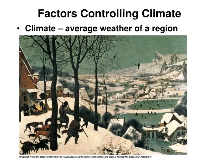
Factors Controlling Climate • Climate – average weather of a region
Factors Controlling Climate • Daily & annual cycles • Daily rotation of the Earth (day/night) • Annual revolution around the sun (seasons) • Longer-term cycles: • El Nino – several years • Continental Glaciation – hundreds of thousands of years • Factors influencing annual cycle of air temp:
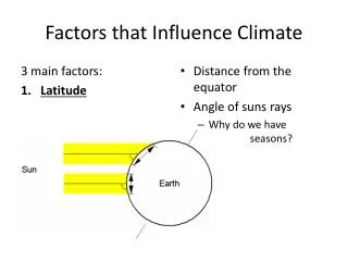
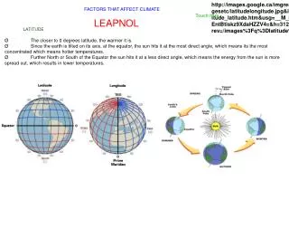
Factors Controlling Climate • Factors influencing annual cycle of air temperature: • Latitude • Altitude • Coastal vs. Continental location • Factors influencing precipitation: • The three above, plus: • Annual & daily air temperaturess • Prevailing air masses • Relation to mountain barriers • Position of persistent low & high pressure center • Prevailing winds & ocean currents
Temperature Regimes • Temp Regime – Annual cycle of temp driven by latitude & location • Insolation is main control on temperature • Variation in insolation due to latitude • Effect of marine or continental location moderates variation
Precipitation Regimes • Seven global precipitation regions: • 1. Wet Equatorial Belt - >2000 mm (80 in) rainfall • mE air masses – heavy convective rainfall • 2. Trade-wind Coasts – 1500-2000 mm precip • Narrow belts from Equator to 30° N & S on east coast of continents • mT air masses carried on trade winds bring rainfall • 3. Tropical Deserts - < 250 mm rainfall • Located on or near tropics • cT air masses under subtropical highs
Precipitation Regimes • 4. Midlatitude deserts & steppes – 100-500 mm precip • In centers of continents, 30-50°N • In rainshadow of mountain chains to west • 5. Moist Subtropical – 1000-1500 mm precip • 25-40° N & S on moist, western side of subtropical high • mT air masses from ocean provide moisture for precip
6. Midlatitude West Coast – 1500-2000+mm precip • On west coasts of continents in path of moist westerlies • mP air masses & orographic precipitation • 7. Arctic & Polar Deserts - <300 mm precip • Above 60°N & S • cP & cA air masses can hold little moisture
Precipitation Regions Isohyets – lines drawn through areas with equal annual precipitation
Seasonality of Precipitation • Timing of precipitation during year key to climate • 3 types of precipitation patterns: • Uniform throughout year • Precipitation maximum during summer • Precipitation maximum during winter
Climate Classification • Based on mean monthly values of temp & precip • 13 climate types based on: • Air mass movements • Frontal zones • Climate types broken into 3 groups: • Group I – low latitudes - cT, mE and mT air masses • Group II – midlatitudes - Polar front, varied air masses • Group III – high latitudes - cP, mP and cA air masses
Climograph • Tool for defining the climate of a given location or region • Mean monthly temp on line chart • Mean monthly precip on bar chart • May include dominant weather systems
Low-Latitude Climates (Group I) • Wet Equatorial (1) – warm to hot w/abundant rainfall • Example – Amazon Basin or Congo • Trade Wind Coastal (2) – warm to hot w/very rainy season • Example – any coastal region exposed to trade winds
Low-Latitude Climates (Group I) • Wet-Dry Tropical (3) – warm to hot w/distinct wet & dry seasons • Example – Sahel or monsoon region of central India • Dry Tropical (4) – very hot in high-sun season, cooler in low sun • Little to no rainfall • Examples – Sahara Desert, Central Australia
Midlatitude Climates (Group II) • Dry Subtropical (5) – not as hot as dry tropical • Example – Death Valley, CA • Moist Subtropical (6) – hot, humid summers, mild winters, ample rain • Example – Southeastern US • Mediterranean (7) – hot, dry summers, rainy winters • Examples – Southern California, Mediterranean Sea
Midlatitude Climates (Group II) • Marine West Coast (8) – warm summers, cool, wet winters • Expls – Northwestern US • Dry Midlatitude (9) – warm to hot in summer, cold winter, little precip • Expl – Great Plains of North America • Moist Continental (10) – warm summer, cold winter, ample precip. • Expl – Northeastern US
High-Latitude Climates (Group III) • Boreal Forest (11) – short, cool summers, long, very cold winters • Example – Siberia, Central Alaska • Tundra (12) – short, cool summers, winters slightly warmer than (11) • Example – western Alaska coast • Ice Sheet (13) – bitter cold all year • Examples – inland Greenland and Antarctica