Download
1 / 11
130 likes | 306 Views
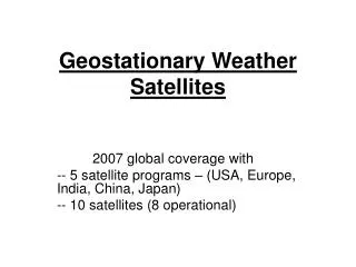
Geostationary Operational Environmental Satellite (GOES) R Series. Program Overview. Anthony Comberiate System Program Director April 2006. N. Subsatellite Point. Equator. 22,300 Mi. S. GOES Mission. Two satellites and on-orbit spare.

E N D
Geostationary Operational Environmental Satellite (GOES) R Series Program Overview Anthony Comberiate System Program Director April 2006
N Subsatellite Point Equator 22,300 Mi S GOES Mission Two satellites and on-orbit spare • Satisfies national operational environmental requirements for 24 hour observation of weather, earth’s environment, and solar and space environment • GOES I-M (8-12)* series operational since 1994 • GOES-N launch planned for 2006, GOES O & P being built • GOES-R series needed to replace the GOES-N series, expected launch no earlier than 2012 • Part of US contribution to Global Earth Observation System of Systems (GEOSS) * Note: satellites are labeled with letters on the ground and changed to numbers on-orbit
General Assumptions • Satellite Constellation • Geostationary Earth Orbit • East Position– 75o W Longitude • West Position– 135o W Longitude • Central Position– 105o W Longitude– storage and contingency operations • Inclination– 0o +0.5o • Mission Life: • 7.5 years operational • 7.5 years combined terrestrial and on-orbit storage– up to 5 years for either • Mission Launch Readiness Date: No earlier than 2012
System Architecture GOES R Satellite Constellation Ground Segment Users Antennas Wallops, VA Wallops, VA User Interface User Interface Ground Stations Operations Location: TBD Location: TBD Primary NSOF NSOF Backup: TBD Backup: TBD Suitland, MD Suitland, MD Space Environment Merged Merged CLASS Center, Boulder, CO Processing Processing • NSOF – NOAA Satellite Operations Facility • CLASS – Comprehensive Large Array Stewardship System
GOES-R GOES-R series being developed to replace GOES-N series. First launch is no earlier than 2012 Significant improvement in technology over GOES-I and GOES-N series New acquisition relationship builds on longstanding partnership between NOAA and NASA Improvements over current capabilities Imager 5X improvement in geographic coverage rate 30 second repeats for severe weather threats 4X improvement in horizontal resolution 3X increase in channels Sounder 5X improvement in geographic coverage rate 4 minute repeats for severe weather threats 3X improvements in vertical resolution Lightning detection Continuous coverage of total lightning flash rate over land and water Coastal Water Monitoring 0.375 km true color vs 1 km monochrome Transition of ocean color research satellite capability to operational platform First ever geostationary sampling of ocean color allows coastal resource management GOES-R Series Status GOES-R Contractors: System Program Definition and Risk Reduction (PDRR): Boeing, Lockheed Martin, Northrop-Grumman System Acquisition Contract: to be competitively awarded in August 2007 Instruments: ITT, BAE, Ball Aerospace, Lockheed Martin Advanced Technology Center
Program Management Structure DOC NOAA Program Management Council NOAA NESDIS System Program Director (SPD): Anthony Comberiate (NOAA) Deputy SPD: Michael Crison (NOAA) (Acting) Deputy SPD Advanced Instrument & and Technology Infusion: NASA GSFC Program Management Council Program Systems Engineering (NOAA) Lead: Alexander Krimchansky (NASA) (Acting) Program Scientist Lead: James Gurka (NOAA) (Acting) Contracts Lead: Robert Ransom (NOAA) Program Control Lead: Lisa Hurt (NOAA) (Acting) Operations Project Project Manager: Tim Walsh (NOAA) (Acting) Deputy: Vacant (NASA) Flight Project Project Manager: Michael Donnelly (NASA) Deputy: Tim Walsh (NOAA)
GOES-R Baseline Instruments to Meet User Requirements • Advanced Baseline Imager (ABI) • Monitors and tracks severe weather • Images clouds to support forecasts • Better resolution, faster coverage and more coverage simultaneously • Hyperspectral Environmental Suite (HES) • Provides atmospheric moisture and temperature profiles to support forecasts and climate monitoring • Monitors coastal regions for ecosystem health, water quality, coastal erosion, harmful algal blooms • Better resolution, faster coverage, adds coastal water imagery • Solar Imaging Suite (SIS) and Space Environmental In-Situ Suite (SEISS) • Images the sun and measures solar output to monitor solar storms (SIS) • Better Imager (UV over X-Ray) • Measures magnetic fields and charged particles (SEISS) • Better Heavy Ion detection, adds low energy electrons and protons • Enables early warnings for satellite and power grid operations, telecom services, astronauts, and airlines • Geostationary Lightning Mapper (GLM) • Detects lightning strikes as an indicator of severe storms • Previous capability only existed on polar satellites
OverviewProgram/Instrument Schedule 2011 2010 2012 2008 2013 2007 2009 2006 Q3 Q3 Q3 Q3 Q3 Q3 Q3 Q3 Q4 Q4 Q4 Q4 Q4 Q4 Q4 Q4 Q1 Q1 Q1 Q1 Q1 Q1 Q1 Q1 Q2 Q2 Q2 Q2 Q2 Q2 Q2 Q2 Current Schedule Completed Schedule As of: 3/31/2006 Fiscal Year Program Level SRR SCR IPDR CA Program Definition & Risk Reduction (Boeing, Lockheed Martin, Northrop-Grumman) 03/06 08/06 02/07 CA A&O RFP Acquisition & Operations 12/06 KDP-B 08/07 KDP-C/D Key Events 11/06 10/05 Instruments Advanced Baseline Imager (ABI) PDR CDR FM-1 Acquisition & Operations (ITT) 12/05 11/06 10/10 Hyperspectral Environmental Suite (HES) Program Definition & Risk Reduction 12/06 (ITT, BAE, Ball) CA SDR PDR CDR FM-1 Acquisition & Operations 06/07 09/07 09/08 09/09 06/13 Solar Imaging Suite (SIS) Program Definition & Risk Reduction 03/06 (LMATC) CA SDR PDR CDR FM-1 Acquisition & Operations 09/06 12/06 12/07 12/08 03/11 Space Environmental In-Situ Suite (SEISS) CA SDR PDR CDR FM-1 Acquisition & Operations 05/06 08/06 08/07 08/08 09/10 Geostationary Lightning Mapper (GLM) CA Program Definition & Risk Reduction 02/07 (ITT, LM, Ball) CA SDR PDR CDR FM-1 02/06 Acquisition & Operations 09/07 12/07 12/08 12/09 03/12 Legend CA: Contract Award SDR: System Design Review PDR: Preliminary Design Review CDR: Comprehensive Design Review FM-1: Flight Model 1 delivery SRR: System Requirements Review SCR: System Concepts Review IPDR: Interim Preliminary Design Review
Key Activities • Instrument Development • System Development • Affordability Trades • Requirements Prioritization • Acquisition Strategy Refinement We need timely user inputs to solidify GOES-R requirements