Download
1 / 25
250 likes | 576 Views
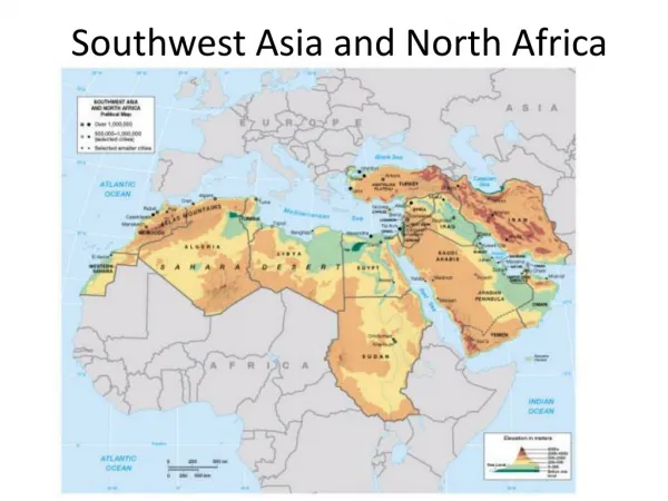
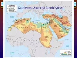
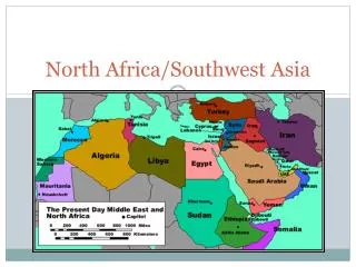
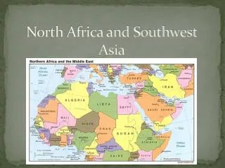
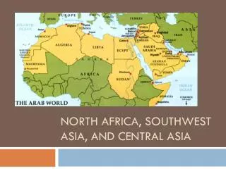
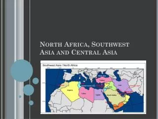
North Africa and Southwest Asia. Physical Geography. Physical Geography. Plate Tectonics Clashing Plates Arabian Plate into Eurasian Plate Separating Plates Arabian Plate pulling apart from African Plate Red Sea. Physical Geography of Northern Africa & Southwest Asia. Deserts

E N D
North Africa and Southwest Asia Physical Geography
Physical Geography • Plate Tectonics • Clashing Plates • Arabian Plate into Eurasian Plate • Separating Plates • Arabian Plate pulling apart from African Plate • Red Sea
Physical Geography of Northern Africa & Southwest Asia • Deserts • The Sahara Desert - • The Saudi Arabian Desert • The Libyan Desert • Negev Desert
Physical Geography of Northern Africa & Southwest Asia: Mountains • Mountains • Atlas Mountains • ThorusMts (Turkey) • Elburz & Zagros Mts. (Iran) • Golan Heights (Israel)
Mountain Ranges in Mid-East Elburz Mts., Iran Zagros Mts., Iran Lebanese Mts. Taurus Mts., Turkey
Physical Geography of Northern Africa & Southwest Asia: Water • Rivers & Sea • The Nile River • The Tigris & Euphrates Rivers • The Jordan River • The Red Sea • Gulfs - • Persian Gulf, • Gulf of Suez, • Gulf of Aqaba • Lakes • Dead Sea • Sea of Galilee
River Systems There are two great river systems: 1. Tigris-Euphrates Rivers (Iraq) - Flow south from the mountains of Turkey - Both rivers join south of Baghdad and flow into the Persian Gulf - For 1000’s of years, people have lived here because of the rivers irrigating the land 2. Nile River (Egypt) - Longest river in Africa and the world - Begins in the highlands of East Africa (flows 4000 miles north to the Mediterranean Sea) - The river brings rich soil and water to the Nile Valley Without the Nile, few people could live in Egypt (“the gift of the Nile”) 96% of Egypt is desert.
Egypt: The “Gift of the Nile” Nile Delta Annual Nile Flooding 95% of the Egyptian people live on 5% of the land!
Aswan High Dam, Egypt HydroelectricPower Plant
Suez Canal Completed by the British in 1869
The Tigris & EuphratesRiver System Mesopotamia: ”Land Between the Two Rivers” Marsh Arabs, So. Iraq
Qanats • Underground tunnels built by specialists. • The gently slopping tunnels use gravity to transport water from it’s source, usually at base of mountains. • Qanat tunnels can measure 20 to 30 miles • Originally used in the first century by the Persians in present day Iran. • Qanat tunnels were hand-dug, just large enough to fit the person doing the digging. • Many qanats are still in use stretching from China on the east to Morocco on the west, and even to the Americas
Physical Geography of Northern Africa & Southwest Asia • Climates • Desert Climates with less than 10” of rain • under high pressure latitude belt and NE trade winds • med. zones on Northern Africa coast & eastern coasts of Mediterrean