Download
1 / 26
260 likes | 480 Views
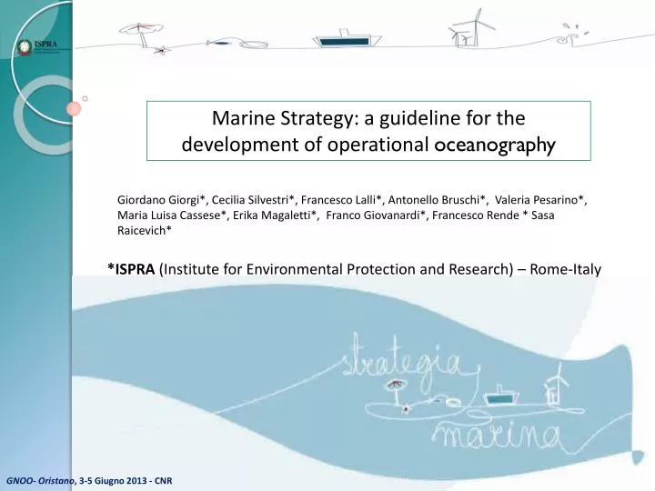
Marine Strategy: a guideline for the development of operational oceanography. Giordano Giorgi* , Cecilia Silvestri* , Francesco Lalli* , Antonello Bruschi* , Valeria Pesarino* , Maria Luisa Cassese* , Erika Magaletti* , Franco Giovanardi* , Francesco Rende * Sasa Raicevich*.

E N D
Marine Strategy: a guidelinefor the developmentofoperationaloceanography Giordano Giorgi*, Cecilia Silvestri*, Francesco Lalli*, Antonello Bruschi*, Valeria Pesarino*, Maria Luisa Cassese*, Erika Magaletti*, Franco Giovanardi*, Francesco Rende * Sasa Raicevich* *ISPRA (Institute for Environmental Protection and Research) – Rome-Italy GNOO- Oristano, 3-5 Giugno 2013 - CNR
On July 15, 2008 came into force the Marine Strategy Framework Directive (Directive 2008/56/EC) The main objective: to achieve or maintain good environmental status in the marine environment by the year 2020. Good environmental status: the environmental status of marine waters, considering the structure, functions and processes of the constituent marine ecosystems together with the associated physiographic, geographic and climatic factors, hydro-morphological, physical and chemical properties, including those resulting from human activities in the area concerned. The use of the marine environment is at level that is sustainable. GNOO- Oristano, 3-5 Giugno 2013 - CNR
Spatial scale of the Directive MSFD WFD GNOO- Oristano, 3-5 Giugno 2013 - CNR
Steps for National Marine Strategies development 2012 Building uponexistingactivitiesdevelopedwithin EU Directives and RegionalSeaConventions 2020 Toachieve or maintainGoodEnvironmental Status in the marine environment Adaptive management , with regular review (every 6 years) GNOO- Oristano, 3-5 Giugno 2013 - CNR
The initial assessment of marine waters through the existing data Data currently available GNOO- Oristano, 3-5 Giugno 2013 - CNR
RS- Physicalfeatures Parameters Data/information used • Topography Bathymetry Surveys • Sea Surface Temperature Satellite data • SeaBottom Temperature Oceanographic campaigns • MyOcean’s numerical model • Turbidity Oceanographic campaigns • Upwelling RMN and satellite data • Mixing characteristics MyOcean’s numerical model • Salinity MyOcean’s numerical model • Current velocity MyOcean’s numerical model • Wave Exposure ECMWF numerical model • ResidenceTimeMyOcean’s data post processing lagrangian particle model GNOO- Oristano, 3-5 Giugno 2013 - CNR
RS- Interferencewithhydrologicalprocess Report WISE RBMP data on analysis of pressures and impacts of coastal water bodies due to saline and temperature changing regime RS- Nutrient and organicmatterenrichment RS- Descriptor 5: Eutrophication Parameters Data/information used • Nutrients In situ monitoring data • MyOcean’ s numerical model • LTER-MC database • VECTOR-NASA database • Oxygen In situ monitoring data • Chlorophyll a In situ monitoring data Satellite data • phytoplankton In situ monitoring data GNOO- Oristano, 3-5 Giugno 2013 - CNR
DeterminationofGoodEnvironmental Status GES 14 Indicators D1-Biodiversity D2-Non idegenous species 3 Indicators D3-Fisheries 7 Indicators D4-Food web 3 Indicators D5-Eutrophication 56 8 Indicators D6-Seafloor integrity 6 Indicators D7-Hydrgrafic condition 3 Indicators D8-Contaminants 3 Indicators D9-Contaminants in seafood 2 Indicators D10-Litter 4 Indicators D11-Noise 2 Indicators GNOO- Oristano, 3-5 Giugno 2013 - CNR
Report MSFD Initialassessment Determinationof GES Establishment ofenvironmental target • Supportingdocuments • Cartography, detailed information, bibliography etc. • Paper report • Generalcontext, methodologies, • Executive summary • Reporting sheets • Analytical information (data) Italy October 2012 April 2013 QA/QC EuropeanCommission EuropeanEnvironmentalAgency REPORTNET WISE Marine GNOO- Oristano, 3-5 Giugno 2013 - CNR
La Direttiva Quadro sulla Strategia per l’Ambiente Marino TIMING Accordingto the MSFD management cycle, at the moment allMemberStatescompletedboth the Initialassessment and the Determinationoftheir GES . Now the EC isassessingallreports and already a high variabilityofapproachesisresulted. The lackofspecificmethodologies and/or technicalguidelinesregarding some descriptors and relatedindicatorslimitsanEU-wideharmonisation 2012 Initialassessemnt, determinationof GES, establishment of target G F M A M G L A S O N D 1° Reportingto EC 2013 2° Reportingto EC G F M A M G L A S O N D 2014 Monitoringprogrammes G F M A M G L A S O N D 2015 Elaborationofprogrammesofmeasures G F M A M G L A S O N D 2016 Start up of Programmesofmeasures L G F M A M G L A S O N D GNOO- Oristano, 3-5 Giugno 2013 - CNR
Which scientific gaps have been highlighted by the initial assessment? Identification of geographical and functional limits (range of variability) of ecosystems Assessmentof the cumulative impactsofhumanpressures on benthic, pelagic habitat integrityaswellasecosystemfunctioning and theireffects on biodiversity Impacts on benthic and pelagiccommunities due toalterationofhydrologicalcharacteristics Physiographicfeatures and consequencesforfood-webstructure and functionalecosystemprocesses GNOO- Oristano, 3-5 Giugno 2013 - CNR
MSFD – Ecosystem approach and Adaptive management with regular review (every 6 years) The ecosystem approach requires adaptive management to deal with the complex and dynamic nature of ecosystems and the absence of complete knowledge or understanding of their functioning…. Management must be adaptive in order to be able to respond to such uncertinties and contain elements of “learning-by-doing” or research feedback. Measures may need to be taken even when some cause-and-effect relationships are not yet fully established scientifically GNOO- Oristano, 3-5 Giugno 2013 - CNR
Some gapscouldbecompensedduring the following MSFD cycle (ending in 2018) bydevelopingnewmethods and gatheringadditional data GNOO- Oristano, 3-5 Giugno 2013 - CNR
Is t possibleto reduce thesescientificgaps? YES………advancing a methodologicalframework in ordertoprovideguidelinesfordevelopingoperationaloceanography GNOO- Oristano, 3-5 Giugno 2013 - CNR
HOW? 1) Defining the geographical and functional limits (range of variability) of ecosystems using oceanographic data from models, and other more variables GNOO- Oristano, 3-5 Giugno 2013 - CNR
and 2. Setting up a modellingframeworkforassessing the relationshipsbetweennatural (suchasmeterological, hydrodynamical, morphological ) and humanpressures (mainlyeutrophication, pollution, dredging, trawiling) and the benthic and pelagicphysical and ecologicalcharacteristics GNOO- Oristano, 3-5 Giugno 2013 - CNR
Mainstepto do that…………? • Characterise forcing processes • Describing the generic and specific hydrological, sedimentary and biological forcing processes involved in selected areas for the pelagic and benthic environment, how human pressures affect such processes and formalising these relationships (knowledge rules) in a generic framework for modelling GNOO- Oristano, 3-5 Giugno 2013 - CNR
Set up a modelling framework Select the available models for simulating the state and dynamics of the benthic and pelagic, physical and ecological processes and how natural and antropogenic pressures in general relate to the various parameters and modules in the model. • Developing sets of submodels to be intercompared: physical forcing models, biogeochemical models, and ecological models • Set up an end-to-end modelling framework, integrating above mentioned modules. GNOO- Oristano, 3-5 Giugno 2013 - CNR
Pelagic model Pelagicecologymustbedescribedbygroupinghighertrophiclevelorganism in functionalgroups, or focusing on target species, byfollowingcarbondynamics and energyflows and byderivingsyntheticindicatorsofecosystemstructure and functioning GNOO- Oristano, 3-5 Giugno 2013 - CNR
Benthic model Benthicecologymustbesimulated up tospeciesfunctionalgroups (diversity, sizedistributions, tolerant/sensitivespeciesgroups, etc..) habitat heterogeneity (gamma diversity, i.eassemblages in landscapes, small scale tomesoscalemorphologicalfeatures), and ecosystemfubctionality (functionaltraits, organiccarbonprocesssing, relationshipswithdemersalfish production GNOO- Oristano, 3-5 Giugno 2013 - CNR
End-to-Endmodel Integration a coupledbenthicpelagicbiogeochimicalmodel and a marine food web model GNOO- Oristano, 3-5 Giugno 2013 - CNR
Testing and validation of indicators for: D1 (Biodiversity) D4 (Food webs) D5 (Eutrophication) D6 (Seafloor integrity) D7 (Hydrological alteration) Selectingindicators for the three levels (species, habitat and ecosystem functioning) among those chosen in the determination of GES and formalising them within the three modules: • Dose-effect relationships for each pressure and indicator combination • Calibration runs for reliability and sensitivity analyses to test indicator performance • Indicator validation in the subregional seas for multiple/cumulative pressures GNOO- Oristano, 3-5 Giugno 2013 - CNR
Howto reduce the gap about the impacts on benthic and pelagiccommunities due toalterationofhydrologicalcharacteristics? • Description of the quantitative level of pressure due to change of the thermal regime or salinity using parameters: volume, flow, dispersion. • The tools for this study are models of hydrodynamics and coastal oceanography (MyOcean) and monitoring. • 2) Description of the quantitative level of impact due to changes in the thermal regime and salinity through the study of the alteration of community (eg species composition) and ecosystem functions. • Possible tools: modeling, mapping of benthic habitats (EuSeaMap) and monitoring. GNOO- Oristano, 3-5 Giugno 2013 - CNR
Development of innovative monitoring systems Integrating the information from tested and validated indicators and developed modelling tools to develop innovative monitoring approach, that efficiently and effectively assess the effects of human activities on marine environment in space and time, providing data/advices useful to achieve or maintain “good environmental status”. These monitoring systems could support ongoing monitoring programsof Member States that shall be implemented by 2014 according to Article 5 and 11 of MSFD. GNOO- Oristano, 3-5 Giugno 2013 - CNR