Download
1 / 37
380 likes | 633 Views
The use of WSR-88D radar data at NCEP. Shun Liu SAIC/ National Centers of Environmental Prediction, Camp Springs, Maryland. Outline. WSR-88D radar data processing at NCEP Radar data quality control (QC) Radar reflectivity mosaic Radial wind assimilation.

E N D
The use of WSR-88D radar data at NCEP Shun Liu SAIC/ National Centers of Environmental Prediction, Camp Springs, Maryland
Outline • WSR-88D radar data processing at NCEP • Radar data quality control (QC) • Radar reflectivity mosaic • Radial wind assimilation
WSR88D-Radar Data Processing at NCEP • The images from radar observations are successfully used to detect severe weather and warn of thunderstorms. • The use of high-resolution radar data to improve numerical weather prediction (NWP) is also active in the academic and research communities. • However, progress in the use of high-resolution Level-II data in operational NWP models has been slower
WSR88D-Radar Data Processing at NCEP Problems of using radar data in operation: • (1) the relatively large volume of radar data restricting the data to be transmitted to the operational center in real time • (2) the radar data decoding software and storage taking excessive computational resources • (3) the quality control (QC) problems of radar data further limiting the applications of radar data for operational use
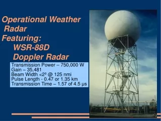
WSR88D-Radar Data Processing at NCEP Figure from http://www.rap.ucar.edu/weather/radar/
WSR88D-Radar Data Processing at NCEP Radar data received at NCEP: (1). VAD wind (2). WSR88D Level-III (NIDS) data (3). WSR88D Level 2.5 data (4). WSR88D Level-II data
WSR88D-Radar Data Processing at NCEP Flowchart of radar data processing at NCEP
Radar data QC at NCEP • To meet the high standard required by data assimilation, it is necessary to develop simple and efficient QC technique for operational applications. • Radar data quality control is a necessary and initial step for operational applications of radar data. • Develop statistically reliable QC techniques for automated detection of QC problems in operational environments • Among various of radar data quality problems, radar measured velocities can be very different (≥10 m/s) from the air velocities in the presence of migrating birds.
Radar data QC at NCEP QC Parameters: Mean reflectivity (MRF) Velocity data coverage (VDC) Along-beam perturbation velocity sign changes (VSC) Along-beam velocity sign changes(SC) Standard deviation of radial wind (STD)
Mean reflectivity No bird bird Histogram of MRF for (a) non-contaminated and (b) bird-contaminated sweeps. KTLX (From April 15 to June 15 2003) night Observation
Velocity Data Coverage No bird bird Histogram of VDC for (a) non-contaminated and (b) bird-contaminated sweeps. KTLX (From April 15 to June 15 2003) night Observation
Along-beam Perturbation Velocity Sign Changes No bird bird Histogram of VSC (%) for (a) non-contaminated and (b) bird-contaminated sweeps. KTLX (From April 15 to June 15 2003) night Observation
Probability Density Function MRF VDC VSC Prior probability density functions of MRF (a), VDC (b) and VSC (c).
Bayes Identification Denote the weather event by H0. Denote the bird event by H1. Denote the i-th QC parameter by Xi. P(H0 |xi) = p(xi |H0)P(H0)/p(xi), P(H1 |xi) = p(xi |H1)P(H1)/p(xi). p(xi)= p(xi |H0)P(H0)+p(xi |H1)P(H1) P(H0)=N0/(N0+N1) P(H1)=N1/(N0+N1)
Posterior Probability MRF VDC VSC Posterior probability distributions of MRF (a), VDC (b) and VSC (c)
23% KBUF 2009090513 6% KFWS 200909110605
Performance of radar data QC analysis (m/s) analysis (m/s) Observation (m/s) Observation (m/s) after QC before QC
With QC Goes image
1. Flowchart of Radar data 1. raw radar data decoding 2. Radial velocity QC 3. Reflectivity QC Fig. 1 4. Single Radar Cartesian (coordinate transformation) 5. Output ref in Cartesian grid Fig. 2 6. Reflectivity 3D mosaic Fig. 3
2. Reflectivity in radar coordinate Fig. 1. Raw reflectivity from KATX radar at 0.5 deg elevation at radar coordinate and zoom-in area
3. Reflectivity after SRC at 1500m Fig. 2. Reflectivity after SRC at Cartesian grid at 1500 m and zoom in area The difference between Fig. 1 and Fig. 2 are because the reflectivity data are at different height after interpolation.
Domain setup 3 4 1 2 8 6 5 7 Figure is from NSSL
Domain Specifications Table is from NSSL
Test in domain 6 Reflectivity mosaic fields at 500 and 2500 m
Radar wind assimilation in GSI • 3D variational (3DVAR) algorithm (Wu et al. 2002). • The cost function is defined by • Forward model
GSI namelist for radial wind assimilation • WSR-88D radar wind observations VAD, level-2.5 data, level-II data. &OBS_INPUT dfile(06)='radarbufr', dtype(06)='rw', dplat(06)=' ', dsis(06)='rw', dval(06)=1.0, dthin(06)=0, &SUPEROB_RADAR del_azimuth=5.,del_elev=.25,del_range=5000.,del_time=.5,elev_angle_max=5.,minnum=50,range_max=100000., l2superob_only=.false., /
Level-II radar wind bufr Radial wind bufr: • SSTN | 001018 | RADAR STATION IDENTIFIER (SHORT) | • | RPID | 001198 | RADAR STATION IDENTIFIER | • | VOID | 001212 | RADAR VOLUME ID (IN THE FORM DDHHMM) | • | SCID | 001213 | RADAR SCAN ID (RANGE 1-21) | • | ANAZ | 002134 | ANTENNA AZIMUTH ANGLE | • | ANEL | 002135 | ANTENNA ELEVATION ANGLE | • | YEAR | 004001 | YEAR | • | MNTH | 004002 | MONTH | • | DAYS | 004003 | DAY | • | HOUR | 004004 | HOUR | • | MINU | 004005 | MINUTE | • | SECO | 004006 | SECOND | • | STDM | 004075 | TIME DISPLACEMENT IN MINUTES FROM BASE TIME (SHORT) | • | CLAT | 005002 | LATITUDE (COARSE ACCURACY) | • | SUPLAT | 005197 | LATITUDE OF RADIAL WIND SUPEROB(COARSE ACCURACY) | • | CLON | 006002 | LONGITUDE (COARSE ACCURACY) | • | DIST | 006021 | DISTANCE (FROM ANTENNA TO GATE CENTER) | • | SUPLON | 006197 | LONGITUDE OF RADIAL WIND SUPEROB(COARSE ACCURACY) | • | DIST125M | 006210 | DISTANCE (FROM ANTENNA TO GATE CENTER) IN UNITS OF 125M | • | SELV | 007001 | HEIGHT OF STATION | • | HEIT | 007007 | HEIGHT OF RADIAL WIND SUPEROB | • | HSMSL | 007030 | HEIGHT OF STATION GROUND ABOVE MSL | • | HSALG | 007032 | HEIGHT OF ANTENNA ABOVE GROUND | • | HREF | 021001 | HORIZONTAL REFLECTIVITY | • | DMVR | 021014 | DOPPLER MEAN RADIAL VELOCITY | • | DVSW | 021017 | DOPPLER VELOCITY SPECTRAL WIDTH | • | HNQV | 021019 | HIGH NYQUIST VELOCITY | • | RWND | 021194 | RADIAL WIND RADIAL WIND SUPEROB | • | RWAZ | 021195 | AZIMUTH OF RADIAL WIND SUPEROB | • | RSTD | 021196 | STANDARD DEVIATION OF RADIAL WIND SUPEROB | • | VOCP | 021197 | VOLUME COVERAGE PATTERN | • | QCRF | 033250 | QUALITY MARK FOR REFLECTIVITIES ALONG RADIAL LINE | • | QCRW | 033251 | QUALITY MARK FOR WINDS ALONG RADIAL LINE | • | MGPT | 050004 | BUFR MESSAGE NUMBER |
Radar data flow in GSI Outer loop: • read-in radar data • Compute O-B • Call Inner loop 1). Compute cost function and gradient 2). Update analysis increment