Download
1 / 1
10 likes | 173 Views
Land Value and Elevation By Sandi Cain, R. Andrew Worthingon, Zack Stewart, Kristen De Graauw. ABSTRACT. METHODS. RESULTS.

E N D
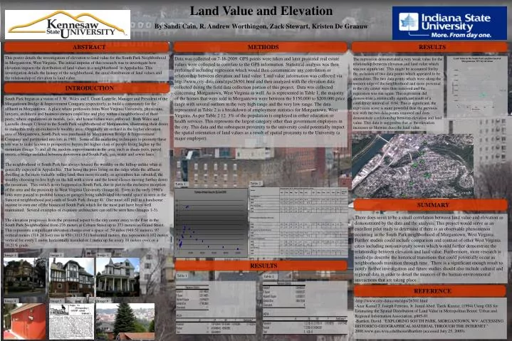
Land Value and Elevation By Sandi Cain, R. Andrew Worthingon, Zack Stewart, Kristen De Graauw • ABSTRACT • METHODS • RESULTS This poster details the investigation of elevation to land value for the South Park Neighborhood in Morgantown, West Virginia. The initial impetus of this research was to investigate how elevation impacts the distribution of land values in a neighborhood in Appalachia. This investigation details the history of the neighborhood, the areal distribution of land values and the relationship of elevation to land value. Data was collected on 7-16-2009. GPS points were taken and later proximal real estate values were collected to correlate to the GPS information. Statistical analysis was then preformed including regression which would then communicate any correlation or relationship between elevation and land value. Land value information was collected via http://www.city-data.com/zips/26501.html and then analyzed with the elevation data collected during the field data collection portion of this project. Data was collected concerning Morgantown, West Virginia as well. As is represented in Table 1, the majority of the homes that were sold in Morgantown were between the $150,000 to $200,000 price range with several outliers in the very high range and the very low range. The data represented in Table 2 is a breakdown of employment statistics for Morgantown, West Virginia. As per Table 2 12. 3% of the population is employed in either education or health services. This represents the largest category other than government employees in the city. This data and the subsequent proximity to the university could potentially impact the spatial orientation of land values as a result of spatial proximity to the University (a major employer). The regression demonstrated a very weak value for the relationship between elevation and land value which was not significant. This might be accounted for by the inclusion of two data points which appeared to be anomalous. The two data points which were along the western edge of the neighborhood and more proximal to the city center were then removed and the regression was run again. This regression did demonstrate a statistically significant result of a confidence interval of 0.04. This is significant, the regression score is more powerful than the previous test with the two data points removed and does demonstrate a relationship between elevation and land value. This data is suggestive that as the elevation increases so likewise does the land value. • INTRODUCTION South Park began as a vision of J. W. Wiles and I. Grant Lazzelle, Manager and President of the Morgantown Bridge & Improvement Company respectively, to build a community for the affluent in Morgantown. A place where professors from West Virginia University, physicians, lawyers, architects and business owners could live and play within a neighborhood of their peers; where stipulations on morals, race, and house values were enforced. Both Wiles and Lazzelle (Image 1) lived in the South Park neighborhood of Morgantown, illustrating their desire to make this truly an exclusively wealthy area. Originally an orchard in the higher elevation area of Morgantown, South Park was purchased by Morgantown Bridge & Improvement Company and partitioned into lots in 1901. Some of the marketing techniques to promote these lots was to make known to prospective buyers the higher class of people living higher up the mountain (Image 5) and all the modern improvements in the area, such as shade trees, paved streets, a bridge installed between downtown and South Park, gas, water and sewer lines. The neighborhood of South Park has always housed the wealthy on the hilltop unlike what is generally expected in Appalachia. That being the poor living on the ridge while the affluent dwelling in the more valuable valley land, then more recently, as agriculture has subsided, the wealthy choosing to live high on the hill with a view and the lower classes moving further down the mountain. This switch never happened in South Park, due in part to the exclusive inception of the area and the proximity to West Virginia University (Image 6). Even in the early 1990’s laws were passed to prohibit houses or garages being subdivided into rental space as seen in the Suncrest neighborhood just south of South Park (Image 4). One must still pull in a handsome income to own one of the houses of South Park which for the most part have been well maintained. Several examples of exquisite architecture can still be seen here (Images 1-3). The elevation progresses from the proximal aspect to the city center away to the East in the South Park Neighborhood from 276 meters at Coburn Street up to 373 meters on Grand Street. This represents a significant elevation change over a space of .59 miles (949.51 meters). 97 vertical meters (318.24 feet) rise in 950 (3113.51) horizontal meters, this represents 0.102 meters vertical for every 1 meter horizontally traveled or 1 meter up for every 10 meters over, or a 10.21% grade. Table 2 Table 1 • SUMMARY There does seem to be a small correlation between land value and elevation as demonstrated by the data and the analysis. This project would serve as an excellent pilot study to determine if there is an observable phenomenon occurring in the South Park neighborhood of Morgantown, West Virginia. Further studies could include comparison and contrast of other West Virginia cities including non-university towns which would further demonstrate the relationship between elevation and land value. Furthermore, more research is needed to describe the historical transitions that could potentially occur as neighborhoods transition through time. There is a significant enough result to justify further investigation and future studies should also include cultural and regional data in order to detail the nuances of the human-environmental interactions that are taking place. Image 1 Image 2 Image 3 • RESULTS Table 1 Table 2 • REFERENCE • -http://www.city-data.com/zips/26501.html • Azar Kamal T. Joseph Ferreira, Jr. Jamal Abed. Tarek Kazzaz. (1994) Using GIS for Estimating the Spatial Distribution of Land Value in Metropolitan Beirut. Urban and Regional Information Association, p805-81. • -Bartlett, David. "EXPLORING SOUTH PARK, MORGANTOWN, WV: ACCESSING HISTORICO-GEOGRAPHICAL MATERIAL THROUGH THE INTERNET." 2000.www.geo.wvu.edu/thesis/dbartlett (accessed July 25, 2009). Image 4 Image 5 Image 6