Download
1 / 18
180 likes | 366 Views
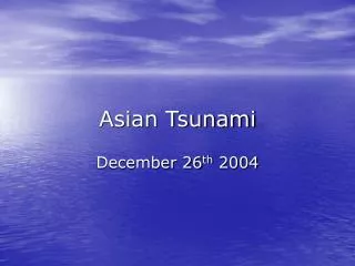
The National Tsunami Hazard Mitigation Program: Oregon’s Perspective. National Tsunami Hazard Mitigation Program Annual Meeting – Honolulu, Hawaii November 1, 2007. Progress, Future Goals and Proposed Work for Fiscal Year 2008. Robert C. Witter Oregon Regional Coastal Geologist

E N D
The National Tsunami Hazard Mitigation Program: Oregon’s Perspective National Tsunami Hazard Mitigation Program Annual Meeting – Honolulu, Hawaii November 1, 2007 Progress, Future Goals and Proposed Work for Fiscal Year 2008 Robert C. Witter Oregon Regional Coastal Geologist Jay Wilson Earthquake, Tsunami & Volcano Programs Coordinator
Mitigation and Preparedness Outreach • Continuing work on Post- Disaster Recovery Planning (w/CREW) • Continuing work towards Oregon’s unified tsunami warning standard • Developed and released the Tsunami Emergency Guidebook for Oregon Mass Media
Mitigation and Preparedness Outreach • Working closely with WFO Portland on providing guidance to Lincoln City’s new TsunamiReady Program coordinator, Althea Turner • Progress made on Seaside tsunami risk mitigation: • CERT training initiated • School tsunami ed program updated • Acquiring Tone/Voice sire system • Tsunami outreach coordinator • Reverse 911
Mitigation and Preparedness Outreach • Working with WC/ATWC, reviewed and revised the tsunami warning and advisory criteria after the Kuril Islands event Impacts in Crescent City, CA
1964 Tsunami Video Compiling interviews and observations of the 1964 Alaska tsunami in Oregon Tom Horning discusses multiple sites in Seaside, during 1964 tsunami
1964 Tsunami Video Compiling interviews and observations of the 1964 Alaska tsunami in Oregon 1964-Seaside, Sea foam inundation, From Necanicum River 2007-Seaside, Current location, Near Convention Center
1964 Tsunami Video Compiling interviews and observations of the 1964 Alaska tsunami in Oregon 1964-Seaside, late Tsunami surge on the following day 2007-Seaside, Tsunami vulnerable Dock, especially considering new Tsunami Advisory
Observations of Tsunami Impacts • Mapped extent of 3 prehistoric tsunami deposits in Cannon Beach, Oregon • Used geologic data to reconstruct prehistoric landscape • Compiled historical reports on 1964 tsunami impacts • Using tsunami observations to verify computer simulations Peat Debris layer Sand Peat
Impact of 1964 Alaska Tsunami House carried ~400 m upstream Bridge deck carried ~300 m upstream Cannon Beach Elementary School Bridge alignment Bell Harbor Motel Foundation Published in the Hillsboro Argus, March 30, 1964
Impact of 1964 Alaska Tsunami Bell Harbor Motel “Bell Harbor Motel, fronting on Elk Creek at the north end of Cannon Beach, found itself in the direct path of the incoming tidal wave that swept up the little stream. The motel was inundated, and debris strewed its yard. This building roof, carried hundreds of yards, wound up in the front yard.” Daily Astorian, March 30, 1964
Comparisons of Models vs Sand Sheet Elementary school Average 9 Small 1 no dune Small 1 dune Proposed School N City Hall 0 2000 feet Fire Station 0 500 meters
Cannon Beach Tsunami Hazard Assessment • Developed new Cascadia earthquake source characterization • Finalizing 25 Cascadia tsunami scenarios • Simulated 1964 and worst-case Alaska tsunamis • Probabilistic map explores the variability and uncertainty in the earthquake source process • Expanding tsunami hazard assessment into southern Oregon Cannon Beach Cannon Beach, Oregon Vertical seafloor deformation
Conceptual Tsunami Hazard Map Worst-case Cascadia Elementary school “Most likely” Cascadia Cannon Beach, Oregon Worst-case distant Proposed School City Hall Fire Station
Oregon’s Long-Term Goal: Accelerate and complete tsunami hazard mapping along entire Oregon coast in the next 5 years • Complete Cannon Beach Tsunami Hazard Assessment (winter 2008) • Develop prototype online interactive tsunami hazard and evacuation map for Cannon Beach (summer ‘08) • Use selected tsunami scenarios to map inundation hazard to entire northern Oregon coast (2009) • Complete online interactive tsunami hazard and evacuation maps for northern Oregon coast (2010)
…A Five-Year Plan • Bandon Tsunami Hazard Assessment (fall 2007) • Develop Cascadia earthquake source characteriza-tion for southern Oregon (fall ’07-winter ’08) • Investigate prehistoric tsunami inundation and runup at Bandon, Oregon (winter-summer 2008) • Run multiple tsunami simulations for Bandon (2009) • Use selected tsunami scenarios to map inundation hazard to southern Oregon coast communities (2010) • Complete mapping of southern Oregon coast (2011) • Education and outreach (ongoing)
FY 2008 Oregon ProposalTask 1 – Mitigation and Preparedness • Develop effective public outreach programs and media tools • Presentations to Lodging Assoc., CERTs, Oregon State Parks • Tsunami Emergency Guidebook for Oregon Mass Media • PSAs and press packets • Develop the next generation tsunami evacuation maps for Cannon Beach as digital online interactive maps (ARC IMS) • Consistent information and style • Zoomable to business or home location • Explore feasibility of an Oregon Tsunami Advisory workgroup • Support NOAA-NWS TsunamiReady activities • Contribute to NTHMP and international mitigation efforts Task 1 Costs Labor Non-labor $57,242 $7,235 $64,477
FY 2008 Oregon ProposalTask 2 – Inundation Modeling and Mapping • Complete compilation of eyewitness observations for video documentary of past tsunami impacts on the Oregon coast • Develop new earthquake source models for southern Cascadia • Complete probabilistic tsunami hazard assessments for southern Cascadia at Bandon, Oregon • Develop the next generation tsunami hazard maps using an online interactive map display (ARC IMS) Task 2 Costs Labor Non-labor $108,241 $66,108 $174,349
FY 2008 Oregon ProposalTask 3 – Tsunami Notification Infrastructure • Support efforts of coastal communities to mitigate tsunami risk • Ensure that communities have access to multiple communication pathways for tsunami warnings • Participate in end-to-end tests of the tsunami alert system Task 3 Costs Labor Non-labor $0 $36,174 $36,174 Total NTHMP Costs Labor Non-labor $160,483 $109,517 $275,000