Download
1 / 13
130 likes | 290 Views
Internet GIS Application Framework for Location-Based Services Development. Dragan Stojanovic, Slobodanka Djordjevic-Kajan Computer Graphics & GIS Lab, Computer Science Department Faculty of Electronic Engineering, University of Nis Yugoslavia dragans@elfak.ni.ac.yu. Internet/Web-based GIS.

E N D
Internet GIS Application Frameworkfor Location-Based Services Development Dragan Stojanovic, Slobodanka Djordjevic-Kajan Computer Graphics & GIS Lab, Computer Science Department Faculty of Electronic Engineering, University of Nis Yugoslavia dragans@elfak.ni.ac.yu
Internet/Web-based GIS • Internet/Web GIS: for everyone, from everywhere • Architecture: • server-side vs. client-side; thin, medium, thick clients • multiple-tiers, components, Web services • ISO/TC 211 • OpenGIS
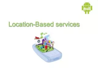
Location Based Services • Importance of location in space and time for business, consumer and government sectors • LBS = f (Internet GIS + Positioning+ Wireless) • GIS brings the truth value to LBS, providing geo-information and geo-processing services based on location of mobile user • Three LBS generations • stationary users & wired connection • mobile user & rough location & limited services • precise location & service triggering
GSM / GPRS / UMTS GPS / GLONASS/ Galileo Stationary user Location application service clients Mobile user Location application services GIS Wireless-IP Platform GIS (Location) application server Network Management Network services Internet or Intranet Gateway Services Positioning server (GMLC) Control Location Information GIS (Location) Information Server Location Data Sources (DBMS, Files,…) DSL & Cable PSTN LBS architecture
Temporal GIS application framework • Application (component) frameworks • Argonaut project • STOMM - suite of spatio-temporal object modeling and management technologies and tools • Object-oriented spatio-temporal data model compliant with ISO/TC 211 and OpenGIS feature geometry standards • Architecture-oriented application frameworks • dSTOMM (desktop) & iSTOMM (internet)
STOMM data model (1) User-defined temporal class
STOMM data model (2) • Spatio-temporal modeling • Object-attribute timestamping by valid time • Change of thematic properties (TGeographicObject ) • Changes of spatial properties (SpatioTemporalObject)
iSTOMM • Compliant with the ISO/ODP 10746 guidelines • Consistent with ISO/TC 211 & OpenGIS services architectures • iSTOMM supports 3-tiers Internet GIS • Spatio-temporal information server • Spatio-temporal application server and application components • Spatio-temporal service client components • Based on (object-)relational DBMS, Java, XML/GML, CORBA, EJB
iSTOMM application support • Processing of spatio-temporal-thematic queries, through visual iSTOQL • Visualisation and animation of spatio-temporal objects through iSTOVAM • Conversion from/to STOMM object format to/from temporaly extended GML (or proprietary formats) • Spatio-temporal analysis, reasoning and data mining (only generic support to appropriate, user-defined components);
iSTOMM based "Yellow pages”(1) • Currently based on wired Internet access • Yellow pages information (MapVect) • City streets and numbers, • Location and attributes of business & government • Mosaic of GIF images as background • Oracle 8i (Spatial and interMedia) & Oracle 9iAS • Hypothetical location of user: street address and number, telephone number, closest well-known city object, or geographic coordinates
iSTOMM based "Yellow pages”(2) • Request parameters in the form of: • type and/or nature of the closest organisation that he/she is attempting to find • name, phone number, or some other unique and known identifier of requested organisation • Respond to user: • Display of organisation’s location on a map • Determine and display the best and/or shortest route from the hypothetical position, or • Display thematic information of interest
Conclusions and future work • Enable integration and chaining of iSTOMM-based LBS with Web services for administration, business, transport, culture, leisure,… • Implementation of SOAP, WSDL, UDDI • Follow standardisation processes within ISO/TC 211 & OpenGIS (OpenLS) • Follow other LBS initiatives: MAGIC, LIF,… • Development & provision of useful LBSs including mobile positioning and wireless access