Download
1 / 18
180 likes | 311 Views
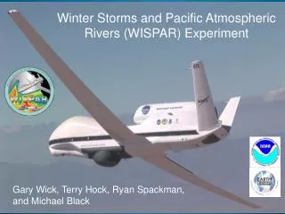
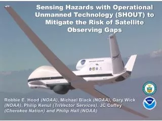
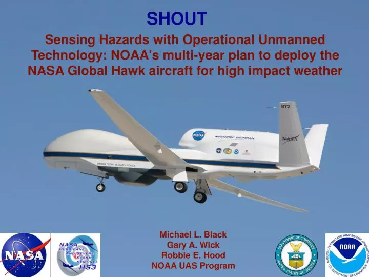
SHOUT. Sensing Hazards with Operational Unmanned Technology: NOAA's multi-year plan to deploy the NASA Global Hawk aircraft for high impact weather. Michael L. Black Gary A. Wick Robbie E. Hood NOAA UAS Program. Overall Goal

E N D
SHOUT Sensing Hazards with Operational Unmanned Technology: NOAA's multi-year plan to deploy the NASA Global Hawk aircraft for high impact weather Michael L. Black Gary A. Wick Robbie E. Hood NOAA UAS Program
Overall Goal • Demonstrate and test prototype UAS concept of operations that could be used to mitigate the risk of diminished high impact weather forecasts and warnings in the case of polar-orbiting satellite observing gaps • Objective 1 • Conduct data impact studies • Observing System Experiments (OSE) using data from UAS field missions • Observing System Simulation Experiments (OSSE) using simulated UAS data • Objective 2 • Evaluate cost and operational benefit through detailed analysis of life-cycle operational costs and constraints SHOUT Objectives 2
2014 – Collaboration with NASA HS3 • August 26 to September 29, NASA Wallops • Up to 15 total flights • NOAA input to mission design • 2015 – NOAA led Missions • September – November, NASA Armstrong • Tropical cyclones (ATL, EPAC)and high impact weather targets (Pacific, Alaska) • Single deployment location adds flexibility for potential targets- Atlantic, EPAC, Pacific, Arctic • Possibility for 2 GH aircraft to be explored • 10-16 potential flights • 2016 – NOAA led Mission • September – November, NASA Armstrong • NASA EV-2 programs would lead to NASA collaborations and parnership with NOAA SHOUT Proposed Mission Plans 3
PROPOSED SHOUT HIGH-IMPACT WEATHER MISSIONS • Early period: Tropical cyclones • Forecast improvements for track and intensity • Option for both Atlantic and Pacific Basins • Atlantic tradeoff of deployment costs vs station time • Later period: High-impact storms affecting the continental US and Alaska weather: • Coastal flooding • Atmospheric rivers • Forecast improvement for threats such as extreme precipitation and damaging winds • Targeted lead times of 3-7 days • Potential contribution to satellite calibration/validation 5
HS3 2014 • 5th week in place on NASA schedule • Agreements drafted with both NASA Goddard and Armstrong • NOAA adding: • Up to 5 flights • 240 dropsondes • Mission science support and guidance • Real-time data transmission/assimilation planned • Targeting methodology for missions possible 4
SHOUT ADAPTIVE OPERATIONAL STRATEGY • Tropical cyclones • SUNY group proposed to explore methodology • (R. Torn, J. Dunion, Grad. Student) • Collaborations with AOML and ESRL NOAA Labs. • High-impact weather events • Zoltan Toth (ESRL) proposed to explore methodologies • Identification of high- impact weather threat cases • Fully automated Ensemble Transform sensitivity algorithm to • identify sensitive areas • Produce “optimized” flight track to sample sensitive region for selected threat 6
<-To WFF FP IP • Typical AV-6 Flight Pattern - ~ 600 nmi-
<-To WFF FP Extra Drops IP • Possible Modified AV-6 Flight Pattern • with approaching trough to the west - ~ 600 nmi-
Possible Modified AV-6 Flight Pattern with building ridge to the NE <-To WFF IP FP Extra Drops - ~ 600 nmi-
<-To WFF FP IP Extra Drops • Possible Modified AV-6 Flight Pattern • with SAL East of Center - ~ 600 nmi-
Does a butterfly pattern (2 crossings) at the beginning of the pattern yield more symmetric coverage?
Does a butterfly pattern (multiple long leg crossings) yield more symmetric coverage and still provide adequate environmental sampling?
CONSIDERATIONS FOR NOAA-MODIFIED MISSIONS: • HS3 objectives and goals come first- especially with AV-1 • NOAA objectives are complimentary to those of NASA • Modifications proposed only when there is adequate time on station for changes • Try to minimize alterations to the NASA proposed flight tracks • We would like to fly with NOAA IFEX missions (P3s and • G-IV) when possible • Some coordinated portion of flight legs with NOAA P3s and/or the G-IV is beneficial to compare radars • NOAA slightly more interested with AV-6 flights (AVAPS) but would like to evaluate and, possibly, modify a couple of AV-1 flights, especially if NOAA is flying • Cooperation and coordination will yield success for both agencies 8
To the new, brilliant italian GH scientist: • WE ARE COUNTING ON YOU TO PROVIDE GOOD HDVIS AND NIGHT TIME GH IMAGERY!!! :) “Sì, posso fare”(YES, I CAN DO) 8