Download
1 / 33
330 likes | 423 Views
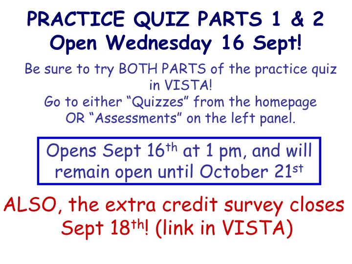
PRACTICE QUIZ PARTS 1 & 2 Open Wednesday 16 Sept!. Be sure to try BOTH PARTS of the practice quiz in VISTA! Go to either “Quizzes” from the homepage OR “Assessments” on the left panel. Opens Sept 16 th at 1 pm, and will remain open until October 21 st.

E N D
PRACTICE QUIZ PARTS 1 & 2 Open Wednesday 16 Sept! Be sure to try BOTH PARTS of the practice quiz in VISTA! Go to either “Quizzes” from the homepageOR “Assessments” on the left panel. Opens Sept 16th at 1 pm, and will remain open until October 21st ALSO, the extra credit survey closes Sept 18th! (link in VISTA)
Rotating Earth. No continents. One more clicker question: 90º FROM what direction do the surface winds blow for the sailboat? FROM the… 60º 30º 0º • north • south • northeast • southwest • southeast 30º 60º 90º
Rotating Earth. No continents. 90º Polar easterlies Westerlies 60º 30º Northeast Trades 0º Southeast Trades 30º 60º Westerlies Polar easterlies 90º
Coriolis Effect: last point MAXIMUM at poles Large difference in circumference between these latitudes increasing Not much difference in circumference between these latitudes ZERO at ZERO (the equator) increasing MAXIMUM at poles
Atmosphere II: Continents, pressure gradients, geostrophic winds Goals for Today • PREDICT atmospheric circulation, location of cloud formation and precipitation for today’s Earth with continents • EXPLAIN how a balance between atmospheric pressure differences and Coriolis results in geostrophic winds • APPLY geostrophic wind principles to storms and jet streams
To achieve these goals, you’ll need to… • Explain why the distribution of continents matters • At present, there is more land mass in the northern hemisphere than in the southern hemisphere • Land heats up and cools off faster than oceans • Earth’s “thermal” equator is offset to the north, on average • Use a logical sequence of events to deduce geostrophic flow • Air tends to move from high to low pressure, along any horizontal pressure gradient • As an object in motion on a rotating planet, moving wind is influenced by Coriolis • In cases where the horizontal pressure gradient force and the Coriolis force are balanced geostrophic wind
RELEVANCE Storm behaviour Air travel Seasonal climate patterns Monsoon rains
An Earth with continents: Southern hemisphere Northern hemisphere
How easy is it to heat/coolland versus ocean water? Effect of HEAT CAPACITY Takes less energyto heat/cool Takes more energy to heat/cool Heat capacity of fresh water = 4.18 J/gK Heat capacity of seawater = 3.93 J/gK Heat capacity of granite = 0.79 J/gK
How easy is it to heat/coolland versus ocean water? Effects of CONVECTION,CONDUCTION & MIXING Energy (heat) transferred down-ward SLOWLY by conduction Energy (heat) RAPIDLY transferred downward by mixing
Our situation today: Northern hemisphereMORE LANDHEATS/COOLS more QUICKLY Southern hemisphereLESS LANDHEATS/COOLSmore SLOWLY
For our water-covered earth (last class)… 90º • Warm, wet air rises at the equator. • Surface winds blow toward the equator to replace the rising air. • Surface winds CONVERGE at the equator 60º 30º ITCZ @ equator 0º 30º 60º 90º
Earth’s Thermal Equator, a.k.a., the INTERTROPICAL CONVERGENCE ZONE(ITCZ) Geographic equator 0⁰ …on today’s Earth, with continents Image: GFDL
ITCZ average location Blue = risingRed/pink = sinking Equator Tracer: ascent/descent of air Image: W.M. Connolley
Clicker question: Within the box, where is the ITCZ? A B C D E (this is a satellite image showing clouds) NOAA, GOES satellite image
Incoming/Outgoing energy distribution Top of Atmosphere Energy ITCZ Absorbed at Surface 90°N 0° 90°S Latitude (after Gill, Figure 1.1)
Cloud patterns in hurricanes:What’s the air doing in this picture? Hurricane Kate, 2003, NASA
The weather: A surface analysis map Environment Canada
High Pressure: AtmosphericCirculation Direction of PRESSURE GRADIENT FORCE (NOT the wind!) L L L H 1008 1004 1000 L L L
High Pressure: HPGF H Horizontal Pressure Gradient Force Horizontal Pressure Gradient Force L L PL < PH > PL
High Pressure: Circulation Coriolis HPGF X H L Geostrophic Flow: Coriolis = HPGF
High Pressure: Circulation L L L Coriolis= HPGF HPGF =Coriolis H 1008 1004 1000 L L L Flow clockwise around a high (N. Hemisphere)
Upper atmosphere: Geostrophic flow and jet streams At a given altitude, air pressure over low latitude is greater than air pressure over high latitude. L H Marshak, Figure 20.14a
Clicker question: What about the southern hemisphere?What direction do the jet streams flow there? A. West to east B. East to westC. North to south D. South to north South Pole Marshak, Figure 20.14a
Summary: Continents, pressure gradients, geostrophic winds • The presence and distribution of continents influences the average position of the ITCZ, locations of cloud formation, and precipitation. • Horizontal pressure gradients set air masses in motion. Once in motion, they are influenced by Coriolis. Geostrophic flow occurs when HPGF balances the Coriolis force. • You can use knowledge of the geostrophic balance to figure out wind directions in different scenarios, e.g. hurricanes, jet streams Relevance: storms, seasonal climate, air travel
OUTLINE • An Earth with continents • The Intertropical Convergence Zone (ITCZ) • Differential heating of continents and oceans • Winds driven by atmospheric pressure gradients • Monsoon circulation • Seasonal air movement • Seasonal precipitation patterns • The geologic record of monsoons
G 2-3 Upper atmosphere: Geostrophic flow and jet streams At a given altitude, air pressure over low latitude is greater than air pressure over high latitude. L H NOAA, Natl. Weather Service