Download
1 / 20
290 likes | 820 Views
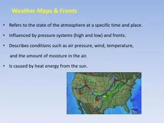
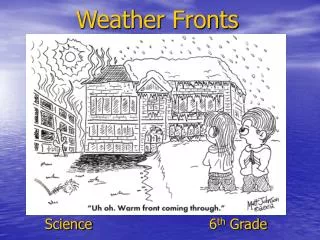
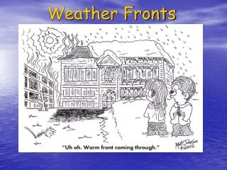
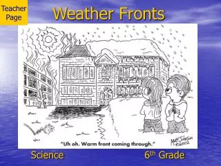
ES 20.2 Weather Fronts . Fronts . ES 20.2 Weather Fronts . Formation of Fronts: Recall that air masses have different temperatures and amounts of moisture, depending on their source regions.

E N D
ES 20.2 Weather Fronts Fronts
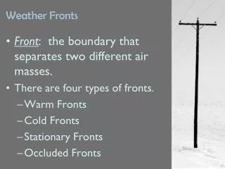
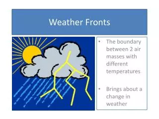
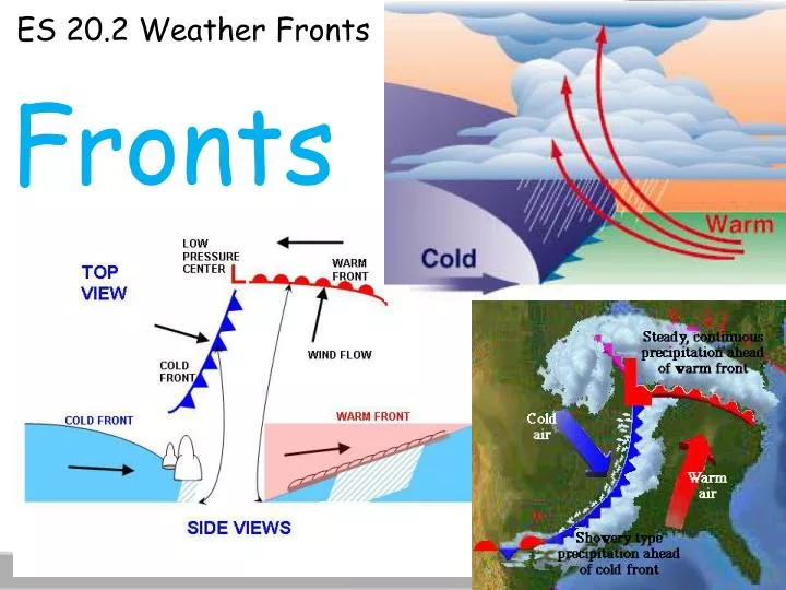
ES 20.2 Weather Fronts Formation of Fronts: • Recall that air masses have different temperatures and amounts of moisture, depending on their source regions. • Recall that these properties can change as an air mass moves over a region. What in fact happens when two air masses meet? • When two air masses meet, they form a front, which is a boundary that separates two air masses of different properties. • Fronts can form between any two contrasting air masses. Fronts are often associated with some form of precipitation.
ES 20.2 Weather Fronts • In contrast to the vast size of the air masses; fronts are very narrow. Most weather fronts are between 15 and 200 kilometers wide. • Above Earth’s surface, the frontal surface slopes at a low angle so that the warmer , less dense air overlies cooler, denser air. • Occasionally, the air masses on both sides of a front move in the same direction and at the same speed. • When this happens, the front acts simply as a barrier that separates the two air masses.
ES 20.2 Weather Fronts • In most cases however, the distribution of pressure across a front causes one air mass to move faster than the other. • When this happens, one air mass advances onto another and some mixing of air occurs. • Fronts are classified according to the temperature of the advancing front. • There are four types of fronts:warm fronts, cold fronts, stationary fronts, and occluded fronts.
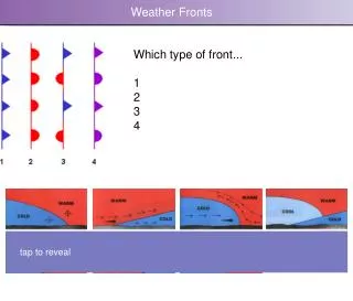
ES 20.2 Weather Fronts Warm fronts: • A warm front forms when air moves into an area formerly covered by a cooler front. • On a weather map, the surface position of a warm front is shown by a red line with red semicircles that point toward the cooler air.
ES 20.2 Weather Fronts • The slope of a warm front is very gradual. • As warm air rises, it cools to produce clouds, and frequently precipitation. The sequence of clouds shown at right typically comes before a warm front. • The first sign of the approaching warm front is the appearance of cirrus clouds. • As the front nears, cirrus clouds change to cirrostratus clouds, which blend into denser sheets of altostratus clouds. • About 300 kilometers ahead of the front, thicker stratus and nimbostratus clouds appear and rain or snow develops.
ES 20.2 Weather Fronts • Because of their slow rate of development and very low slope, warm fronts usually produce light to moderate precipitation over a large area for an extended period of time. • A gradual increase in temperature occurs with the passage of a warm front. The increase is most apparent when a large temperature difference exists between adjacent air masses. • Also a wind shift from the east to the southwest is associated with a warm front.
ES 20.2 Weather Fronts Cold fronts: • A cold front forms when a cold, dense air moves into a region occupied by warmer air. • On a weather map, the surface position of a cold front is shown by a blue line edged with blue triangles that point toward the warmer air mass. • The picture at right shows how a cold front develops. As the cold front moves in, pushing the warm air up over it, it becomes steeper.
ES 20.2 Weather Fronts • On average, cold fronts are about twice as steep as warm fronts and advance more rapidly than warm fronts do. • These two differences, steepness of slope and rate of movement, account for the more violent weather associated with cold fronts. • The forceful lifting of air along a cold front can lead to heavy downpours and gusty winds.
ES 20.2 Weather Fronts • As a cold front approaches, towering clouds can often be seen in the distance. • Once the cold front has passed, temperatures drop and winds shift. • The weather behind a cold front is dominated by a cold air mass. • So, weather clears soon after a cold front passes. • When a cold front moves over a warm area, low cumulus or altostratus clouds may form behind the front.
ES 20.2 Weather Fronts Stationary Fronts: • Occasionally, the flow of air on either side of a front is parallel to the line of the front. • In such cases, the surface position of the front does not move, and a stationary front forms. • On a weather map, stationary fronts are shown by blue triangles on one side of the frontand red semicircles on the other side. • Sometimes, gentle to moderate precipitation occurs along a stationary front.
ES 20.2 Weather Fronts Occluded Fronts: • When a cold front overtakes a warm front, an occluded front forms. • An occluded front develops as the advancing cold air wedges the warm front upward. • The weather associated with an occluded front is generally complex. • Most precipitation is associated with the warm air being forced upward.
ES 20.2 Weather Fronts • When conditions are suitable, the newly formed front is capable of making light precipitation on it’s own. • It is important to note that the descriptions of weather associated with fronts are general descriptions. • The weather along an individual front line may or may not conform to the idealized conditions we are discussing. • Fronts, like all aspects of nature, do not always behave as we would expect.
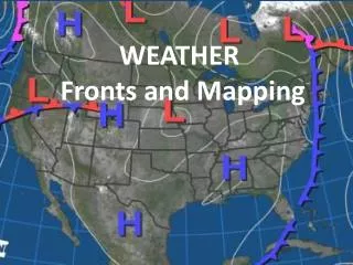
ES 20.2 Weather Fronts Mid-latitude cyclones: • Now that we have looked at air masses and what happens when they meet, we are ready to apply the information to understanding and predicting weather. • The main weather producers in the country are middle-latitude cyclones. • On weather maps, theselow-pressure areas are shown by the letter L.
ES 20.2 Weather Fronts • Middle latitude cyclones are large centers of low pressure that generally travel from west to east and cause stormy weather. • The air in these weather systems moves in a counterclockwise direction and in toward the center of a low. • Most middle-latitude cyclones have a cold-front, and frequently a warm front, extending from a central area. • Forceful lifting causes the formation of clouds that drop abundant precipitation.
ES 20.2 Weather Fronts How do cyclones form? • The first stage is the development of a stationary front. • The front forms as two air masses with different temperatures move in opposite directions. • Over time, the front takes a wave shape. This wave is usually hundreds of kilometers long.
ES 20.2 Weather Fronts • As the wave develops, warm air moves towards Earth’s poles. • There it invades the area formerly occupied by colder air. Meanwhile, cold air moves toward the equator. • This change in airflow near the surface is accompanied by a change in pressure. • The result is a counterclockwise airflow in the Northern Hemisphere.
ES 20.2 Weather Fronts • Recall that a cold front advances faster than a warm front. • When this occurs in the development of a mid- latitude cyclone, the cold front closes in and eventually lifts the warm front. This process, which is known as occlusion, forms the occluded front we see at right. • As occlusion begins, the storm often gets stronger. Pressure at the storms center falls, and wind speeds increase. In winter, heavy snowfalls and blizzard-like conditions may develop from this.
ES 20.2 Weather Fronts The Role of Airflow Aloft: • Airflow aloft plays an important role in maintaining cyclonic and anti-cyclonic circulation. • In fact, these rotating surface wind systems are actually generated by upper-level airflow. Cyclones often exist for a week or longer. • For this to happen, surface convergence must be offset by outflow somewhere higher in the atmosphere (divergence). • As long as the spreading out of air high up is equal to or greater than the surface inflow, the low-pressure system can be maintained. • More often than not, air high up in the atmosphere fuels a mid-latitude cyclone.
ES 20.2 Weather Fronts The Role of Airflow Aloft: • Because cyclones bring stormy weather, they have received far more attention than anti-cyclones. • However a close relationships exists between these two pressure systems. • The surface air that feeds a cyclone generally originates as air flowing out of an anticyclone. • As a result, cyclones and anticyclones are usually found next to each other. • Like a cyclone, an anticyclone depends on the flow of air high in the atmosphere to feed it.In an anticyclone, air spreading out at the surface is balanced by air coming together up high. cyclone anticyclone