Download
1 / 43
430 likes | 553 Views
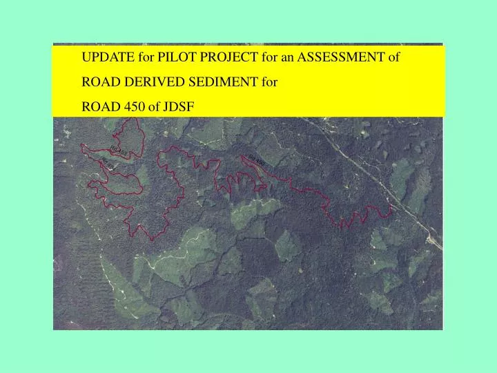
UPDATE for PILOT PROJECT for an ASSESSMENT of ROAD DERIVED SEDIMENT for ROAD 450 of JDSF. Agenda. Overview -accomplishments Data collection Ranking GIS Examples of capabilities Next Steps. KEY FEATURES 1 Road segment data 2 Watercourse crossing data 3 Perched fill

E N D
UPDATE for PILOT PROJECT for an ASSESSMENT of • ROAD DERIVED SEDIMENT for • ROAD 450 of JDSF
Agenda • Overview -accomplishments • Data collection • Ranking • GIS • Examples of capabilities • Next Steps
KEY FEATURES • 1 Road segment data • 2 Watercourse crossing data • 3 Perched fill • 4 Information regarding the condition of landings. • 5 Data that can be used to estimate sediment savings associated with mitigations. • a. Queries that draw from all four data tables
Data Resources • Field data –measurements, observations including almost 15 miles along Rd 450
Other data collected and compiled into the data system • Aerial and field photos • Specific reports • Regional Geology and Landslides • Regional landslide hazards • Soils • Topography LIDAR data, DEM-derivatives • Stream network • Special investigations
A data system for road management • Data management system that covers every phase from collection, storage, retrieval, updating, and publishing • Supports analyses, budgeting, short and long term monitoring • Integrates with other data streams and routines • Facilitates document development • Builds a reference library of studies, standard drawings, photos • Provides observations and recommendations across a range of scales • Provides a framework for an overall road management plan
Identified and ranked the following • Road segments • Watercourse crossings • Landings • Smaller scale sediment sources
A rank of high, medium, or low was assigned to each road segment, landing, and watercourse crossing. The rank is a subjective judgment in regards to the reduction in sediment yield or hazard that repair or rehabilitation may provide.
Identified other features • utilities, • housing, • other facilities.
GIS Organization • GIS and geodatabase serves as the hub for new and existing data, including • data that may be collected in the future, • spatial and statistical analyses, • various erosion models, • Document-ready graphs, tables, maps • Identifies both linear and spatial coordinates
DATA ORGANIZATION – a logical scheme based on actual work flow that is flexible and can grow as new information is developed
Long term monitoring • Set up for long term documentation and monitoring • Tracking change over time • As well as management tracking of activities
A data system for road management • Data management system that covers every phase from collection, storage, retrieval, updating, and publishing • Supports analyses, budgeting, monitoring • Integrates with other data streams and routines • Facilitates document development • Builds a reference library of studies, bmp’s, photos, etc. • Provides observations and recommendations across a range of scales
Next Steps • Get input from JDSF • Modify as appropriate • Finish the rest of road 450 • Meet again with refined product • Generate final pilot project report and associated GIS project