Download
1 / 19
190 likes | 249 Views
Bangladesh Flooding July/August 2004 Causes of the Annual Monsoon Seasonal Flooding: Climatic Terrestrial Processes Human Activity. In summer the land is warmer than the sea making LOW PRESSURE so the summer Monsoon winds bring moist air off the sea = really wet.

E N D
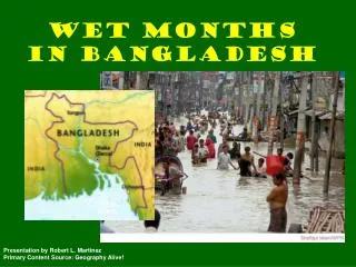
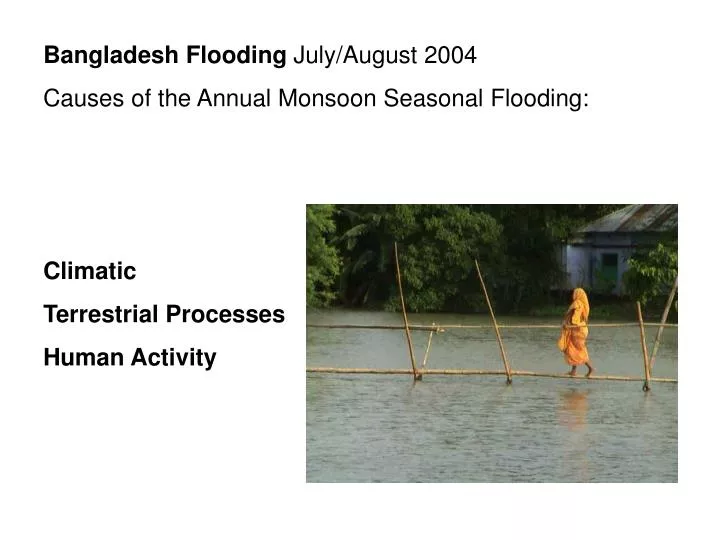
Bangladesh Flooding July/August 2004 Causes of the Annual Monsoon Seasonal Flooding: Climatic Terrestrial Processes Human Activity
In summer the land is warmer than the sea making LOW PRESSURE so the summer Monsoon winds bring moist air off the sea = really wet In winter the land is cold making HIGH PRESSURE. The dry winds blow out from the land to the sea.
Climatic Causes: Random variations in the intensity of monsoon rains cause the flooding. Bangladesh has a tropical monsoon-type climate, with a hot and rainy summer and a dry winter. The climate is one of the wettest in the world. Most places receive more than 1,525 mm of rain a year, and areas near the hills receive 5,080 mm ). Most rains occur during the monsoon (June-September).
Historical records to 1781, showthat a major flood could be expected every seven years and a catastrophic one every 33-50 years. More detailed records since 1954 show the worst flooding since then occurred in 1974, 1987, 1988 and 1998, when 70 percent of the country was submerged in the most serious flood Bangladesh had ever seen.
Then 2004: The mighty Brahmaputra river, swollen by rain and a Himalayan burst dam, has flooded huge swathes of north India and Bangladesh, killing dozens and forcing millions to seek refuge on higher ground.
In late-June 2004, heavy monsoon rains swelled the waters of the Meghna River, whichreached its peak level in early-July. The other rivers burst their banks inearly-July, due to heavy rains in the north of the country, causing flash floods in the north andthe west-central districts. The floods spread, eventually impacting Dhaka and 36 million people (about 25 percent of the population) with 38% of Bangladesh inundated by the time the waters began to recede in late-August. " … we are only at the beginning of the monsoon season and still have another two months to go," The rainy season lasts from June to the end of September, and slightly later in some areas.
September 2004: Monsoon rains have hit Bangladesh once more. For the past four days most of the country has been under water after what is ostensibly the country’s worst bout with bad weather in the last 50 years. This week, according to official sources, the “average rainfall was 300 mm per day, the highest rate since 1952”. Four days of constant rain have caused floods in parts of Bangladesh, as in this village 100km north of Dhaka.
Himalayan Snow Melt … Every summer Gangotri glacier, in the Indian Himalayas, feeds the Ganges river. The glacier is retreating an average 25 metres yearly.
Terrestrial Processes: Relief Rainfall in the Himalayan Mountains feeds the rivers
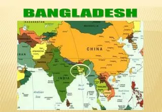
Most of Bangladesh sits astride the deltas of a series of large rivers flowing from the Himalayas, and about a third of the country floods every year during the monsoon.
Roughly 80 percent of the landmass is made up of fertile alluvial lowland called the Bangladesh Plain. This means that it is prone to severe and heavy flooding. Flooding irrigates crops and adds fresh silt to padi fields maintaining the fertility.
Human Activity : Global Warming leading to sea level rise. The flow of water coming from the Himalayas - which is huge - depends on the differential of height. "When the sea level is higher, the flow of that water will be restricted. So when you hear now of Bangladesh being a flood-prone country - it will be a much more flood-prone country in future."
The extraction of groundwater for irrigation had lowered the water table and caused the land to subside by about 2.5m. The groundwater contains naturally high levels of arsenic!
The use of water upstream for irrigation and storing water in reservoirs has reduced the amount of silt deposited so the level of the land has not been built up. People live on river sandbanks called Chars.
Increased amounts of urbanisation has led to higher peak flow on the rivers with much shorter lag times and a greater frequency of floods.
Population Growth in Himalayan headwater countries like Nepal puts pressure to produce more food by increasing the area of land farmed…..
…. So Deforestation in the Himalayas has increased leading to increased run off…. No leaves to intercept , no roots to bind soil in place. It has also destabilised slopes leading to landslides and soil erosion. The soil is carried by rivers and deposited in channels on the low ground. This reduces channel capacity and increases the likelihood of flooding.
A dam at Tsatitsu Lake in the Himalayan kingdom of Bhutan had burst, spilling water into tributaries of the Brahmaputra. A furious G.L.O.F. hit the dam and HEP plant at Kurichu and breached it. The Glacial Lake Outburst Floods may be linked to increased melting because of Global Warming.