Download
1 / 36
410 likes | 660 Views
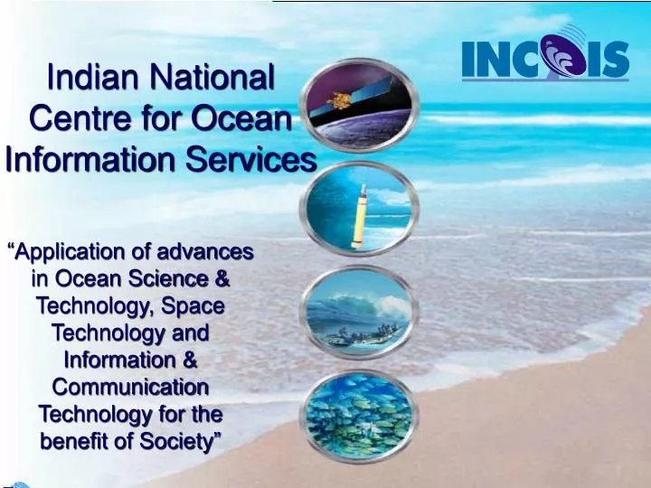
Indian National Centre for Ocean Information Services. “Application of advances in Ocean Science & Technology, Space Technology and Information & Communication Technology for the benefit of Society”. The Mission of INCOIS.

E N D
Indian National Centre for Ocean Information Services “Application of advances in Ocean Science & Technology, Space Technology and Information & Communication Technology for the benefit of Society”
The Mission of INCOIS Provide Ocean Information and Advisory Services to Society,Industry, Government Agencies and Scientific Community through Sustained Ocean Observations and Constant improvements through Systematic and Focussed Research.
Ocean Observation & Information Services • Potential Fishing Zone Advisory Services • Ocean State Forecast Services • Early Warning for Tsunami and Storm Surges • Information Bank & Web-based Service • Contribution to Weather/Monsoon/Climate Forecast • Value-added Services for Coastal Management • Fishing Community • Coastal States National Infrastructure Network • IMD, Navy, NHO, • Coast Guards International Interface Satellite Oceanography Ocean science and Modeling • Ports and Harbours • Off-shore and Shipping • Remote Sensing Satellites • Oceansat-1(1999) • Ocean Colour Monitor • Oceansat-2(2006) • Ocean Colour Monitor, Scatterometer • Foreign Satellites • In-situ Observations • Argo Profiling Floats • Data Buoys • Current Meter Arrays • XBTs, Tide gauges • Sea Truth • Research Institutions • Academia
Recognised as a matured operational application of satellite remote sensing • Pursued as part of the ‘Common Minimum Programme’ of the Government of India PFZ Mission R&D Efforts, Modelling, Technology Development Operational Generation (SST, Chlorophyll) 3 per week Fishing Vessels Dissemination Validation Feedback User Awareness Collaboration with NRSA, SAC, RRSSC, FSI, State Fisheries Departments, Central Fisheries Institutions, Academia, Fisheries Associations, NGO’s, etc
ACHIEVEMENTS (X PLAN)- EXPERIMENTAL FORECAST GENERATION *Forecast for SST and MLD is offline # Two days Forecast is within acceptable accuracy limit)
ACHIEVEMENTS (X PLAN)- DISSEMINATION AND USERS • Disseminating through INCOIS website • Image as gif and text data through webGIS • For Some such as users Navy & Coast Guard data was delivered through email and CD • User interactions were conducted at Mumbai and Kochi • e-group of users formed • About 60 users were registered for OSF products • More than 10 users are using it regularly • Requirements for coastal forecast are collected from many users. 9th November 2004 to 19th May 2005
Services3. Early Warning System for Tsunami and Storm Surges
Warning Centre Numerical Modelling Tsunami Storm Surge The Elements of Early Warning System Warnings CB, Edu.Trg • Historic Data • Bathymetry • Coastal Topography • Coastal Vulnerability Data Communication (INSAT) Coastal Radars, Current Meter Moorings Upper Ocean, Surface Met-Ocean Observations Tide Gauge Network (Real time) A network of Land-based Seismic Stations Bottom Pressure Recorders in the Tsunamigenic Zones
Value-added Services • Monitoring of toxic booms • Assessment of fish stock • Primary production • Fluvial fluxes in coastal environment • Ecosystem health – coral and mangroves • Need-based user projects for coastal & offshore applications • .. • ..
At INCOIS • Set up MOM for Indo-pacific region and ROMS for North Indian Ocean. • Control experiments – changing model physics, boundary forcing, etc • Real Time Forcing (wind, heat flux) • Forcing tides from Tidal circulation model and chlorophyll from Seawifs • Seagrid implemented for computational efficiency • Validation of model is under progress • HPC will be set up by Dec 2006.
INDOMOD Project To enhance the basic understanding and knowledge base on Oceanic and Atmospheric processes for Predictability of Ocean & Climate, Coastal Processes and Catastrophic Weather events and improve operational prediction by the respective national Agencies –the Mission • Ocean and Climate (IISc, IITM, NIO, C-MMACS) • GOCM (MOM, POP, OPA) AGCM (CCM-3, COLA, UK-Met), Hydra • Mostly some of the science questions were addressed • 26 papers published & 2 Ph.d • Coastal Ocean (IIT-D) • WAM, SWAN, POM • Sediment transport model developed (will be used operational basis after validation) • Nested WAM with SWAN • Validation of coastal wave forecast • 4 papers published &2 Ph.d • Hazardous Events (IIT-D, NRSA) • NCAR’s MM5 , NRL’s COAMPS and 1-d price model • The track and intensity of the storm is better simulated with the use of satellite observed SST. • Incorporation of mixed layer depth and upper ocean heat content is under progress • 4. Ocean Data Assimilation (IISc, C-MMACS, NCMRWF, IITM) • High resolution Indian Ocean Model based on MOM4 and POM has been developed. • Assimilated altimeter data and compared the model temperature with Argo temp. • Assimilation of Argo profiles is under progress
Modelling – XI Plan Objectives • Ocean Modelling with Data Assimilation for providing description of past, present & future state of Ocean at appropriate spatial & temporal resolutions. • Contribute to Weather/Monsoon/Climate forecast by providing forcing for Atmospheric Models • Understanding the variability of Ocean & Marine environment • Simulation experiment to optimize the observation system Deliverables • Physical Ocean model (coastal, regional and global) – Operational • Oceanographic fields at different temporal and spatial scales (Currents, temp, sal, sea level) • Coupled atmosphere-ocean model – R & D • Coupled physical-biological model – R & D - experimental • Coupled Physical-biogeochemistry model – R & D
Technology Transfer of Species specific forecast (Tuna) as well as Wind-based Forecast for Operationalisation at INCOIS Technology Transfer of Advanced OSF for Operationalisation at INCOIS Efforts for retirieval of geo-physical parameters from Oceansat 2, Megha-Tropiques, RISAT, etc Mount studies using high-resolution satellite data (Resourcesat, Cartosat, etc) for coastal processes, coastal habitat mapping, etc R&D for incorporating additional parameters (MLD) in PFZ Forecast and Species-specific Forecast for Sardines, etc. Make Satellite data products available at appropriate spatial & temporal resolutions to users. Development & Deployment of Altimeter, Thermal & Microwave radiometers Satellite Oceanography: Targets for XI Plan
ERS Jason Radarsat TOPEX TRMM Radar Imaging Satellite Ocean Observations through Satellites NOAA (AVHRR) Oceansat- 2 Megha Tropiques IRS-1C/D IRS-P4 OCM, MSMR INSAT Series IRS P5/P6 Radiometer (VIS-TIR) Radiometer (VIS, NIR) Radiometer (MW) Altimeter Scatterometer SAR • Sea Surface Temperature (SST) • Ocean Colour • Coastal Process • Wind Speed • SST • Sea Ice Extent • Wave Ht. • Sea Level • Sea Ice Elevation • Surface Wind Vector • Wave Spectrum • Sediment
Ocean Observing Systems – In-situ 107 Floats 20 Moored Buoys 60 Drifters 3 Lines 3 Arrays 18 Gauges INCOIS/NIOT NCAOR/CMLRE NIO/INCOIS NIOT A Fleet of Research Vessels NIO/INCOIS NIO/INCOIS SOI
Drifting Buoys • X Plan Achievements • Measurement of Surface Velocities, SST and air pressure using Satellite Tracked Drifting Buoys in the Indian Ocean • 15 Buoys per year • Developed monthly mean surface currents climatology • Disseminated data through GTS in real-time • XI Plan Targets • Increase the yearly deployment of SVP-B drifting buoys in the Indian Ocean from 15 to 40. • Deployment of 10 drifters attached with wind sensors every year. • Deployment of 10 drifters attached with thermistor chains to measure the upper ocean thermal structure. • Upgrade of monthly mean climatology of surface currents; • prepare an high resolution climatology (on 1 deg latitude x1 deg longitude grid) and analyse the surface currents to understand the pathways of heat transport in the Indian Ocean.
Equatorial Current meter • X Plan Achievements • Long-term measurements of currents in the equatorial Indian Ocean • through current meter moorings along the equator • Data used for Ocean model validation • Biweekly mode (10-20 day period) variability in meridional velocity. • Data available in delayed mode (no real time) • XI Plan Targets • Sustain existing three moorings • Deploy and maintain 2 more moorings. • Deployment of sub-surface ADCP moorings along the equator at 5 locations. • Pressure, temperature and salinity at different depths on the mooring line.
XBT • X Plan Achievements • Temperature profile along the major shipping route • More than a decade of data collected • Atlas of temperature, heat content and dynamic height produced • Data also used for validation • No real-time data available • XI Plan Targets • Propose to organize bi-monthly XBT voyages along (a) Chennai-Port Blair – Kolkatta, (b) Mumbai – Mauritius and (c) Chennai – Singapore transects. • Also propose to organize fortnightly XBT Voyages in the Lakshadweep Sea. • Real-time transmission from Ship to shore • collect vertical temperature profiles, sea surface salinity samples, water samples for the analysis of oxygen and carbon isotopic studies and Phytoplankton samples along all the routes.
Argo Profiling floats - X Plan Achievements • Deployment of 150 floats (NIOT) 107 deployed so far 43 will be deployed before Dec 2006 • Indigenisation of Floats (NIOT) • National Data Center Data Reception Processing and Real time QC • Data Dissemination through GTS and Internet • Publish Products on WEB • Data Analysis • Data Assimilation (CAOS) Assimilated SSHA &Argo floats data will be assimilated by early 2007 Indian Ocean Argo • Regional Co-ordination • Regional Data Center • Development of North Indian Ocean Hydrology • Delayed mode QC
Satellite Data Acquisition and Processing System 2.4 m Polar Orbiting Tracking Antenna inside a 3.2 m Radome X/L-Band Feed Real time data acquisition from: In-situ Platforms Argo Floats, Drifting Buoys in the Indian Ocean (5000 km dia) Remote Sensing Satellites NOAA Series, Aqua & Tera (MODIS), Feng Yun, METOPS
Argo - XI plan • Sustaining 150 active floats (by deploying of 250 floats) • Technology • Two way communication to enable fast sampling • More Parameter (Chlorophyll, Oxygen, rainfall and wind speed) • Real-time data reception & processing • Delayed mode Quality control data to users • Publish more value added products on Web • Analysis of Argo data with other data sets for cyclone, monsoon and long term climate change
New Observations in XI Plan • SOOP Lines • To measure surface marine met parameters by installing 100 AWS onboard commercial, coast guard, FSI, GSI and other Ships • Gliders (10) • To measure currents, temperature and salinity profile in the coastal waters (event based) • Bay of Bengal & Arabian Sea Observatories • 3 surface moorings including radiation, Rain, temperature and salinity profile • Current meter mooring (ADCP and RCM) • Sites for calibration & validation of Satellite Data & Models • With Instruments for Radiation, chlorophyll, SST, Salinity, Rain, Wind, Water Quality Parameters, etc
Oceanographic Data Centre – Web Based & Location Based Services
X Plan Achievements • Successfully hosted INCOIS Website & Ocean Portal (Database Driven, Multilingual, Dynamic & Web GIS Enabled) • Providing Ocean Information Services specially PFZ, EOSF and Argo through INCOIS Website • Successfully established Computational Facilities, Campus Wide Networking, Internet , etc • Initiated Ocean Data Warehouse Design
XI Plan Activities • Maintain INCOIS Website & Ocean Portal (both hardware, software, applications and data) • Continue Providing Ocean Information Services through INCOIS Website & Ocean Portal • Provide Digital Atlas & Products on INCOIS Website • Design, Develop and Implementation of Data Warehouse & Data Mining of Oceanographic Data • Establish National Oceanographic Data Centre as part of International Oceanographic Data Exchange (IODE) programme of IOC
Connectivity Requirement • Real Time data transmission from data buoys, analysis and conveying warning or forecast • Fishery: PFZ forecast, market information, entertainment, phone, etc. • Sea state • Antarctica to Mainland • Security Considerations • …………..
R & D, Capacity Building, Ocean Awareness and International Interface • R & D • Integrated study of Biogeochemical processes in the North Indian Ocean, etc • Capacity Building • Training of Core Manpower, Exchange Programmes, Workshops • Ocean Awareness • Increase awareness on ocean science among general public, schools & colleges, etc • International Interface • IOGOOS • Regional Argo Data Center and Co-ordination for deployments • IODE/NODC • JCOMM, GODAE • POGO, IOCCG • IOTWS Budget: Rs. 25 Crores; Additional Manpower: 10
Objectives & Coverage of IOGOOS M P AM P S P M M M M M P P P M P M M M M M P M M M M M M AM M : Member AM : Associate Member P : Participant S : Secretariat M M M M • Enhance Ocean Observing System in the Region • Promote and Facilitate Management, Exchange and Utilisation of Ocean Data • Promote Projects in Operational Oceanography and Ocean Services in the Region • Capacity Building • Research to support User Needs • Synergies with other Ocean Programmes and Regional GOOS Bodies • Contribute to International Planning and Promotion of GOOS
Applications for coastal altimetry • Present state of Coastal currents (Nowcast) • Assimilate SSHA in the coastal ocean model (ROMS) to predict coastal ocean currents • Understanding the coastal dynamics
In situ Observational plan for 2007-08(coastal altimetry) • ADCP along the coast (6 numbers by this year) • Coastal tide gauge along the Indian Coast as part of Tsunami Warning system • Coastal Radars (5 numbers) • Met-Ocean Moored Buoys along the coast
SARAL(Satellite with ARgos and ALtika) • Altika altimeter/radiometer, composed of a 36 GHz nadir altimeter and a 24/37 GHz nadir radiometer with its three frequency antenna. • Doppler Orbitography and Radiopositioning Integrated by Satellite (DORIS) receiver instrument and its antenna • Laser Retroreflector Array (LRA) • Interface control Unit (Altika and ARgos)