Download

1 / 24
240 likes | 248 Views
Test your knowledge of the American Revolution, Enlightenment ideas, and important historical events with this comprehensive quiz review. Discover the approximate distance between Quebec and Charleston, learn about the ownership of territories, and explore the impact of Enlightenment thinkers. Answer questions about Napoleon, the French Revolution, and the spread of independence movements in South America. This review covers a wide range of topics in an engaging format.

E N D
17. What is the approximate distance in miles between Quebec and Charleston? A. about 1,000 miles B. about 500 miles C. about 1,500 miles D. about 750 miles
18. Which of the following cities was NOT located in the United States in 1783? A. Boston B. New York C. New Orleans D. Charleston
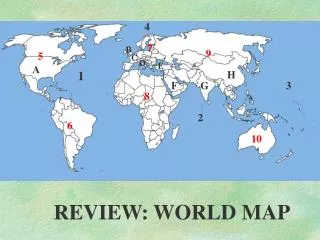
19. Which of the following islands did the British own? A. Puerto Rico B. Hispaniola C. Cuba D. Jamaica
20. Who owned most of the territory west of the Mississippi in 1783? A. Spain B. the United States C. Russia D. Great Britain
21. Which of the following regions did both the United States and Spain claim in 1783? A. the region between Canada, the Louisiana Territory, and the United States B. the region north of New Orleans and northwestern Florida C. the region along the coast of Alaska D. the region around Hudson Bay
22. Between 1550 and 1789, Enlightenment ideas swept A. only through France and colonial America. B. only through European society. C. through European society and colonial America. D. throughout the world.
23. The heliocentric theory challenged the A. political scientists. B. observed patterns. C. geocentric theory D. mathematical theories.
24. Salons helped to spread A. the geocentric theory. B. only the ideas of the philosophes. C. only the ideas of political scientists. D. Enlightenment thinking.
25. The philosophes used reason to address A. British taxes. B. social issues. C. abusive rulers D. All of the above
26.The American Revolution was influenced by A. British policies. B. political scientists. C. the philosophes. D. All of the above
27. In what year did Napoleon seize control of the government and assume dictatorial powers? A. 1800 B. 1799 C. 1805 D. 1804
28. Which of the following events was the latest to occur? A. sale of the Louisiana Territory B. sending an army through Spain to Portugal C. losing the Battle of Trafalgar D. Napoleon's making himself Emperor
29. What does this time line represent? a brief history of the French Revolution B. all the battles Napoleon fought in C. highlights of Napoleon's political and military career D. All of the above
30. In what year did Napoleon sell the Louisiana Territory to the United States? A. 1805 B. 1796 C. 1800 D. 1803
31. Which event happened earliest? A. Battle of Trafalgar B. invasion of Russia C. sale of the Louisiana Territory D. invasion of Portugal
32. Which of the following combined to form Gran Colombia? A. the Viceroyalty of Brazil and the Captaincy-General of Venezuela B. the Viceroyalty of New Granada and the Viceroyalty of Peru C. the Viceroyalty of New Granada and the Captaincy-General of Venezuela D. the Viceroyalty of Peru and the Viceroyalty of Brazil
33. In the early 1800s, which of the following regions was least affected by independence movements? A. the Caribbean B. Central America C. Spanish-speaking North America D. Spanish-speaking South America
34. What does the political division of the Viceroyalty of Rio de la Plata by 1830 show? A. There were many distinct groups within the Viceroyalty of Rio de la Plata. B. Nationalism united the people of this region into one country. C. The people of this region did not fight effectively against the Spanish. D. All of the above
35. By 1830, which of the following had lost all of their colonies in South America? A. the British B. the Spanish C. the Dutch D. the French
36. Which of the following countries gained independence from France by 1830? A. Mexico B. Haiti C. Bolivia D. Brazil
37. In which region were there no railroads in 1840? A. West B. Midwest C. Northeast D. Southeast
38. In which two directions were the majority of railroads in the West traveling in 1890? A. north and south B. south and east C. east and west D. west and south
39. Approximately how many miles of tracks were laid from northern Washington to the southernmost point in California? A. 2500 B. 1000 C. 550 D. 100